
Jim Cluett, W1PID (messages in green) wanted to go to the Pemigewasset River just east of Profile Falls on this late winter day. The temperature was already above 40 F, so it shouldn’t be too bad. Copyright 2018 Tim Carter
Just as I was getting ready to move two water softener drain lines, I got a text message from my friend Jim Cluett, W1PID.
The plan was to set up along the shore of the Pemigewasset River just east of Profile Falls. Profile Falls is one of New Hampshire’s many dramatic waterfalls and is located about two miles south of Bristol, NH.
The weather was warm for this time of year in central New Hampshire. It was above 40 F by mid-morning when Jim texted me.
The Icy Trail to the Pemigewasset River
Late February in central New Hampshire can be icy. Daytime thawing freezes at night. Add to that we were going to a Corps of Engineers flood control basin where January flooding created massive sheets of ice we needed to navigate to get to the river.

Hundreds of acres of land next to the river had flooded seven weeks ago during bitter cold WX (weather). While the water as still at flood stage it froze. The fractured ice you see is about six inches thick. When the liquid water under the ice receded, the ice sheets collapsed down to the soil, but there are many places where there are voids. You can see all the footprints in the snow on the trail. That’s a woman dressed in orange walking her dog. Copyright 2018 Tim Carter
The Towering Pine Tree
A towering majestic pine tree that’s at the top of the riverbank is about 1/3 of a mile from the parking lot. Jim and I were headed there to sit at picnic tables. The trail is very level, but had a layer of soft snow covering the ice that was suspended 16 inches or more in places above the frozen soil.

This friendly pine tree loves to help us harvest QSOs (QSO = a conversation with another radio operator) out of the ether. It’s hard to get a halyard line tangled in this tree. Jim is being careful on the slippery trail. Copyright 2018 Tim Carter
I didn’t waste any time getting my antenna into the huge pine tree. On my first throw, my water bottle soared over a branch about 40 feet in the air and dropped down perfectly straight just 7 feet from the corner of the picnic table.
In minutes I was on the air while Jim was playing patty-cake with his complex antenna, a design developed by W3EDP.
“What’s he doing? For goodness sake, I’ll have my first QSO before he even gets his radio out! This will be a first. He’s ALWAYS beat me in the past getting set up and making a Q (a singular QSO).”
That’s the thought that popped into my head as I was turning on my radio all while Jim was mumbling and cursing as he walked back and forth and back and forth across the ice between two trees.

Minutes after this photo was shot, Jim would be staring up into the branches contemplating how he was going to get a wire up, down and sideways in all these branches. You can see the glare ice he had to deal with. I’m sure that slowed him down. Copyright 2018 Tim Carter
Sure enough, my first QSO happened within three minutes of getting on the air. It was a DX (international) contact with Bruno, F5NTV in France. Thousands of operators in the Midwest and Western USA are jealous of us because we can get international (DX) contacts as easy as we work those west of us across the fruited plain of the USA.
Jim’s worked Bruno many times before, but he wouldn’t today.

Here I am happy as a clam after my QSO with F5NTV. I’m keeping my hands warm with my Morse muff made by Ms. Margaret Lohmann, one of my AsktheBuilder.com newsletter subscribers. My head is warm with my SOTA (Summits on the Air) hat. It’s amazing Jim had the composure to take this photo after futzing around for fifteen minutes with his antenna. Copyright 2018 Jim “Grumpy” Cluett
The Howling Wind By the Pemigewasset River
Walking to the river the air was calm, we were both warm and it was delightful. But once I started to set up on the one table, I noticed the wind.
It was gusting and biting. When the WX starts to get your attention, it’s never a good thing. At one point a gust blew my Rite-in-the-Rain log book and launched my pen into the mud.
Within 30 minutes Jim and I were packing up to walk back to his car. My hands got cold because I had to take them out of my wool Morse muff to spin the VFO dial and write in my log book. Jim complained that everything on him was cold.
I made three QSOs in just under twenty-five minutes and was thrilled. Here’s my log for the outing:
| F5NTV | 579 | 1803Z | 10.110Mhz (megahertz) |
| KB4GY | 579 | 1815Z | 7.041 Mhz |
| N1KW | 579 | 1825Z | 10.121 Mhz |

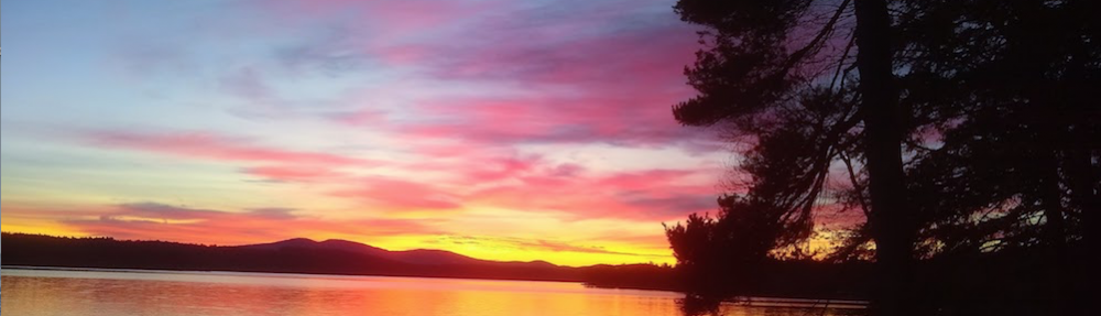
Here’s the mighty Pemigewasset River as it flows next to us when we come to this peaceful place. Copyright 2018 Tim Carter
Even though we were chilled, Jim and I agreed it was great to get out. The weather forecast for the next two weeks is promising. Let’s hope for some sunlight next time!
what is a QSO? ,,,and all the other acronyms used here.
Liz, I went up and fixed all of them for you. Check it out.
wow, you are super, Tim. Thanks so much!
Sheesh. I won’t be complaining about Austin winters anymore. You guys are hiking-ham maniacs!
I liked your 40ft toss; I can never get my wires that high. And you did it on slip’n fall ice!
I’m also impressed with the bullet-proof ruggedness of your Kx2 in weather that could freeze my little Morse hands off.
My little adventures are at a picnic table in our local city park. The spectacular LNR MTN3b and an EFHW make every QSO a memory.
You make it all sound fun .Thanks for this
fine story from Ice Station Zebra. Hope to work you before long!
72. Randy K5TTE. Austin
TNX. But we’re sissies compared to Steve Galchutt, WG0AT who does regular winter SOTA activations up high on the front range of Colorado. Read his stories!
Great post, Tim! Looks like a fun time.