Just after 8:30 am yesterday an email dropped into my inbox from my outdoor radio mentor and friend Jim Cluett, W1PID. Journalism was one of Jim’s many jobs before retirement, and he excels at using a few watts of power with radio waves as well as with words when communicating clearly with the written language.

As you can see, Jim has great skills and magic when it comes to using just a few characters to extract needed data.
It didn’t take me but a nanosecond to put an X in between the parentheses after the word “yes” and click the “send” button.
After all, it was another much-needed bluebird day here in central New Hampshire and I had been working like a dog all week. An afternoon outside doing QRP (low power) radio was just what I needed to finish off the work week.
Thirty minutes later Jim and I were on the phone coming up with a plan. We had lots of options and it was decided bicycles should be part of the outing. I don’t have a bicycle, so Jim said he had one for me. I’m asking for a bike for Fathers Day, so hopefully I’ll have a nice machine in less than eight weeks.
I had been up and working since 6 a.m. and had a very important proposal to submit before I could head out. We decided to meet just before 1 p.m. and carpool to our outdoor tiny dxpedition.
“It’s good to see you,” Jim said as we pulled out of the gravel parking lot where I stashed my beastly F-250 4×4 Super Duty pickup truck.
“It’s good to see you too old man.”
“What do you want to do? Ride up in Old Hill Village or go over to the Rail Trail in Andover?”
We had been to Old Hill Village the past two adventures and I was afraid that more dogs had been let loose. For years I had wanted to ride on the Northern Rail Trail so it was an easy decision.
“Rail trail. Let’s go there and see what it’s like.”
Jim had biked there countless times, so it was up to him to select a section of the old rail line to explore. Little did I know, he had decided to do the trip from Andover, NH up to Eagle Pond, a distance one way of just under four miles.
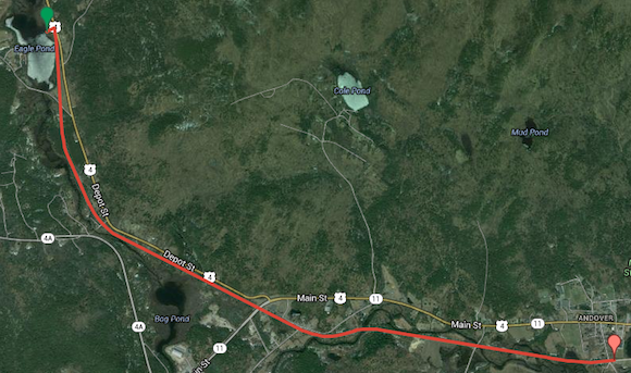
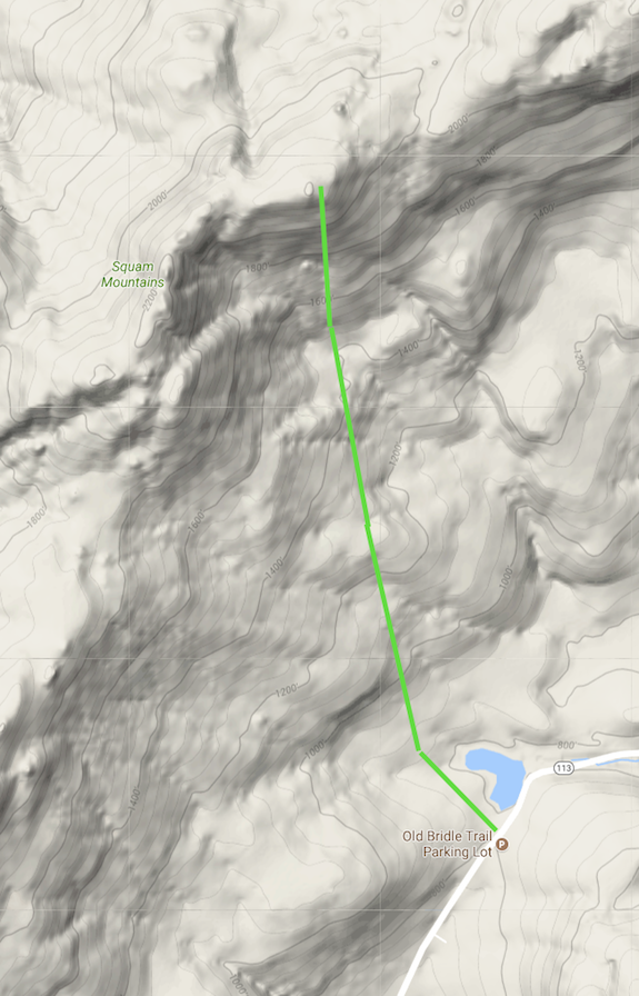
This is the route we took. CLICK the image to access the interactive map. Map courtesy of Google Maps and Tim Carter – W3ATB
The drive to Andover took a strong 30 minutes or more in Jim’s dandy VW vanagon camper. He uses it for our annual Field Day as his private command center and bug-free transceiving station. It’s also a great vehicle for outings like this.
“This would make for a great road trip vehicle, Jim.” I was trying to sow a seed or two for a one or two-day radio adventure later in the summer.
Once at Andover, we were out of the vanagon in seconds and getting ready to ride.
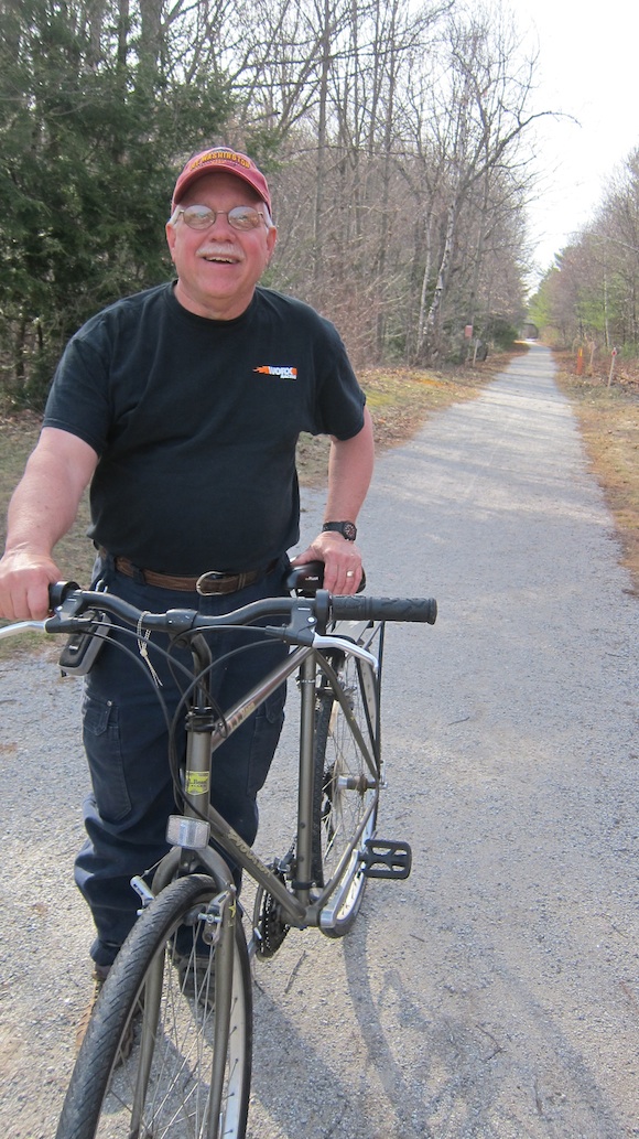
This is the bike Jim let me use. It was a fine machine. This photo was taken on the trail, not in the parking lot in Andover, NH. Photo credit: Jim Cluett – W1PID
“Do you want a rubber band for your pants? It’ll keep your pant’s leg out of the chain.” I accepted and it turned out to be a good idea.
“Do you remember how to ride a bike?” That was a good question as I couldn’t remember the last time I was on a bicycle. I think Jim said that because it looked like I was going to mount the sleek two-wheeler while the kickstand was still down.
“Sure. I know how to ride a bike!”
“Well, on the other side of that playground be careful of some deep wicked sand.”
We were off. Just past the playground we passed through a large tunnel and I swear Jim was sending Morse code making beeping sounds in the long tube. Maybe it was something else.
“Are you going to ride back there or side by side so I don’t have to turn and yell at you?” Jim was leading the way and I was concentrating on how to switch gears on the 21-speed bike I was piloting.
“Side by side, buddy.” I pulled up to his left and we proceeded to peddle west and slightly north.
Within five minutes my butt started to hurt. OUCH! But being the typical male, I sucked it up and didn’t say anything so as to not look weak. Little did I know it, but Jim was experiencing the same pain after not riding a bike for at least six months.
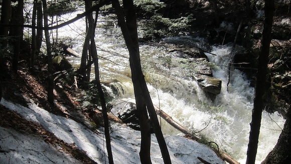
As we peddled on the trail, we passed all sorts of great scenery. Within the first mile we came up to an old covered bridge across the Black River. Suspended from that bridge, as well as the heavy iron railroad bridge that held up the bike path over the river, were vertical red and blue plastic tubes that stopped about one foot short of the water level.
“Those must be for the Proctor School kayakers,” Jim said. Proctor School, an exclusive private center of influence and networking, was located in Andover, NH. My guess is he was right.
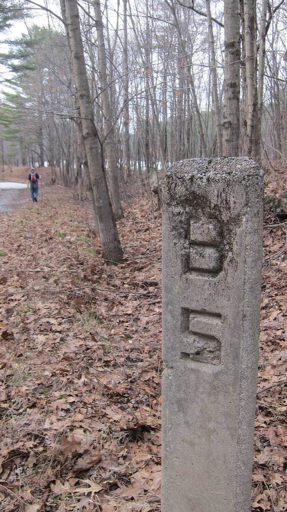
As we continued the journey towards Eagle Pond, we passed large granite mile markers used by the old railroad engineers. On one side you might see “B 103” and the other side “WRJ 40”. That meant from that point it was 103 miles to Boston and 40 miles to White River Junction, NH. I would soon discover Eagle Pond was just northwest of the WRJ 37 mile marker.
“Potter Place is just up ahead. Let’s pull over there.” Jim didn’t say his butt hurt, but I now know that was the primary motivation for the stop at the quaint restored railroad station at Potter Place, NH.
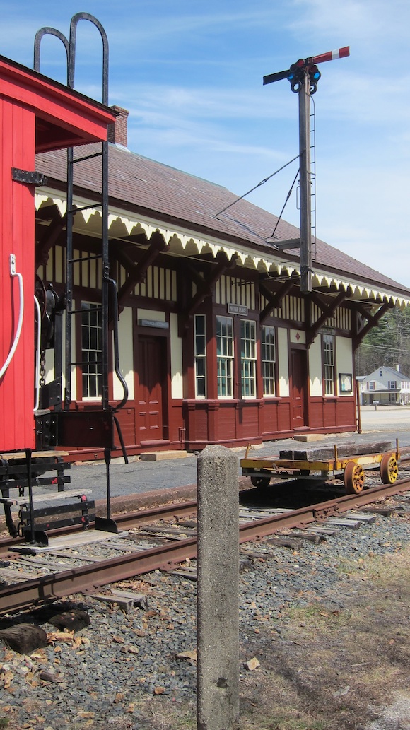
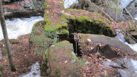
In the summer, all sorts of railroad carts, luggage carriers and other gear is outside. Jim said you could tour the station during normal hours. We sat on the dry grass just opposite this station to the right of the photo to munch on peanut M&Ms hoping that would provide pain relief. Photo credit: Tim Carter – W3ATB
Once at Potter Place, I was glad to get off the bike. Either I was a sissy, I had overly sensitive gluteus maximus muscles and/or the bicycle Jim lent me was left over from the Spanish Inquisition.
We rested up, looked at Richard Potter’s headstone and munched on a large bag of peanut M&Ms I had brought along for the ride. At our last outing, Jim had purchased a small bag of them at the Hill Village store and shared six of them with me. There are not many in those small bags.
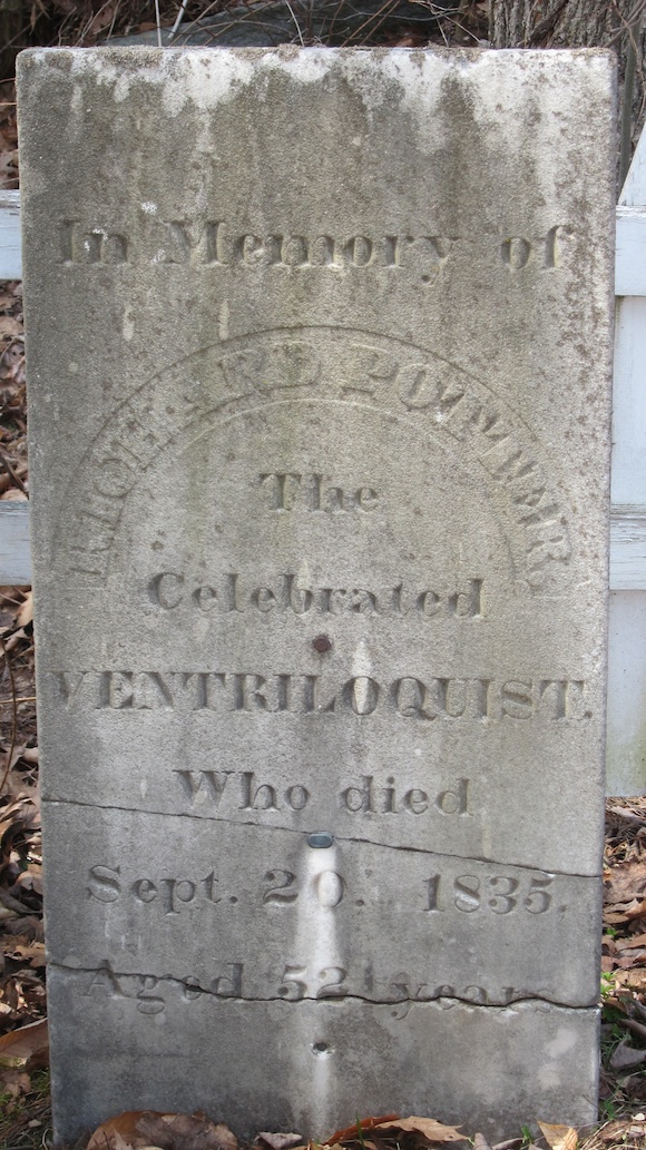
If my math is correct, Richard Potter was born in 1783! Photo credit: Tim Carter – W3ATB
After ten minutes at the rail station we got on the bikes and made the final dash to Eagle Pond. By the time we got there, my butt was screaming like a newborn baby for mother’s milk.
Eagle Pond was glorious. The sun was still high in the sky even though it was after 3 p.m. A small dirt road that crosses the Northern Rail Trail led to a popular parking area that the local teenagers must use on Friday and Saturday nights to neck and advance the human species. Fishermen park there too to cast into Eagle Pond.
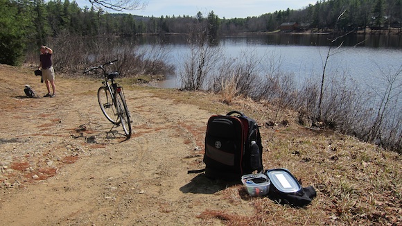
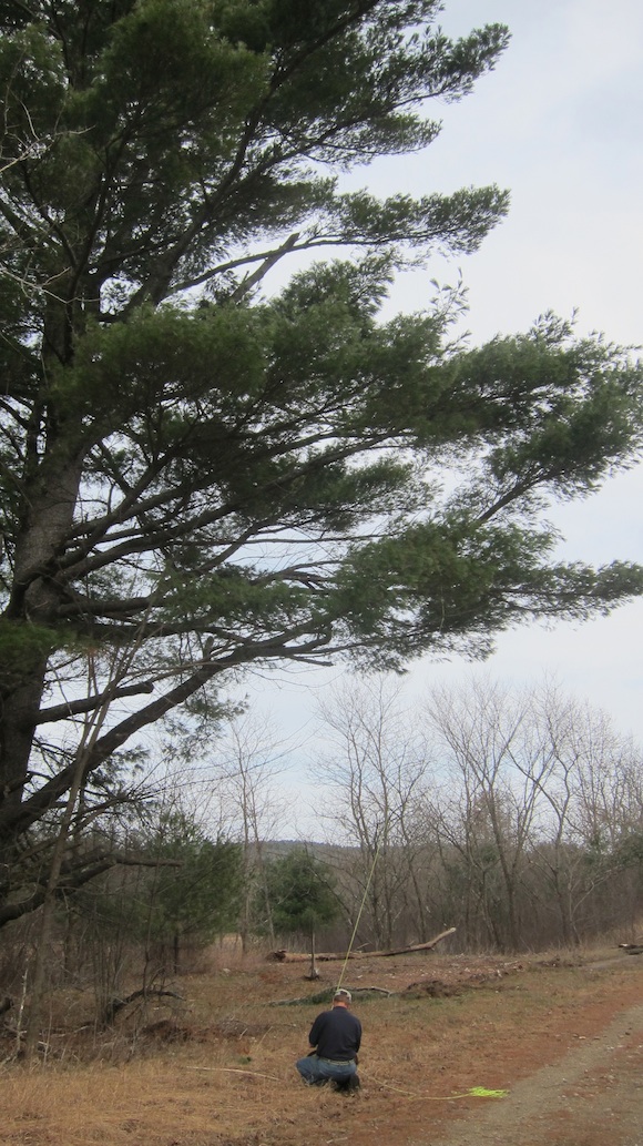
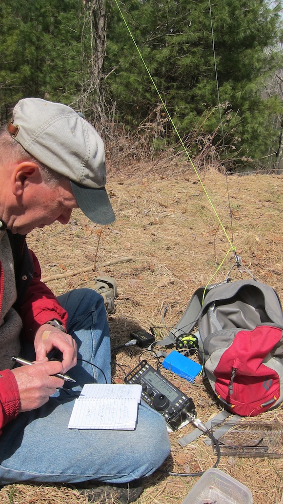
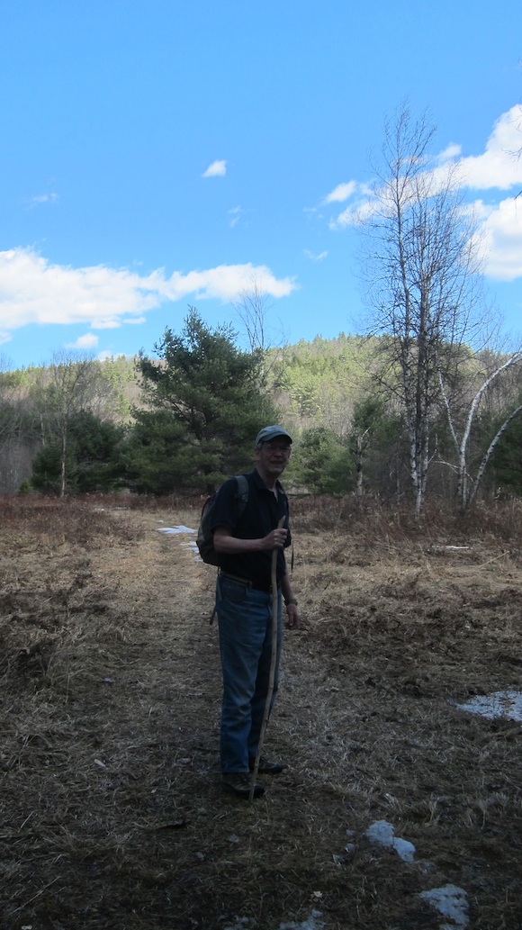
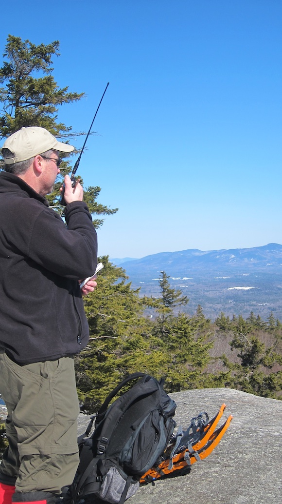
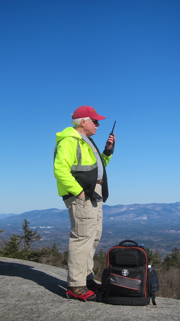
Jim, W1PID, is pondering how he’s going to loft his water bottle up into the tree trailing his green halyard that will pull up his thin 33-foot antenna wire. Photo credit: Tim Carter – W3ATB
Jim got his antenna up in a flash. It took me three attempts at slinging my water bottle up about 40 feet over the exact small branch that would allow my 10, 20 and 40-meter end-fedz antenna to drop straight to the ground. Jim’s taught me that a perfectly vertical antenna provides the best performance.
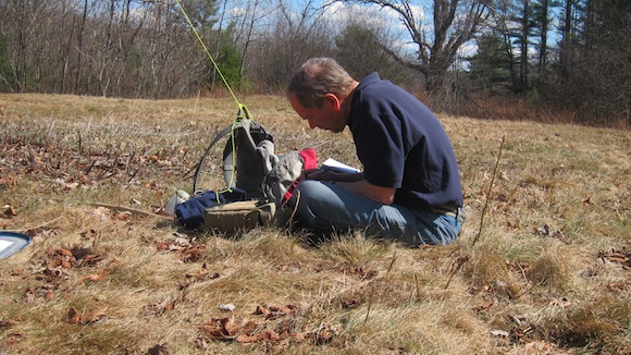
By the time I had set up and was ready to operate, Jim had already captured invisible radio waves with his Elecraft KX3. Here’s who he connected with while I was preventing getting skunked:
- HA9RT Hungary
- EM90WF Ukraine
- HA8FK Hungary
- KA4RRU Virginia
- 4Z5IW Israel
I connected my HB-1B quad-band QRP radio and jumped on 20 meters. I heard several strong signals but after 15 minutes I was unable to get a contact. I tried jumping into an ending conversation, but either the other operators were tired or they couldn’t hear my 5-watt signal.
Finally, I was able to have an exchange with KG9HV. It was John in Lafayette, IN. Jim’s able to get DX (international contacts) with ease and I struggle to go 1,000 miles. I simply need to get better and faster listening to Morse code. That’s the issue. It’s not the radio, it’s not the antenna, it’s me.
“I didn’t get skunked!” I tooted my horn to Jim as he was all packed up and ready to ride back to Andover.
“Good.” Jim was probably pondering how far we could get before his butt would be screeching at him to stop.
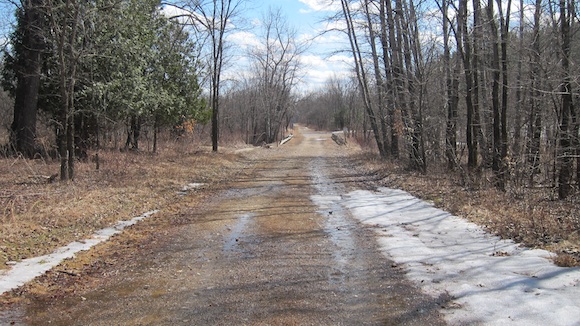
Minutes later we were headed back to Andover. We had almost 4 miles of downhill biking in front of us. Railroad grades are very slight in most cases, and this stretch of the Northern Rail Trail appears flat but it’s not. I could tell it took less effort to ride the bike towards Andover and the comfort of a large seat in the vanagon.
“Hey, look down at that river. It’s got to be 70 or 80 feet down wouldn’t you say?” Jim was straddling the center bar of his bike and had stopped where the bike trail was just above the Black River. The slope down to the clear rushing water was very steep.
“No way. I’d say it’s maybe 35 or 40 feet. Perhaps 45 feet at the most,” I replied. There was no way it was 70 feet. Jim had shown me earlier in the ride how his plastic-lensed glasses had been damaged by the high heat of his coal stove when he opened the door years ago. Perhaps the micro cracks were distorting the view.
“Well, do you have a timer?” I posed this question to Jim and he indicated he had his nice analog wristwatch as well as a digital timer on his cell phone.
“I’m going to throw this rock to the water. You time when it splashes. Give me a 3, 2, 1 countdown so we can time it accurately.”
“Three, two, one.”
I flung a piece of railroad ballast out horizontally and it immediately succumbed to the pull of gravity and kerplunked right in the middle of the river.
“1.5 seconds,” Jim said.
“Well, what’s the square of that?” Jim looked slightly perplexed.
I said, “Well, it’s less than 4 and probably less than 3.”
Jim got out his cellphone and fired up the calculator. The result was 2.25.
“Multiply that by 16,” I said.
“It’s 36,” Jim said.
“Well, it’s about 33 feet from the ground up here down to the water. You need to subtract the 3 feet the rock was above the ground at as it left my hand.”
“What? How did you figure that?” Jim was visibly disturbed.
“It’s easy. The physics formula to determine how far an object falls under the force of gravity is: s = 1/2at².” ( s = distance in feet, a = 32 ft per second squared and t equals time in seconds)
There was silence. A long pregnant pause as Jim processed this factoid.
“Well, I’ve possibly been wrong about many things in my life as I’ve been estimating vertical distances inaccurately for decades.”
“It’s no big deal. I was taught how to do this back in college by my geology field professors. We’d have to throw stones to measure the thickness of a rock formation.”
Jim had me toss another stone to check the timing. We got nearly the same result.
It was time to get back to the vanagon.
As we peddled, Jim said, “Is your butt sore?”
“You bet it is! That’s why I stand on the peddles every five or ten seconds to lift my butt up off the seat.”
I was glad to hear I wasn’t the only one suffering.
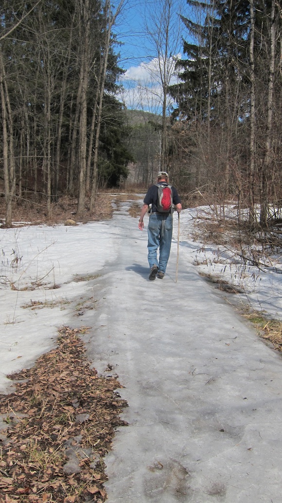
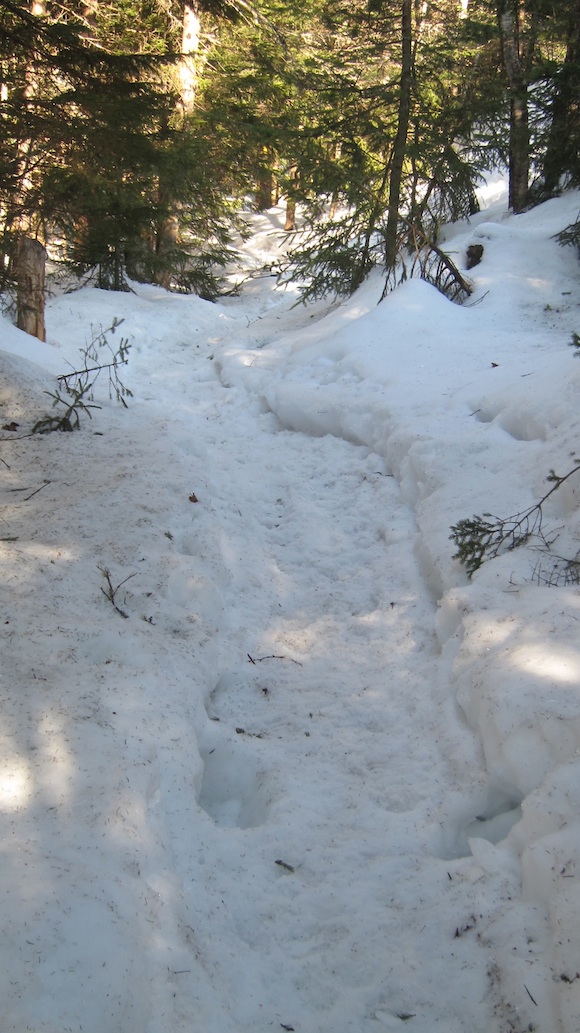
Soon I could see the tunnel up ahead that marked the spot we started. There was still a patch of soft snow and ice leftover from the bitter winter. It would be gone for sure within 48 hours.
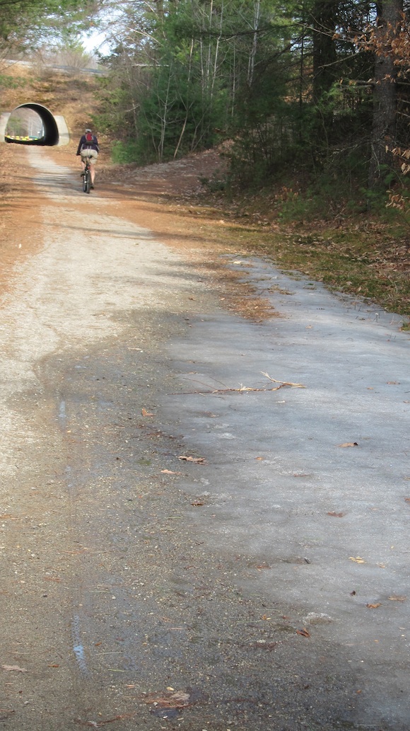
The parking lot and vanagon was just on the other side of the tunnel. You can clearly see Jim and the remnant snow and ice. Photo credit: Tim Carter – W3ATB
Minutes later we were back at the vanagon and both our butts were singing “Hallelujah!” as we got off and loaded them into, and on the back of, the vanagon.
Jim started up the vanagon, backed out and headed up the slight hill to turn right to head into Andover.
“Hanz and I came up here in the winter to ski on the trail once. They hadn’t plowed the parking lot and the snow was 3 or 4 feet deep is my guess. Once we parked I thought it wasn’t such a smart idea to do that. We just barely got out.”
I’ve driven quite a bit in snow and know that if a car or truck gets into deep snow where it drags on the bottom of the car or truck, you’ll not go anywhere, much less up a hill.
Jim looked at me sideways and said, “Well, maybe it was only 6 inches. You’ve shown me that I’m not too good at judging distances.”
We laughed and stopped at the corner to get our requisite reward of an ice cream bar and a Dove bar. Sitting on the wooden bench outside the store looking across at the Proctor School, we both reflected on the fine adventure.
Soon we were back in the vanagon headed for home.
NOTE TO SELF: Purchase bike with comfy seat.