NEFR South Arm 80-Meter NVIS Test

On Saturday, October 10, 2020 I (Tim Carter – W3ATB) met with four other dedicated radio operators in Bethel, Maine. Our goal was to solve a pesky communications issue that has plagued the New England Forest Rally (NEFR) for many years. CLICK or TAP HERE to read about the conundrum.

A year before at the 2019 NEFR I tested Near Vertical Incidence Skywave (NVIS) propagation with two other NEFR operators. It worked well, but I wanted to conduct a thorough test.

I’ve known about NVIS for several years and the ARRL did a fantastic podcast about the topic. Listen to it:

How Does NVIS Work?

NVIS works by sending radio waves straight up and they bounce straight back down off the ionosphere. Imagine pointing a garden hose straight up into the air. Watch this video for the science:

I’m the Chief of Communications for the NEFR and had the pleasure of working with four dedicated radio operators who’ve volunteered for the rally in past years. They understood the importance of coming up with a solution for this world-class racing event. Here are the following Extra-class radio operators who volunteered their precious time and their skills for this test:

  • Tim Foy – W1FOY
  • Justin Hughes – KJ1H
  • JT Isherwood – N1JTI
  • Wayne Reetz – KA1CPR

Wayne also brought along his wife Sharyn. It’s always wonderful to have an XYL (former young lady) to help brighten the atmosphere.

We met just before 9 AM at the Sunday River Brewing Company restaurant to get fueled up as we would be in the middle of nowhere once we were up at South Arm.

South Arm 80M NVIS

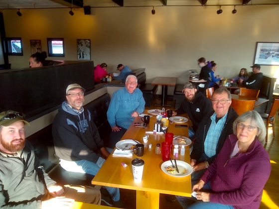
Here’s the gang! Going counter-clockwise around the table: Sharyn Reetz, Wayne Reetz, Tim Foy, Tim Carter, Justin Hughes, and JT Isherwood

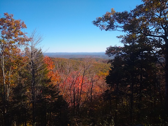
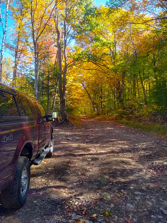
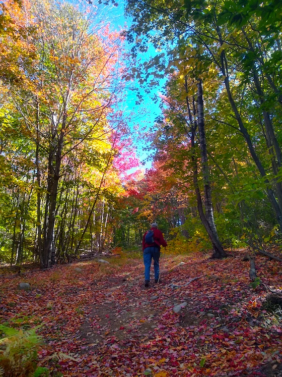
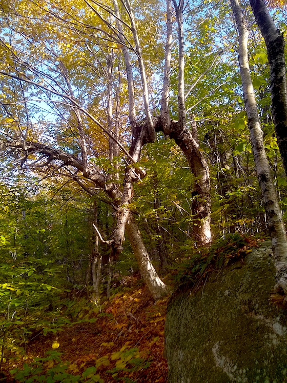
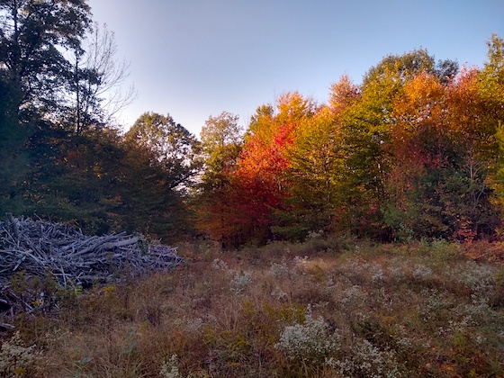
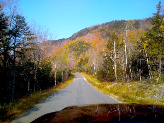
Once we left the restaurant, we had to drive nearly forty miles to get to South Arm, Maine. It was a stunning autumn day and we were treated with plenty of ocular delights as we traveled up Route 5 and then South Arm Road.

South Arm 80M NVIS

We lucked out on the weather. The temperature by Noon was close to 70 F.

South Arm 80M NVIS

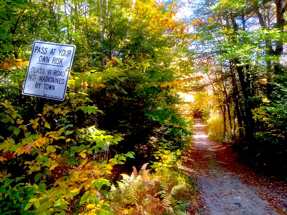
South Arm, Maine is pretty much in the middle of nowhere. It’s a great place for peace and quiet.

We had decided to test two HF bands: 80 and 10 meters. Our plan was to use either a flat or low inverted-V NVIS antenna for 80 meters and vertical 10-meter dipole antennas for the test.


South Arm 80M NVIS

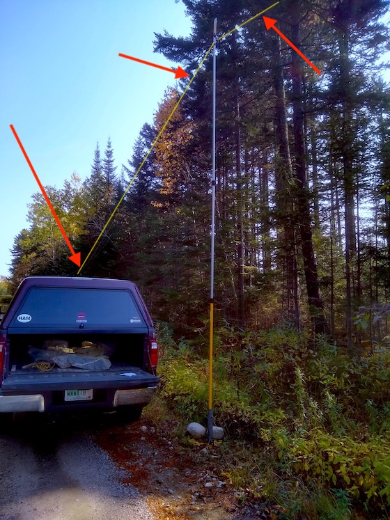
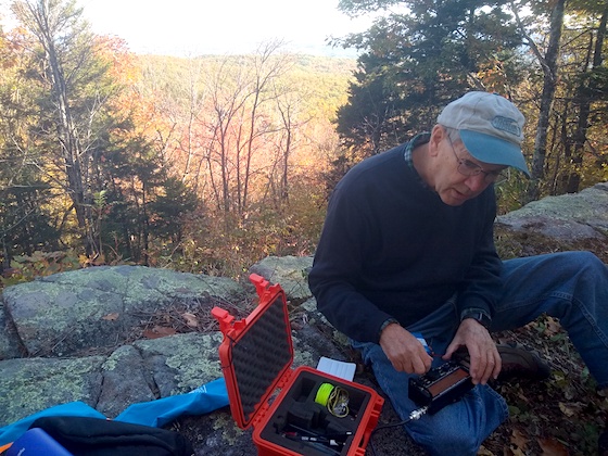
Here’s my 80-meter NVIS antenna setup. I have an extendable fiberglass painter’s pole supporting the center of the 80-meter dipole. The arrows point to yellow lines that indicate where the antenna wires stretched. I was able to set this up in just fifteen minutes.

South Arm 80M NVIS

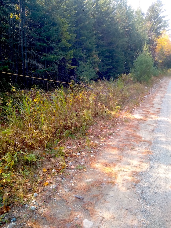
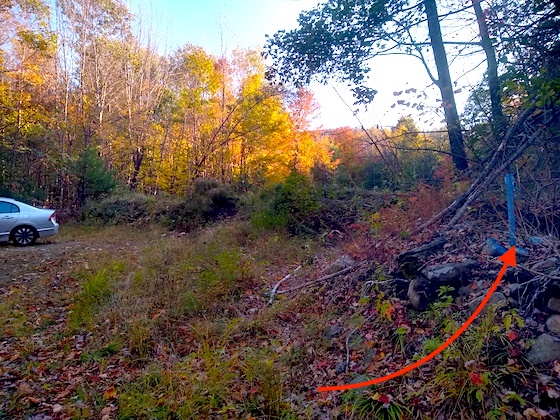
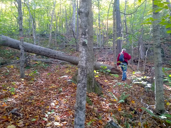
This is one end of the 80-meter NVIS antenna. That’s a fiberglass electric-fence support that’s ideal to hold up the end of the wire. JT had suggested using these. This small post is about 60 feet from the painter’s pole.

I had asked Tim Foy if he’d be kind enough to be net control for the test. He was positioned at the Start position of South Arm stage of the NEFR. I decided to set up at the Finish position about nine and one-half miles down the course. Wayne, JT, and Justin were at critical locations where normal radio operators set up during this NEFR event.

South Arm 80M NVIS

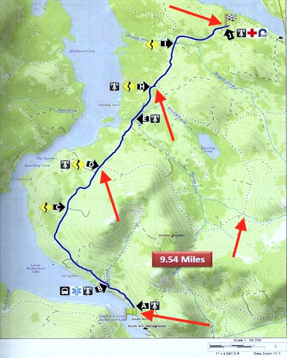
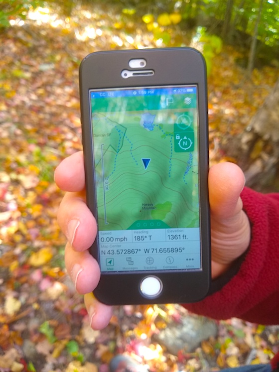
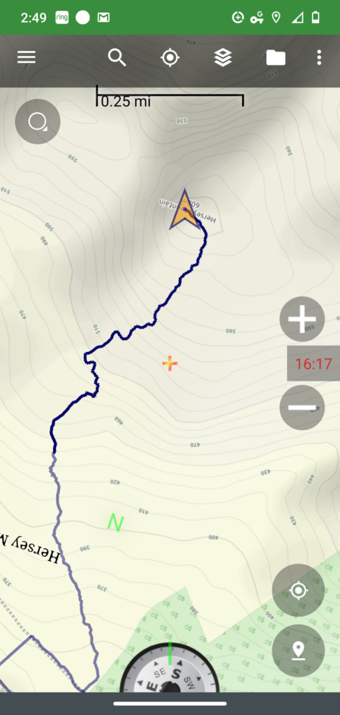
Here’s the actual map of the South Arm racecourse (stage). Tim Foy was at position A, Wayne Reetz was at position D the first turn off up the Icicle Brook Loop Road, Justin was at the red arrow to the right of Wayne at the traditional relay position on Icicle Brook, JT was at position H the other end of the Icicle Brook Loop Road, and I was at position J, the Finish of the South Arm stage.

We all had 2-meter mobile radios as well so we could communicate via a relay system to ensure all were ready to begin the test.

Our plan was to start with 100 watts of power and work down to low power until one, or more, operators could not be heard clearly.

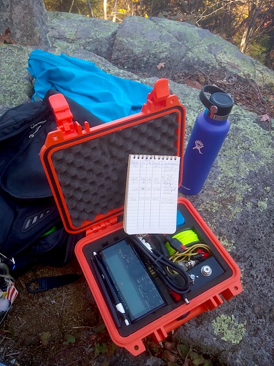
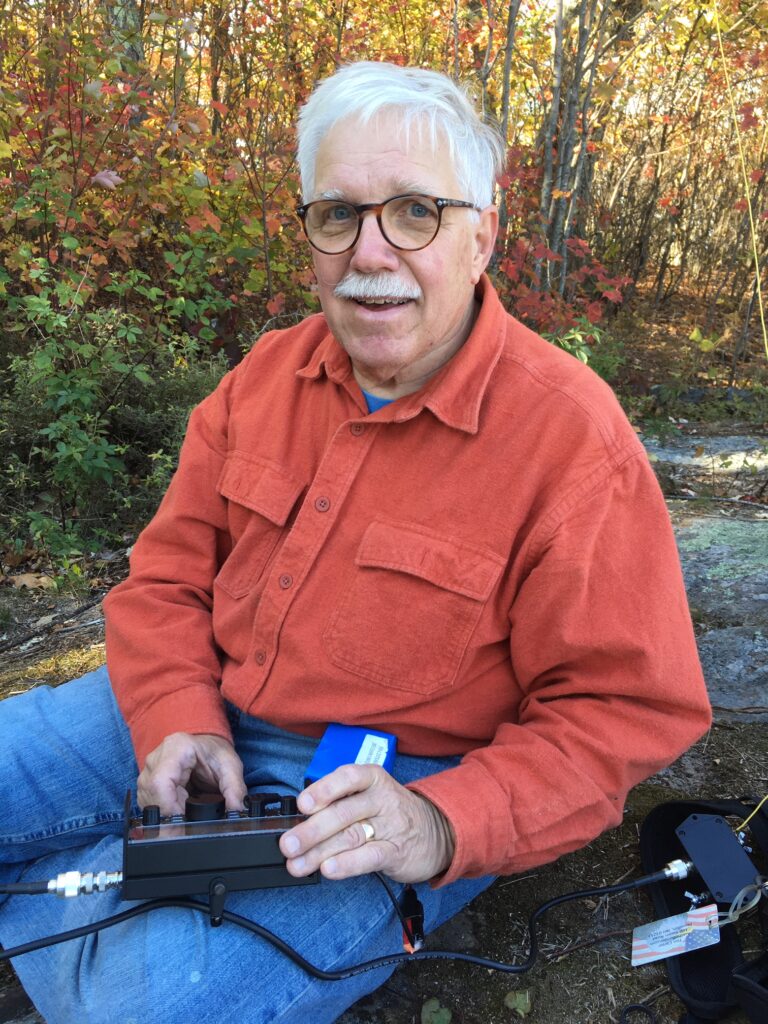
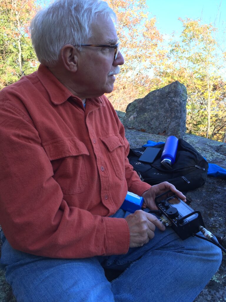
I was using my trusty ICOM-7000 mobile HF radio. The other four operators also were well equipped for the test. I had created some simple logsheets for each operator to use to record the signal strength of each other operator as Tim Foy called for them in the round-robin net.

South Arm 80M NVIS

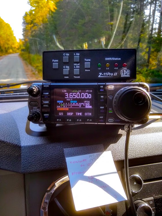
Here’s my ICOM 7000 with my LDG Z-11Pro II tuner ready to transmit.

I was always the last to check-in and I was bouncing up and down during the first round of the net. Every operator’s signal was strong and clear. Justin had a minor over-modulation issue, but even with that I could clearly make out what he was saying.

As we continued to reduce power levels from 100, to 50, to 25, to 10, and finishing with 5 watts, I was able to hear everyone and everyone heard all others. This had never before been done on this stage of the South Arm course. Our test was a success! We had finally solved the South Arm comms conundrum.

Listen to the entire test:

Justin had suggested weeks before that we try 10 meters. It’s a little-used HF band and it very close to the older citizen’s band of 11 meters that was popular in the 1970s. I was able to hear all the other operators on the course with extreme clarity, but I couldn’t hear Tim Foy at the Start. Ten meters turned out to be a dismal failure.

I had hoped it would work because those with Technician privileges are allowed to use a small part of the voice segment of the 10-meter band. This would open up the candidate pool to all who volunteer so long as they own a radio that can transmit on 10 meters.

We are going to continue to test other HF bands and try to get the 10-meter dipole antennas higher in the air to see if that will make a difference. But for now, we know 80 meters NVIS works and we can provide the quality of communications this spectacular race event deserves.


Hersey Mountain Hike SOTA

Hersey Mountain

Hersey Mountain Vista | This is the payoff for hiking up 1000 feet in elevation in just 1.4 miles. You’re looking to the southeast from the summit of Hersey Mountain.

On Friday, October 9, 2020 I joined my very good friend Jim Cluett, W1PID, on our first outing of the year. Our goal was to get to the top of Hersey Mountain which straddles both Sanbornton and New Hampton, New Hampshire.

It was a stunning autumn day with the temperature in the mid-50s. The sun was warm and the air was cool and crisp. Our goal was to get out in the fresh air and hopefully achieve a SOTA activation. Hersey Mountain is in the SOTA database: W1/HA-029.

The Hersey Mountain trailhead is very easy to find. Travel to Carter Mountain Road in New Hampton and follow it just over one mile until you come to a small parking area on the right for three cars. This is where the Class VI Mountain Road begins.

Hersey Mountain

I’m standing on Carter Mountain Road looking at the start of the Class VI road. The parking area is to my right.

If you have a vehicle with enough ground clearance, you can drive the 6/10ths of a mile east on Mountain Road to the actual trailhead. There’s a wide parking area that can handle at least four or five cars.

Hersey Mountain

This is the actual trailhead. I’m standing on the Class VI Mountain Road. The red arrow points to the northeast corner blue boundary marker of the George Duncan State Forest. There were also blue-painted blazes in the tree just to the right of the blue metal stake. Had we known about this large parking area, I would have parked my truck next to the car.

A giant berm has been bulldozed here to prevent cars and trucks from traversing up the logging road that makes up the first 30 percent of the hike.

Hersey Mountain Trail

Hike Hersey Mountain during peak color and this is some of the ocular delights you’ll enjoy.

Jim and I both brought our cell phones and each of us was running an active GPS app to help us make sure we were headed the right way. Jim had talked with a friend of ours, Hanz Busch, a few days before. Hanz had hiked the trail and said it was marked with surveyors tape in many places, but the trail itself is not as clear as one might like it to be.

Hersey Mountain

I parked my F-250 4×4 at a large clearing on the north side of Mountain Road. I knew we were close to the trailhead and had no idea we could park at it. You’re looking east on Mountain Road and you just have to go a short distance to get to the trailhead.

We started the hike at 1:30 PM and I had estimated it would take us about 1 hour and 15 minutes to summit. By driving to within 500 feet of the trailhead, we saved a mile overall on the hike.

Hersey Mountain

Here’s Jim nearly at the top of the logging road. It was a fairly steep climb up the road.

The first half-mile of the hike is up a very wide logging road. There were quite a few large water bars put in by the landowner to prevent the road from washing out. Water bars act like gutters on the bottom of a roof. They capture the water and re-direct it to the side of the road.

“Look, there’s a cairn. This is no doubt the way to go.” Jim had spotted it. You could clearly see the trail take off into the forest.

Hersey Mountain

This is the cairn marking the end of the logging road and the beginning of the trail into the forest.

Every now and then we’d stop to catch our breath. It’s not like we’re both 28 years old and can run up the hill! Once when we stopped, Jim noticed how some of the tree branches had strange shapes.

Hersey Mountain

This is the one branch Jim spied. It is most unusual. How do you think it happened?

“I think the story title might be, “The Mystery of the Twisted Twigs.” It was pretty lame, but I was starting to get a little winded. We still had a ways to go. Everytime we stopped, Jim would check his GPS to get an idea of our progress.

Hersey Mountain

We still have quite a ways to go! The summit elevation is close to 1990 feet. If the GPS reading is correct, and I’m sure it’s darn close, we still have to go up about 630 feet in elevation.

For me when hiking a new trail, it always seems like it’s three times longer than it really is. I like hiking, but I don’t love it. We talked about how radio operators who live to do SOTA activations must love hiking 10 times more than doing radio. You can invest hours of hiking just to sit on a summit for 30 minutes or so doing radio.

Hersey Mountain

We’re clawing our way to the top. Slow and steady!

It was a beautiful hike through the forest and not overly steep. Every now and then you’d come to a short part where you’d take your time, but there were also some quite flat spots as you’d go back and forth on the trail. If you go, be sure to take a roll of orange surveyor’s tape to help create a few markers to help others. The wind really does a number on the tape and it doesn’t last as long as you might think.

The minutes were clicking by, but we were having a good time. The closer we got to the top, we noticed there were fewer pieces of tape around the trees. We could see the trail only because there were no green ferns or saplings growing in the trail. You’d be in a world of hurt in the winter with snow on the ground. You’d just have to keep climbing UP. You’ll never go wrong doing that!

Hersey Mountain

We made it! This is what you see as you’re just ten feet below the summit. A delightful hikers shelter constructed around 1990.

“We’re close!” Jim had just checked his GPS and the blue arrow was basically on the summit. I could see some blue sky in front of us and knew that was our goal.

Hersey Mountain

This is the map of the trail. The start of the trail is where the tracing touches the gray bar to the left of the compass. You can see the dashed lines indicating the Class VI Mountain Road. I don’t know why the tracing shows going up Mountain Road and going the other direction. I think that was from a past hike a year ago. I captured this from my phone app immediately upon walking out to the vista point in front of the hiking shelter. Note the time – 2:49 PM.

It’s such a rewarding feeling getting to the top on a hike like this. I looked at my watch and by gosh, it had only taken us the hour and nineteen minutes I budgeted. I know that I can normally do 1,000 feet of elevation gain in an hour, but since I hadn’t hiked a hill like this in a while, I wanted to add 25% to my estimate. “Well, I was way off. I thought we could do it in 40 minutes,” Jim exclaimed.

It was time to do radio. While I was setting up my Elecraft KX2 and the 29-foot wire attached to a 9:1 unun, Jim decided to break out his Baofungus tiny transceiver with a stubby antenna. He called out and lo and behold a man from 40 miles away in Concord, NH answered back. Altitude sure helps when you’re doing radio.

Here are some photos of the radio part of our adventure:

Hersey Mountain

This is my Elecraft KX2 and the logbook of our contacts.

Hersey Mountain

Jim can’t keep his hands off an HF radio! He wanted to get some contacts too.

Hersey Mountain

I had on an autumn-themed shirt! I’m busy chatting with a Canadian radio operator.

Hersey Mountain

We had a successful SOTA activation. You need four contacts and we got five.

My antenna sloped to the east which was perfect. Soon we had three European stations in the logbook. There’s nothing like long-distance (DX) contacts in the log on a SOTA adventure. Here are the five contacts:

STATION FREQ RST Sent RST Rcvd TIME
NS1O 146.520 5/9 S  5/9 R  1912
LZ3XT 20 M 599 599 1917
HA5JI 20 M 599 599 1920
IU0LJD 20 M 599 599 1924
VE1EX 40 M 579 569 1927
Hersey Mountain QSO Map

Here are my five contacts. Map courtesy of: qsomap.org

We decided to head back down the mountain after getting the five radio contacts. But first, I wanted to see the inside of the shelter and to sign in the logbook. You could easily spend the night here! Look at everything that you can use for free.

Hersey Mountain

Anyone can use the shelter and all that’s in it. You just keep it clean and pay it forward.

Hersey Mountain

Look at the dandy cast-iron woodstove! That will take the chill off if you come up on a blustery cold day. Look at all the supplies!

Hersey Mountain

Here’s the logbook you can sign. What fun reading what others write!

The trip back down only took forty minutes, but that’s to be expected. We did stop twice to rest as it’s hard on my knees, and Jim’s too, coming down.

I’d hike this mountain again anytime in great weather. I have to say we lucked out on such a beautiful day with the forest ablaze with fall color. It’s my favorite time of year and a true prize to be able to enjoy it.

Hersey Mountain

Here’s another odd-shaped tree we saw on the way back down.

Hersey Mountain

This is the top of the logging road. The rock cairn is behind me and over my right shoulder as I shot this photo. You need to head towards the orange and red trees to get back down to the trailhead. If you hike this mountain soon, I suspect you’ll be able to see the gray wood slash pile unless some kids set it ablaze one night! You can see the sun was getting lower in the sky as it smooched the trees with some golden-hour light.