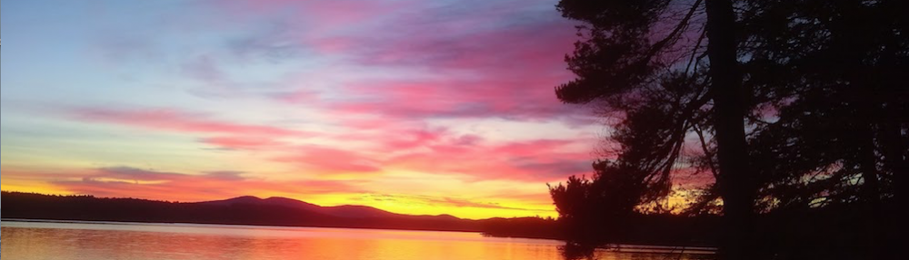
Hersey Mountain Vista | This is the payoff for hiking up 1000 feet in elevation in just 1.4 miles. You’re looking to the southeast from the summit of Hersey Mountain.
On Friday, October 9, 2020 I joined my very good friend Jim Cluett, W1PID, on our first outing of the year. Our goal was to get to the top of Hersey Mountain which straddles both Sanbornton and New Hampton, New Hampshire.
It was a stunning autumn day with the temperature in the mid-50s. The sun was warm and the air was cool and crisp. Our goal was to get out in the fresh air and hopefully achieve a SOTA activation. Hersey Mountain is in the SOTA database: W1/HA-029.
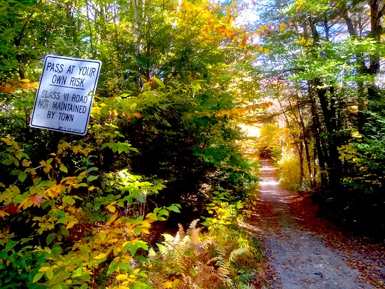
The Hersey Mountain trailhead is very easy to find. Travel to Carter Mountain Road in New Hampton and follow it just over one mile until you come to a small parking area on the right for three cars. This is where the Class VI Mountain Road begins.
I’m standing on Carter Mountain Road looking at the start of the Class VI road. The parking area is to my right.
If you have a vehicle with enough ground clearance, you can drive the 6/10ths of a mile east on Mountain Road to the actual trailhead. There’s a wide parking area that can handle at least four or five cars.
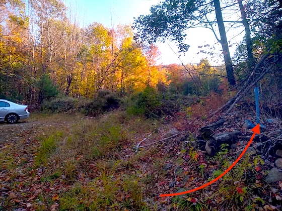
This is the actual trailhead. I’m standing on the Class VI Mountain Road. The red arrow points to the northeast corner blue boundary marker of the George Duncan State Forest. There were also blue-painted blazes in the tree just to the right of the blue metal stake. Had we known about this large parking area, I would have parked my truck next to the car.
A giant berm has been bulldozed here to prevent cars and trucks from traversing up the logging road that makes up the first 30 percent of the hike.
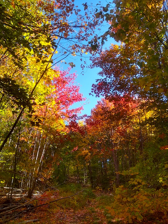
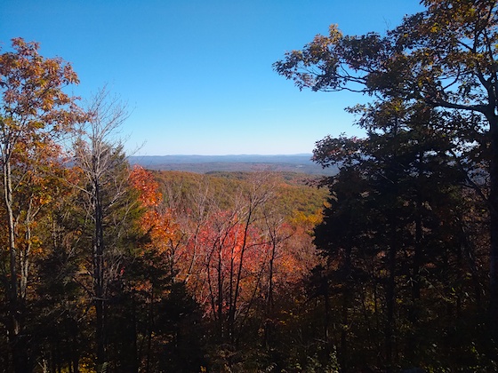
Hike Hersey Mountain during peak color and this is some of the ocular delights you’ll enjoy.
Jim and I both brought our cell phones and each of us was running an active GPS app to help us make sure we were headed the right way. Jim had talked with a friend of ours, Hanz Busch, a few days before. Hanz had hiked the trail and said it was marked with surveyors tape in many places, but the trail itself is not as clear as one might like it to be.
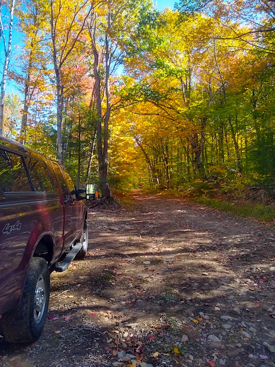
I parked my F-250 4×4 at a large clearing on the north side of Mountain Road. I knew we were close to the trailhead and had no idea we could park at it. You’re looking east on Mountain Road and you just have to go a short distance to get to the trailhead.
We started the hike at 1:30 PM and I had estimated it would take us about 1 hour and 15 minutes to summit. By driving to within 500 feet of the trailhead, we saved a mile overall on the hike.
Here’s Jim nearly at the top of the logging road. It was a fairly steep climb up the road.
The first half-mile of the hike is up a very wide logging road. There were quite a few large water bars put in by the landowner to prevent the road from washing out. Water bars act like gutters on the bottom of a roof. They capture the water and re-direct it to the side of the road.
“Look, there’s a cairn. This is no doubt the way to go.” Jim had spotted it. You could clearly see the trail take off into the forest.
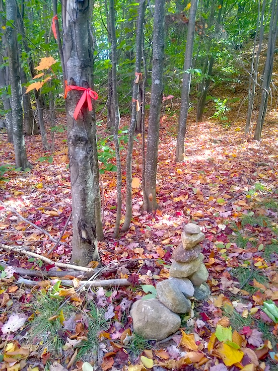
This is the cairn marking the end of the logging road and the beginning of the trail into the forest.
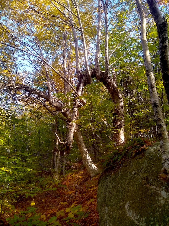
Every now and then we’d stop to catch our breath. It’s not like we’re both 28 years old and can run up the hill! Once when we stopped, Jim noticed how some of the tree branches had strange shapes.
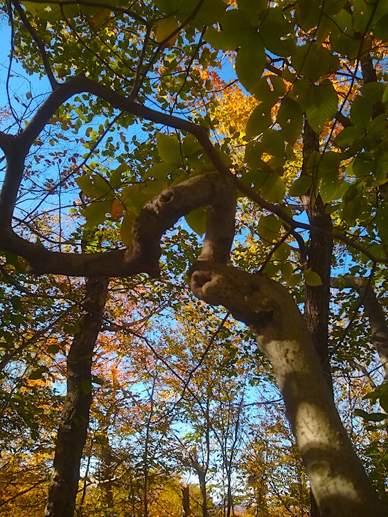
This is the one branch Jim spied. It is most unusual. How do you think it happened?
“I think the story title might be, “The Mystery of the Twisted Twigs.” It was pretty lame, but I was starting to get a little winded. We still had a ways to go. Everytime we stopped, Jim would check his GPS to get an idea of our progress.
We still have quite a ways to go! The summit elevation is close to 1990 feet. If the GPS reading is correct, and I’m sure it’s darn close, we still have to go up about 630 feet in elevation.
For me when hiking a new trail, it always seems like it’s three times longer than it really is. I like hiking, but I don’t love it. We talked about how radio operators who live to do SOTA activations must love hiking 10 times more than doing radio. You can invest hours of hiking just to sit on a summit for 30 minutes or so doing radio.
We’re clawing our way to the top. Slow and steady!
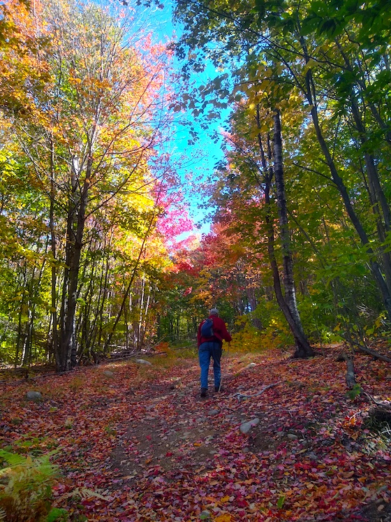
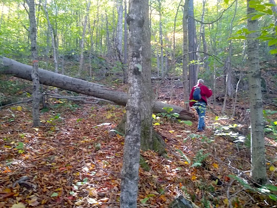
It was a beautiful hike through the forest and not overly steep. Every now and then you’d come to a short part where you’d take your time, but there were also some quite flat spots as you’d go back and forth on the trail. If you go, be sure to take a roll of orange surveyor’s tape to help create a few markers to help others. The wind really does a number on the tape and it doesn’t last as long as you might think.
The minutes were clicking by, but we were having a good time. The closer we got to the top, we noticed there were fewer pieces of tape around the trees. We could see the trail only because there were no green ferns or saplings growing in the trail. You’d be in a world of hurt in the winter with snow on the ground. You’d just have to keep climbing UP. You’ll never go wrong doing that!
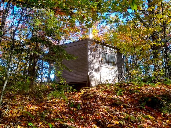
We made it! This is what you see as you’re just ten feet below the summit. A delightful hikers shelter constructed around 1990.
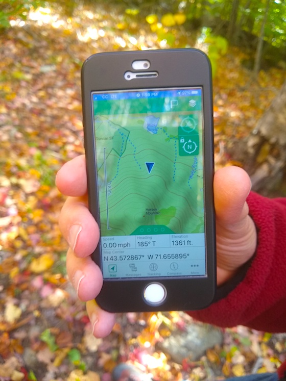
“We’re close!” Jim had just checked his GPS and the blue arrow was basically on the summit. I could see some blue sky in front of us and knew that was our goal.
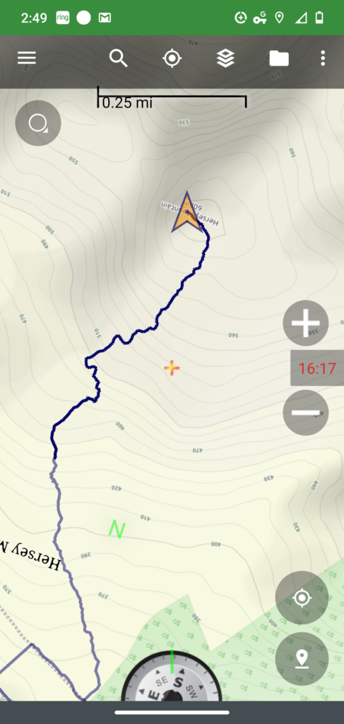
This is the map of the trail. The start of the trail is where the tracing touches the gray bar to the left of the compass. You can see the dashed lines indicating the Class VI Mountain Road. I don’t know why the tracing shows going up Mountain Road and going the other direction. I think that was from a past hike a year ago. I captured this from my phone app immediately upon walking out to the vista point in front of the hiking shelter. Note the time – 2:49 PM.
It’s such a rewarding feeling getting to the top on a hike like this. I looked at my watch and by gosh, it had only taken us the hour and nineteen minutes I budgeted. I know that I can normally do 1,000 feet of elevation gain in an hour, but since I hadn’t hiked a hill like this in a while, I wanted to add 25% to my estimate. “Well, I was way off. I thought we could do it in 40 minutes,” Jim exclaimed.
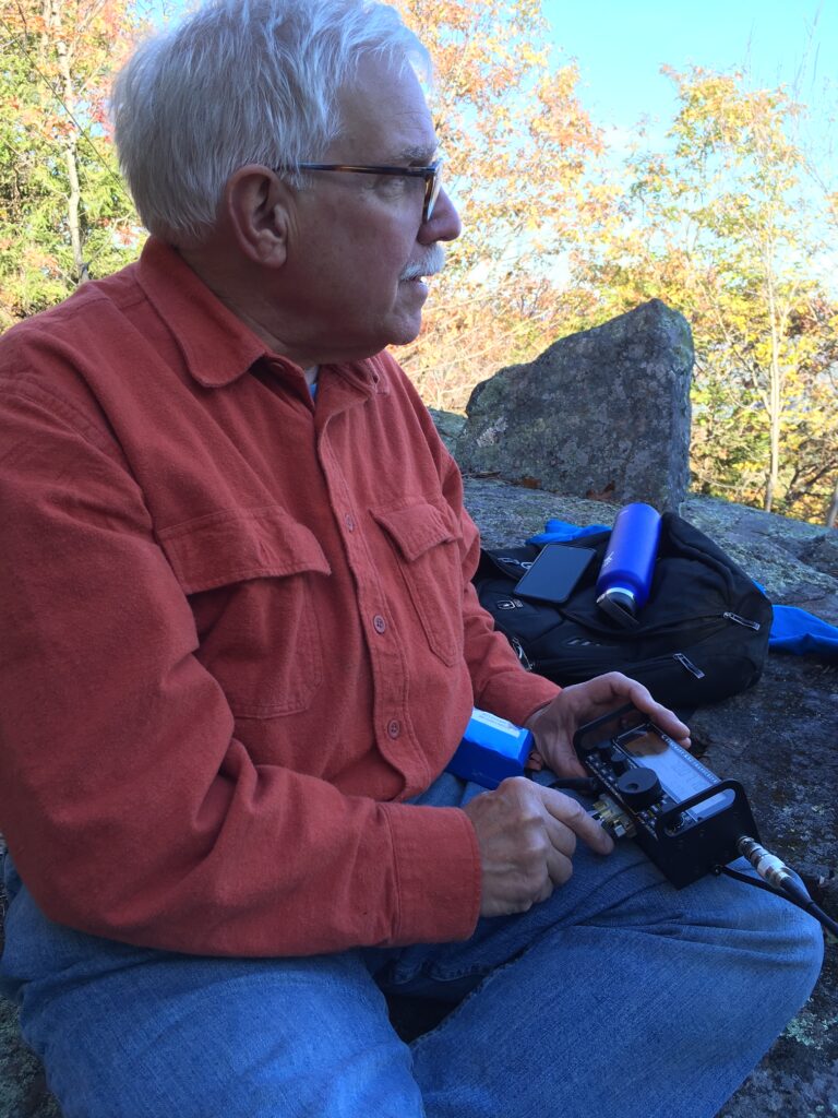
It was time to do radio. While I was setting up my Elecraft KX2 and the 29-foot wire attached to a 9:1 unun, Jim decided to break out his Baofungus tiny transceiver with a stubby antenna. He called out and lo and behold a man from 40 miles away in Concord, NH answered back. Altitude sure helps when you’re doing radio.
Here are some photos of the radio part of our adventure:
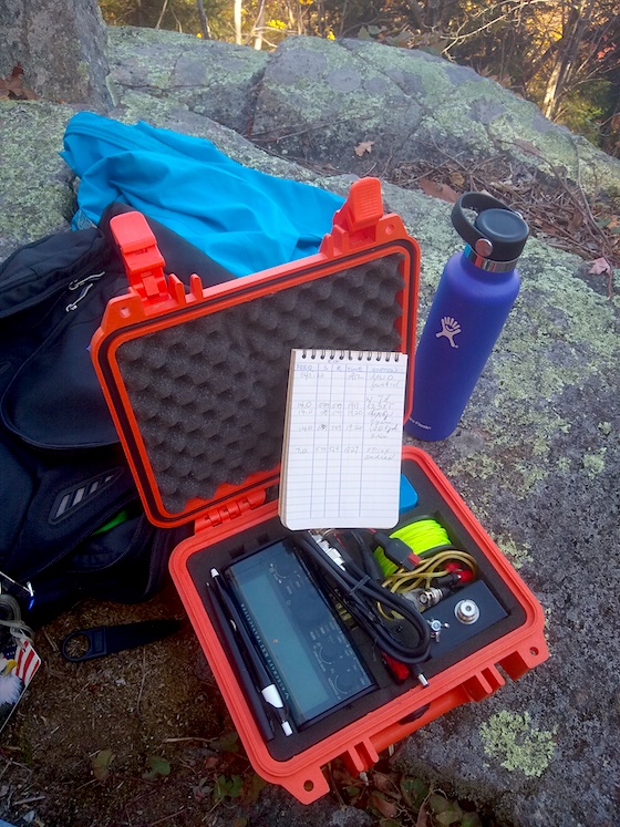
This is my Elecraft KX2 and the logbook of our contacts.
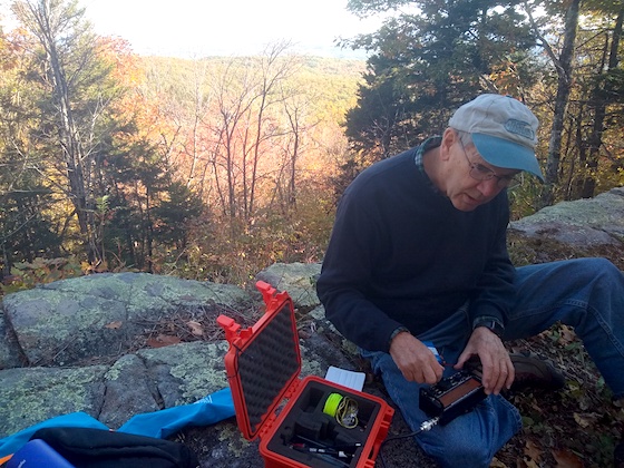
Jim can’t keep his hands off an HF radio! He wanted to get some contacts too.
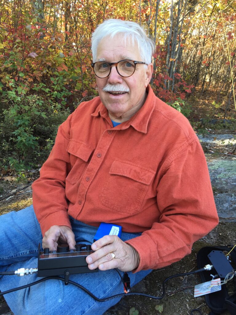
I had on an autumn-themed shirt! I’m busy chatting with a Canadian radio operator.
We had a successful SOTA activation. You need four contacts and we got five.
My antenna sloped to the east which was perfect. Soon we had three European stations in the logbook. There’s nothing like long-distance (DX) contacts in the log on a SOTA adventure. Here are the five contacts:
| STATION | FREQ | RST Sent | RST Rcvd | TIME |
| NS1O | 146.520 | 5/9 S | 5/9 R | 1912 |
| LZ3XT | 20 M | 599 | 599 | 1917 |
| HA5JI | 20 M | 599 | 599 | 1920 |
| IU0LJD | 20 M | 599 | 599 | 1924 |
| VE1EX | 40 M | 579 | 569 | 1927 |
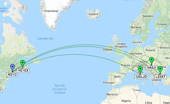
Here are my five contacts. Map courtesy of: qsomap.org
We decided to head back down the mountain after getting the five radio contacts. But first, I wanted to see the inside of the shelter and to sign in the logbook. You could easily spend the night here! Look at everything that you can use for free.
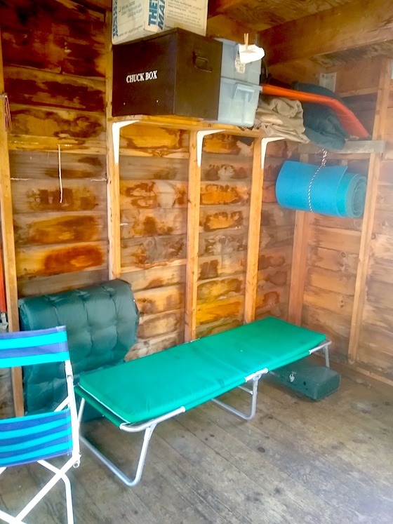
Anyone can use the shelter and all that’s in it. You just keep it clean and pay it forward.
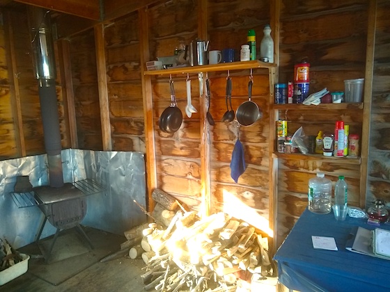
Look at the dandy cast-iron woodstove! That will take the chill off if you come up on a blustery cold day. Look at all the supplies!

Here’s the logbook you can sign. What fun reading what others write!
The trip back down only took forty minutes, but that’s to be expected. We did stop twice to rest as it’s hard on my knees, and Jim’s too, coming down.
I’d hike this mountain again anytime in great weather. I have to say we lucked out on such a beautiful day with the forest ablaze with fall color. It’s my favorite time of year and a true prize to be able to enjoy it.
Here’s another odd-shaped tree we saw on the way back down.
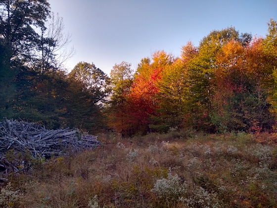
This is the top of the logging road. The rock cairn is behind me and over my right shoulder as I shot this photo. You need to head towards the orange and red trees to get back down to the trailhead. If you hike this mountain soon, I suspect you’ll be able to see the gray wood slash pile unless some kids set it ablaze one night! You can see the sun was getting lower in the sky as it smooched the trees with some golden-hour light.
Hey, My wife and I just hiked this today 1/18/2021. There is about 8″ of snow and the walking was great. We brought flagging as suggested and added where we thought it might be needed to help those that might not be as comfortable as we are with less trail markers. We actually met you and Jim a number of years ago on Wadleigh Ledges in Sanbornton when you were talking with some folks in Japan I believe. I remember Jim and his wife and daughter from my days at SB School., i also know Hanz Busch and his mom. I would also add that your trail description is one of the best ones we found, thanks for doing this. Nice job 🙂
Congrats! Isn’t that shack at the top wonderful? What a great place to warm up or dry off if you have bad WX.
Thanks for this great information, Greg. I should have looked harder in my Boy Scout manual! I made it to Life Scout with 15 merit badges.
Hi! My name is Greg, call sign is K3ANG, with is Lutherville, MD, a northern suburban area of Baltimore. First, nice blog! The pictures and the info are great! Second, those bent tree limbs are old trail markers. Somebody bent and/or cut those limbs in a particular way when they were new growth, then lashed them down until they grew into the shape you found them in. The rope was either cut, or rotted away over time. I saw the process in an old scout manual years ago.
Stay safe.
73, de K3ANG