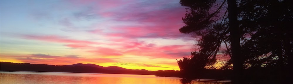
Mountain Pond | It was mid-afternoon and the unseasonably warm weather with the temperature at 70 F created slightly hazy conditions. The last vestiges of autumn color are visible on the underbrush protecting the water’s edge.
Yesterday, November 7, 2020, my good friend Jim Cluett and I finally hiked to Mountain Pond deep in the woods of New Hampton, New Hampshire. We had been denied this achievement no less than two times in the past two years. Twice before we attempted to get to Mountain Pond from another direction other than the ancient trail that comes up the draw from Spectacle Pond in Sanbornton, NH.
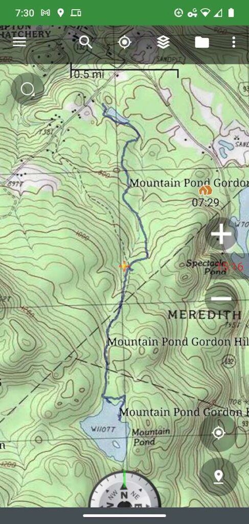
The blue line outlines the path we took to get to Mountain Pond traveling south from the New Hampton, NH Water Works site.
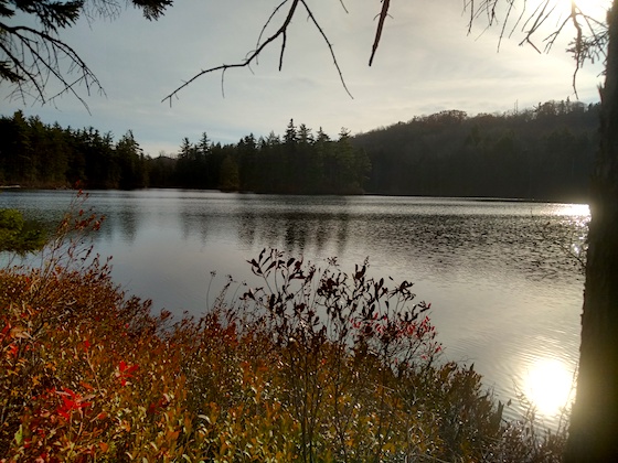
Mountain Pond is the primary water source for the town of New Hampton, New Hampshire. Water draining from the north face of Hersey Mountain quenches the thirst of this tarn scoured out by the last massive continental glacier that covered all of New England just 14,000 years ago.
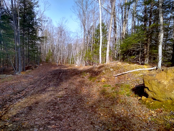
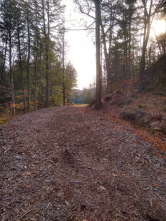
This is the new magnificent road you can use to get to Mountain Pond. The boulder to the right is one the machines moved to create the road.
“How much do you think that boulder weighs?” You can always count on Jim to ask questions about things like the height of trees, how far down a creek is below you, and other things about what we see on our hikes.
We had stopped for a moment for me to ease the pain in my hips. I strained my body the previous few days working outdoors and the night before I had horrible fitful sleep because of the dismal state of affairs here in the USA regarding the recent Presidential election. I was not in the best of shape to do this strenuous uphill hike where we gained 465 feet in elevation in just under 2 miles.
“Well, most rock weighs 150 pounds per cubic foot,” I replied.
We agreed that the giant boulder that was moved to create the new access road in the summer of 2019 measured 4 feet tall, 5 feet long, and 6 feet deep.
“Let’s see, that’s 120 cubic feet, 18,000 pounds, or nine tons.” I’ve always been fairly good with numbers.
Up Up Up
We continued to put one foot in front of the other going uphill almost the entire way. Every now and then it would level out, but sometimes it would be exceedingly steep with some short parts of the magnificent road having a 24% grade. Trust me, that’s steep.
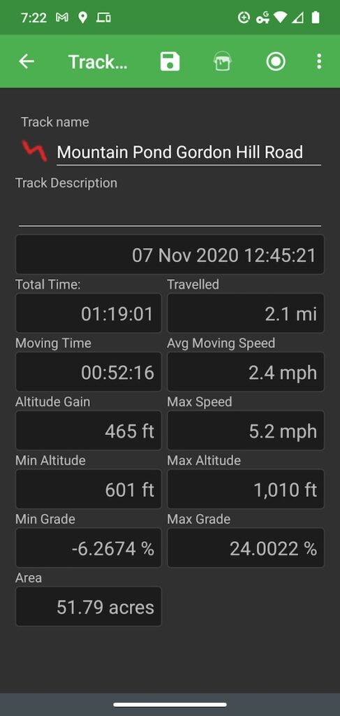
My BackCountry Navigator app on my smartphone creates this set of data when you record a track. About halfway up the trail we ran into two men who owned some of the land we hiked on. I estimate we chatted with them for about ten minutes.
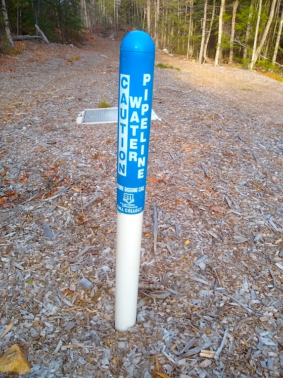
The new road was created so they could install and service a new 10-inch pipeline from Mountain Pond down to the New Hampton Water Works. These markers warn folks to call 811 before they dig.
We’re within 150 yards of Mountain Pond. That’s a man-made dam highlighted by the late-day sun.
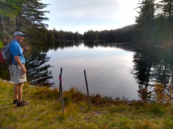
We made it! I shot this photo moments after the grueling 2.0-mile climb. My hips were happy the torture had subsided.
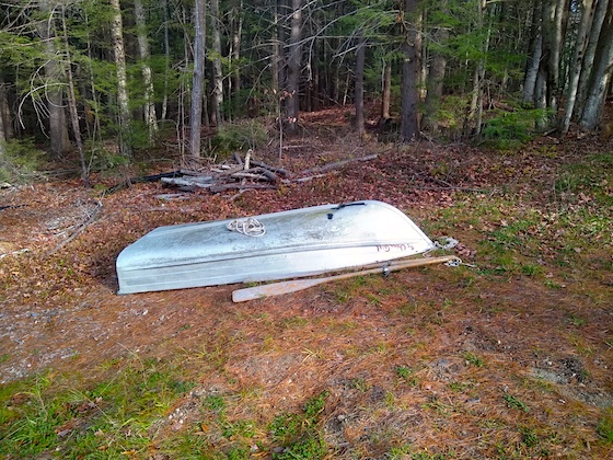
This rowboat must be the property of the New Hampton Water Department. My guess is they go out onto the pond from time to time to test the water quality.
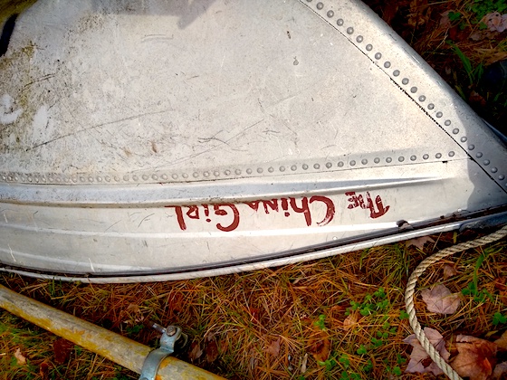
The China Girl – Wouldn’t you love to know the story behind the name of this humble watercraft?
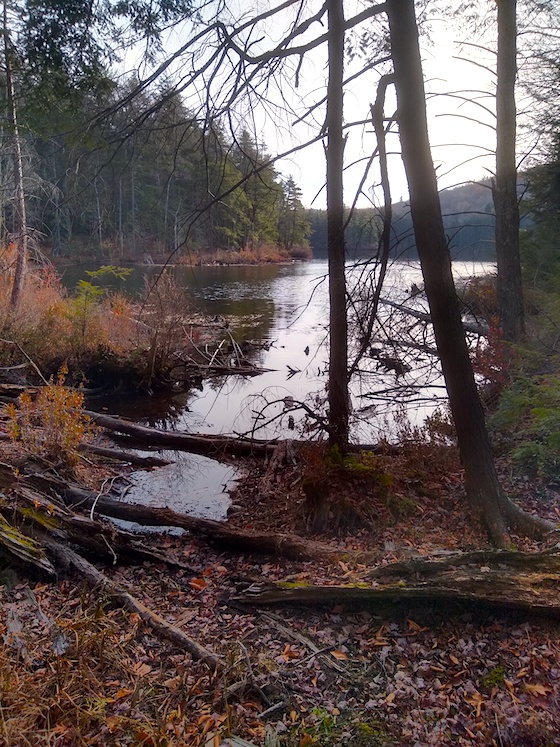
Once we got to the end of the road at the dam, we turned left to walk down a wonderful trail that hugged the shore. Jim knew of a magic campsite where we’d set up to do radio. It was about one-tenth of a mile away. The campsite is along the shore at the top center of the photo where the brown underbrush disappears around the corner.
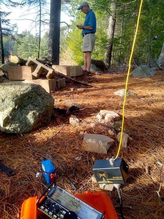
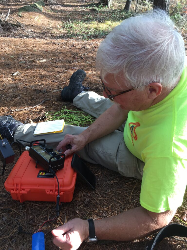
We finally made it to the campsite and it only took minutes for us to set up our radios. Jim is looking at his handheld transceiver. You can see my Elecraft KX2, my 9:1 unun, and my 29-foot yellow antenna wire. That’s a BioennoPower 3 Ah battery powering the radio.
Water Bottles and Antennas
Once we arrived at the south-facing campsite we decided to get on the air. Jim wanted to test out a new 2-meter roll-up j-pole antenna. I was going to do high-frequency work trying to start on 20 meters.
Jim had a much shorter throw to make than me and I was fortunate to snare the exact branch on my first throw so my 29-foot vertical wire would hang vertically directly over where I was sitting on wonderful dry and soft pine needles.
Jim was very interested to discover if he could trip the local voice repeaters and at least one APRS repeater in the area. He tried using a standard small rubber-duck antenna at first and was unsuccessful. But once he connected to the j-pole antenna that was about 15 feet in the air, he hit pay dirt.
“What’s your phone number?” Jim is such an inquisitive guy.
I was busy trying to find a station and gave it to him. Moments later I got a text message. Jim successfully sent me a text using the APRS system. What a great way to get help IF you are out in the wilderness, and are able to connect to an APRS repeater!
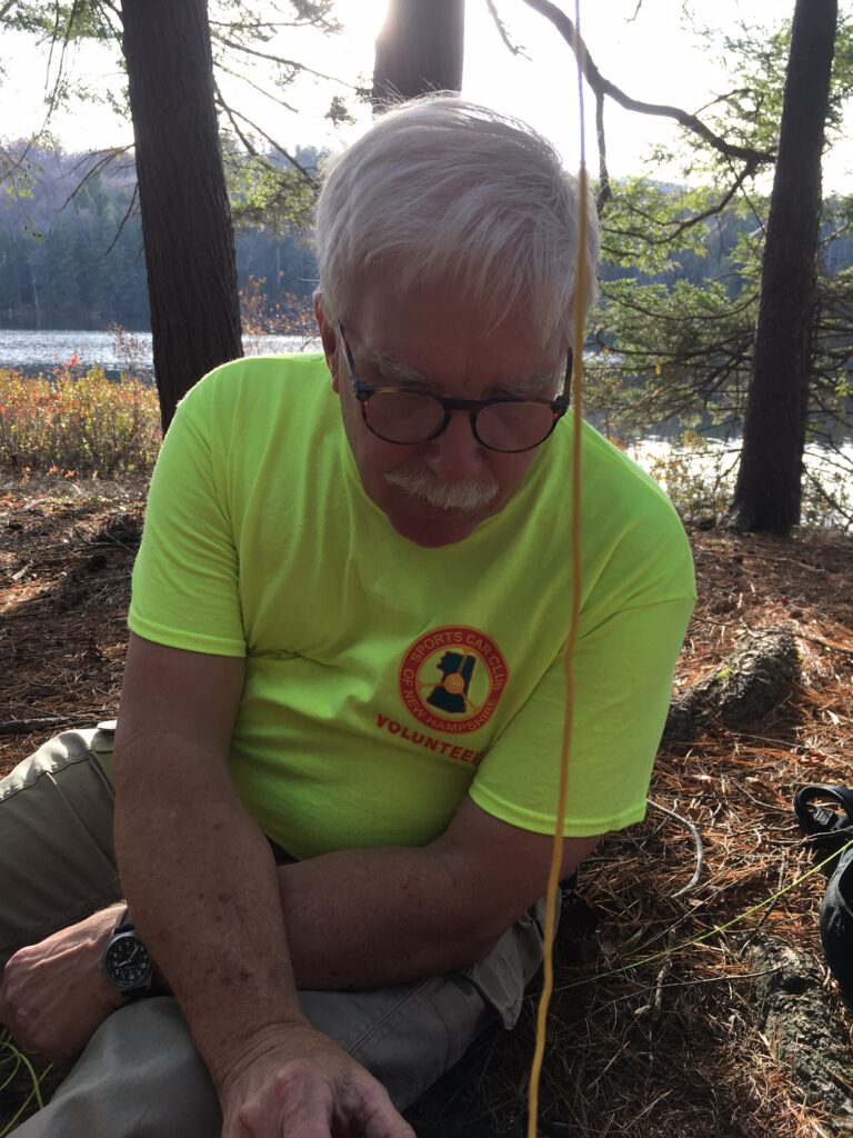
Here I am trying to avoid getting skunked. I decided to wear my not-get-shot shirt since hunting season is upon us.
I was able to make one contact – VA2EO in Canada. I heard our good friend Bert, F6HKA, in France connecting with others, but he didn’t hear me calling him.
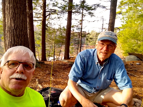
This is the first selfie photo Jim and I have taken in a while. You can tell he had a better radio day than I did! Plus, his hips weren’t hurting.
All in all, we had a magnificent hike and radio outing. It only took us about 45 minutes to get back down to our vehicles. We were both tired because we didn’t talk on our mobile radios as we drove back home.
Mother Nature has a few more great days in store, so I hope to get out at least once more with Jim before it gets cold, rainy, and inclement.