Mt. Washington Bicycle Hill Climb 2017

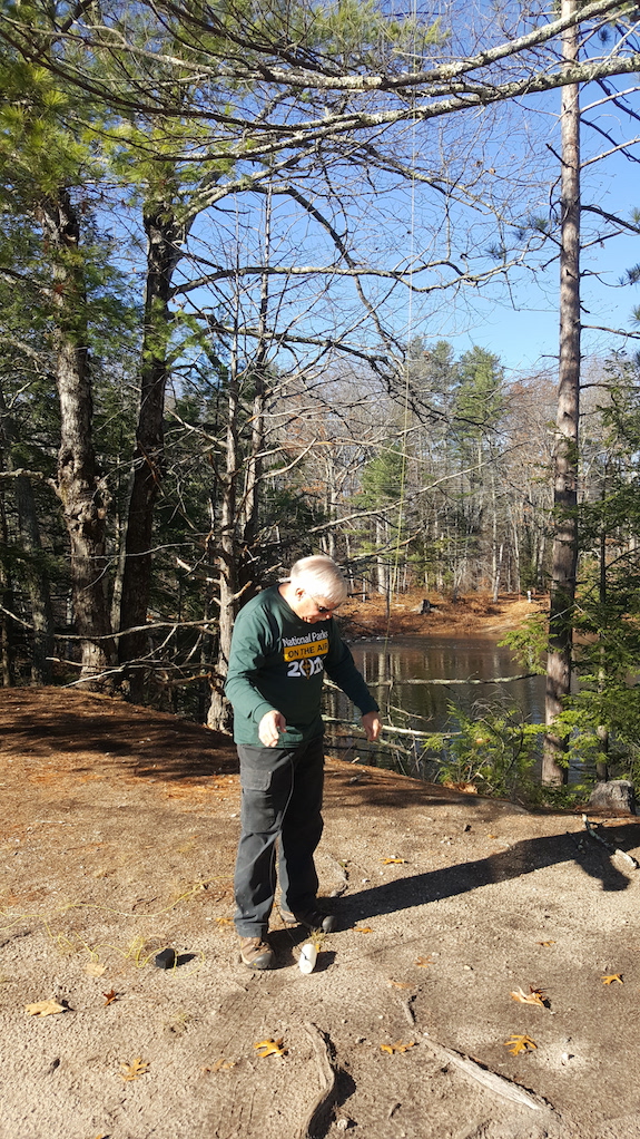
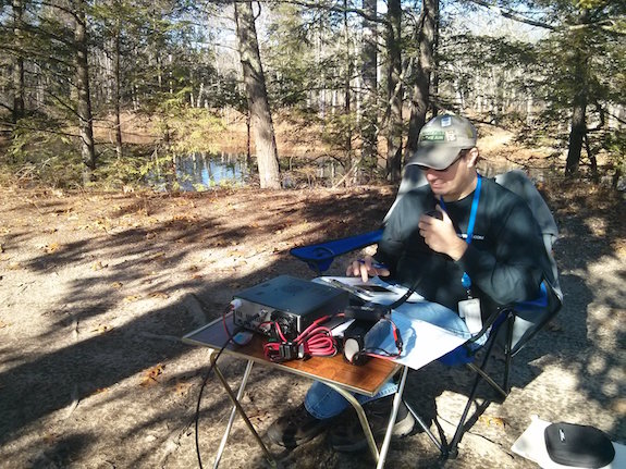
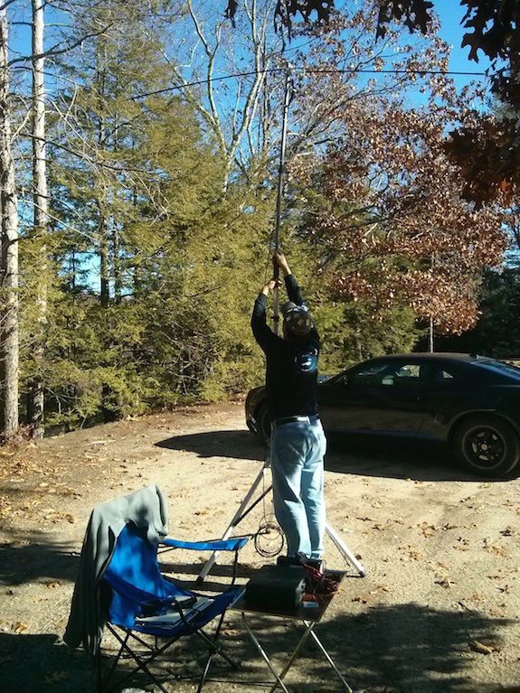
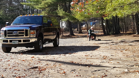
Yesterday I volunteered to be a member of the emergency communications team for the 2017 Mt. Washington Bicycle Hill Climb. It’s an annual event done in conjunction with the private Mt. Washington Auto Road and the Tin Mountain Conservation Center. Cycle professionals and enthusiasts do whatever is necessary to gain 4,875 feet in elevation in as little time as possible.
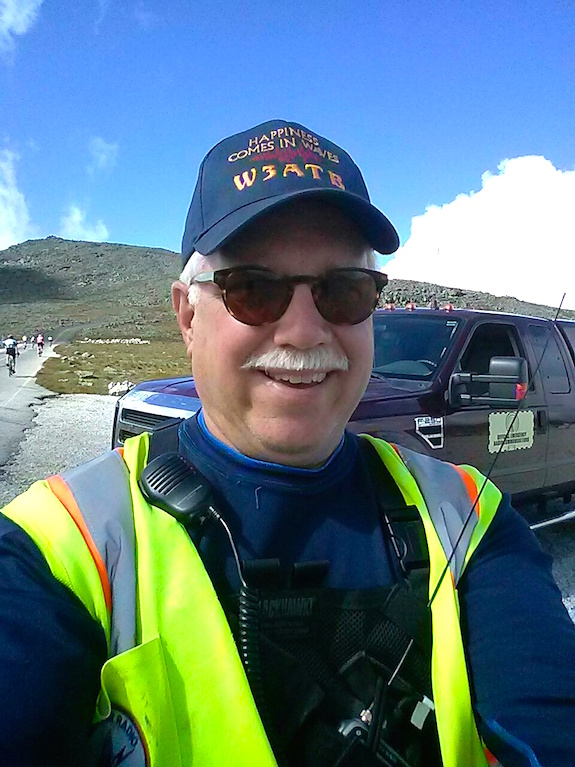
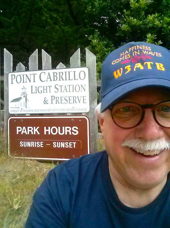
This is an odd selfie shot. My head is tilted down giving me a horrible triple chin because I wanted you to see the words on my hat. Copyright 2017 Tim Carter

This year’s winning time was an astonishing 51 minutes and 13 seconds by Phil Gaimon. The winning woman rider was Aimee Vasse with a time of 1:05:34.

I’ve worked many times on the Rock Pile as it’s called by all the locals. Many don’t realize the history behind the name because they don’t pay close attention as they ascend the mountain.

As you claw your way up the serpentine 7.2 mile road with no guardrails you see nothing but raw bedrock for miles and miles. But as you get up to the strange flat eight-acre cow pasture at the 5,700-foot elevation you start to notice that the mountain is comprised of jumbled rocks and no solid bedrock is exposed.
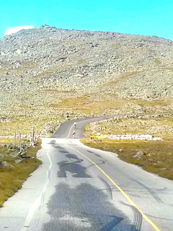
This photo is looking due southwest at a mound of jumbled rocks some as large as cars. Underneath it at some depth is bedrock. I was standing in the cow pasture that’s about 5,700 feet in elevation. It’s a lower quality photo using the digital zoom feature of my cellphone. Copyright 2017 Tim Carter

The massive gigantic continental glaciers that covered all of New England just 15,000 years ago weren’t thick enough to scour the rocks off the tip of Mt. Washington. Normal weathering over hundreds of thousands of years has created a collection of rocks that are slowly being broken down and carried to the oceans.

Mother Nature will expose the bedrock under the rocks, but she’s taking her time doing it.

The day before the event we received three inches of rain at my house which is about 60 miles south of Mt. Washington. As I left my house at 5:20 am, it was still dark but you could feel the atmosphere was choked with moisture.

This is what I drove through for much of the 1-hour 45-minute drive from my home. This photo was taken on State Route 16 just below Pinkham Notch as the road runs next to the base of Mt. Washington. Copyright 2017 Tim Carter

As dawn broke, I drove through fog and leaden skies. No doubt it was going to be a changing weather day up on the mountain. I just hoped for moderate wind.

After the top three male and female riders passed me, my work was done for the day. The only other thing I’d have to do is call in for emergency medical help for a rider near my position.

I decided to pass the time using my elevation to my advantage. I set one side of my Yaseu mobile radio in my truck to the national calling frequency of 146.52 MHz. I was booming out at 50 watts and had line of vision sight to the north of over 200 miles.

It didn’t take long to have at least four or five operators come back to me who were up in Maine. At one point I called, “CQ CQ this is W3ATB atop Mt. Washington.”

A second later I heard, “W1PID”.

What? No way! That’s my very close friend Jim Cluett. It turns out he was driving down in Laconia, NH on his way to help our friend Dick Christopher, N1LT with his sailboat. The tip of my truck antenna was higher than the ground to the south of where I was parked and I was able to talk with anyone in that direction.

After talking with Jim, I then logged two contacts with operators at light houses along the coast. It turns out it was the International Lighthouse and Lightship Weekend and lighthouses all over the world had radio operators in or next to them trying to make contact. Here’s my log for those two contacts:

WS1SM 146.520 MHz 1555 UTC
K1N 146.520 MHz 1610 UTC

K1N was operating at the Newburyport, MA harbor light on Plum Island. How exciting! It was a fun day of radio for me to say the very least.

I vote we let photos tell the rest of the story. They do so much better if you ask me.
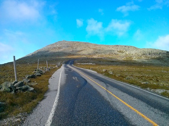
This is one of the selfish reasons why I volunteer for these events. I get to drive up the mountain early and get set up. It’s just me and the mountain. It can be very spiritual as you feel quite alone. That is NOT the summit of Mt. Washington. If you were to hike to the top of that false summit, you’d clearly see the summit building just 500 yards away. Copyright 2017 Tim Carter.
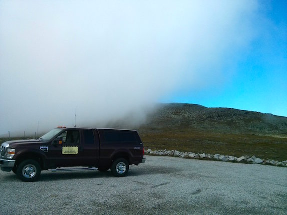
You’re up so high that clouds slither over you. It’s surreal when it happens. Within seconds of snapping this photo, I was surrounded by the soft cloud. Minutes later it had moved to the north and it was clear once more. Copyright 2017 Tim Carter
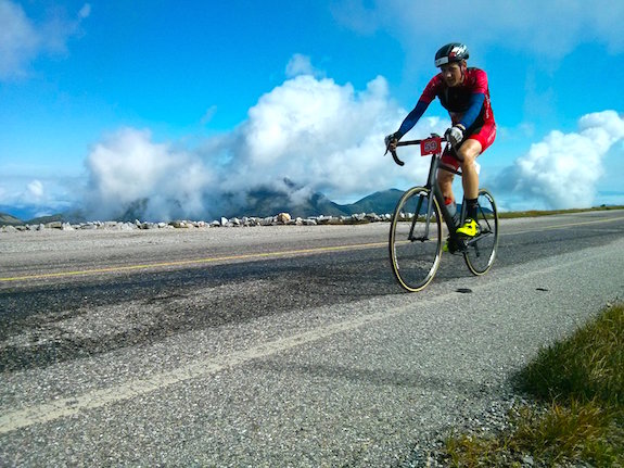
I’m aimed due north in this photo looking across the cow pasture directly at the distinguished Presidential Range of the White Mountains. Copyright 2017 Tim Carter
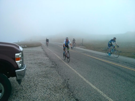
The clouds buffeted the mountain throughout the race. Most of the time it was so sunny and clear the sky was so blue it hurt your eyes to look at it. Copyright 2017 Tim Carter
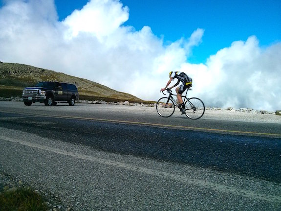
This rider is focused on the road. I found many looked down and my guess is they didn’t want to get distracted by how much higher they had to climb. This photo is taken looking northeast across the cow pasture. Copyright 2017 Tim Carter
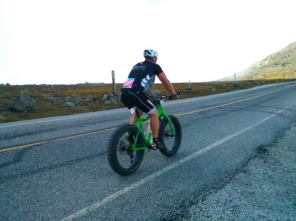
I did pay attention in my high school and college physics classes. I know that friction is the last thing you want when trying to carry yourself and the weight of a bicycle up over 4,875 in elevation! These fat tires would not have been my choice. He was the only one with this configuration. All the elite riders had tires thinner than someone who’s been in a life raft at sea for a month with no food. Copyright 2017 Tim Carter
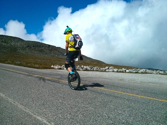
You may be surprised to see a unicyclist competing in this race. I’ve seen several over the years. But you should be in awe because it requires far more energy to be expended. It’s harder to balance yourself and note there’s NO GEARING to help with the task of going up hill for miles and miles. Copyright 2017 Tim Carter



Russian Gulch POTA Activation KFF-1192

Yesterday I found myself just north of Mendocino, CA. I was in the middle of an extended business / pleasure trip in Oregon and California. The pleasure part of the trip was to include as many Parks on the Air (POTA) activations as I could squeeze into each day as I wandered down the California Coastal Range and coastline.

I had decided to try to do four activations in one day. There happened to be four California state parks within a one-hour’s drive of one another. My plan was to start at Russian Gulch, go to Mendocino Headlands right on the coast, head east to Mendocino Woodlands State Park and finish up at Van Damme State Park.

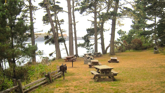
I arrived at this fascinating state park on the coastline around 9:30 am. After paying my day-use fee I found a secluded picnic area high on a bluff right next to the ocean.

I spied that table on the left and felt that was the best place to set up. Copyright 2017 Tim Carter

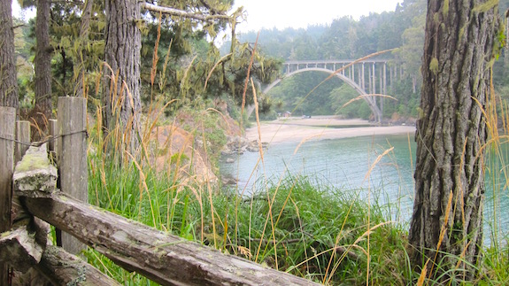
A major stream / river enters the ocean at this state park and a magnificent concrete-arch bridge carries US 1 over the large ravine.

What a wonder of engineering and construction! The infamous Russian Gulch bridge. Copyright 2017 Tim Carter

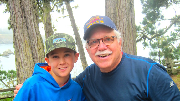
Just after I threw my water bottle up into a tree next to the picnic table, a young boy and his grandfather appeared from the edge of the bluff. There must have been a hiking trail there.

As happens most of the time, they were intensely curious and asked what I was doing.

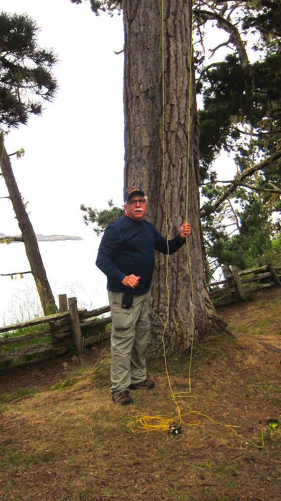
“I’m about to get on the air and do some amateur radio. Could you do me a favor and take my photo? No one is usually around to see how I put up my antenna.”

Thanks Jack for the great photo! Copyright 2017 Jack ????

Jack was the young boy’s name and he didn’t hesitate to grab my camera. I was thankful that he took several photos.

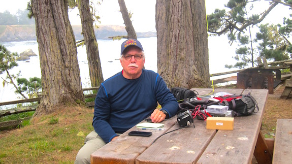
I’m ready to rock and roll using a mini Pico Paddle sending invisible dihs and dahs up into the ether. I was in a great mood, but you’d not think so with this serious look! Copyright 2017 Jack ?????

Within minutes I was on the air while Jack and his grandfather watched with great delight. To send invisible radio waves up into the sky, I use an Elecraft KX3 radio, a simple 29-foot wire that has a 9:1 unun at the bottom and a small mini Pico Paddle to send Morse code. I power the radio with a BioennoPower power pack.

I do carry a microphone if I want to talk, but since I use only 10 watts of power or less most of the time it stays hidden it its box most of the time. The radio propagation has been so dismal this summer that it’s quite hard to do voice communications at low power.

It didn’t take but eighteen minutes to acquire the ten required conversations with other radio operators to officially activate the park. I got several more and decided to move on.

I thanked Jack for his help and told him to contact me if he wanted more information about amateur radio.

Let’s hope Jack takes an interest in the hobby so we can pass the torch to him. Copyright 2017 Unknown Grandfather – TNX for taking the photo!

I felt like Mary Anne the steam shovel as I sat at that table. If you’ve read the classic children’s book Mike Mulligan and his Steam Shovel, you know how Mary Anne worked harder and faster the more people that watched her dig.

If you have grandkids and they’ve never read this book, get it. I still have a copy. It’s one of the BEST romance books I’ve ever read. Seriously. CLICK the IMAGE NOW to have it delivered to your home or to your grandchild’s home.


Mendocino Woodlands POTA Activation KFF-1173


“Turn around you idiot. This is going to be a massive waste of time.”

That’s the thought I had as I drove deeper and deeper along Little Lake Road into the forest east of Mendocino, CA this afternoon. The lake the road was named after sure must have been small, because I missed it.

I was on my way to try to do a Parks on the Air (POTA) activation at Mendocino Woodlands State Park. POTA is an international program where some amateur radio operators go outdoors to different state and national parks across the world, set up small radios and try to have ten separate conversations with other operators while at the park.

Those who are outdoors and do this are called activators and the operators who may be at home at the other end of the magic invisible radio waves are called chasers. Complete the ten conversations and you officially activate the park.

Failure Is Possible

Just a little over a day before I attempted to activate a California state park about seventy miles north, Humboldt Redwoods State Park. It was in a canyon as well and it took me about an hour to achieve one simple conversation. I reluctantly gave up and drove away because I had a long drive ahead of me and didn’t want to do it in the dark.

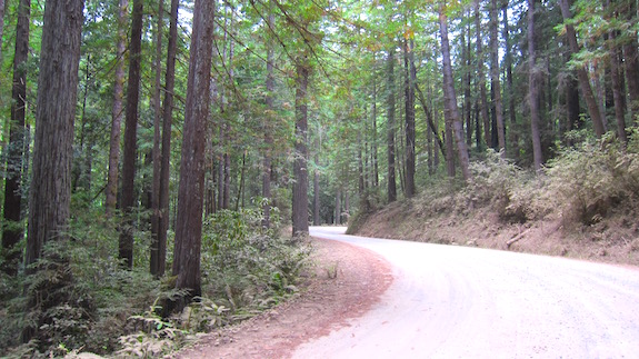
Getting to the Mendocino Woodlands State Park is an adventure on its own. You travel miles east of the town of Mendocino, CA. With each mile you travel, the condition of the road gets worse. Eventually it transforms to a dust-choked gravel surface that used to be the rail bed for the tiny trains that wrestled the giant redwood logs out of this majestic forest.

Planning to go here? You’re going to travel several miles of this road and the closer you get to the park, the worse shape the road is in. Copyright 2017 Tim Carter

I shook my head driving knowing I would go to all the effort and come away with nothing. The walls of the canyon were steep – church-steeple steep. As I navigated curve after curve I anointed this wilderness the Radio Waves Canyon of Death.

Camera shots like this transform a three-dimensional view into two dimensions. You simply can’t get a feel for how steep the hillside is. It’s at least 45 degrees, maybe 50 degrees. Copyright 2017 Tim Carter
As I passed each massive redwood tree on the sheer canyon walls, my brain painted a vivid picture of my radio waves bouncing off the walls of the canyon like a giant game of Pong. All I could think of were the electromagnetic pulses from my CW paddles going back and forth never escaping the clutch of the wretched walls of rock and stone.

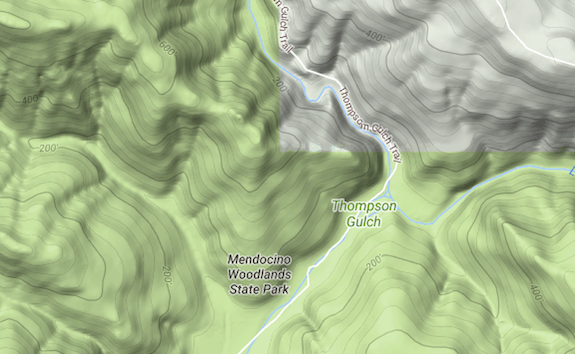
My college degree is in geology. We used topographic maps all the time. If you know how to read one, then you know how incredibly steep the canyon walls are. This is the topo map of the park. Copyright 2017, Google, Inc. All Rights Reserved

My guess is I traveled at least another three or four miles up the gravel road until I finally arrived at the park entrance. It turns out this is the most unique state park I’ve ever been in.

A First For Me

The park is carved up into three giant camps with small cabins, larger buildings for cooking and eating and any number of other improvements. Groups and families rent the camps for a week at a time. Witches and warlocks meet here once a year and all sorts of other unusual groups gather here to do who-knows-what.

I stopped at Camp One. It was home for the week for a massive family and they welcomed me to share a lone picnic table among the giant trees to try to see how fast I’d get skunked.

They were mesmerized that some total stranger would drive so far to try to pluck invisible waves out of the ether. Most had no idea that amateur radio was still around and alive.

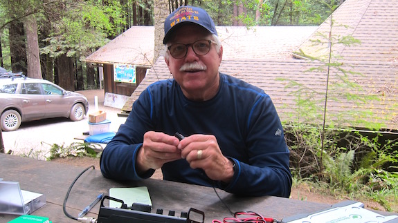
The mess hall for Camp 1 is just behind me. Can you figure out yet why I have that impish look on my face? Copyright 2017 Maretta ???

I was able to launch my trusty water bottle about 40 feet nearly straight up and capture a perfect branch in a tree right next to the table. I’d need every bit of its vertical alignment to try to send a signal out of this wretched canyon where radio waves come to die.

You can’t see the branch I captured with my water bottle and halyard. It’s at least 15 feet above the top of the photo. Copyright 2017 Tim Carter
Within minutes I was on the air with my Elecraft KX3 powered by my trusty BioennoPower power pack. It charged up all morning because the plan for today was to do radio at four California state parks in and around Mendocino.

Before leaving the town of Mendocino, I was able to use my cell phone to reach out to the POTA operators who use the POTA Facebook group page. They knew what time I might get on the air and I told them the frequencies I’d try.

A Miracle

The first thing I did was spin the dial on 20 meters and heard nothing. When I mean nothing, I mean nothing.

No doubt. The ravenous canyon walls were gobbling the signals. Damn them and the tectonic forces that created them!

I took a deep breath and started to send CQ CQ.

“Do you smell that? Get ready for the skunk my friend.”

That’s exactly the thought that went through my head.

BOOM! Within seconds Bob Elsinger, VE6UX, was answering me. You say big deal. I say are you kidding? He’s from Alberta, Canada!

He was hundreds of miles away and on the other side of the Coastal Range I was trying to defeat

But it gets better. He gave me a real signal report of 559.

That’s remarkable as I was straining to reach him with only ten watts of power. That’s just a little more power than you’d use to fire up two old-fashioned night lights.

The Conveyor Belt

One after one I made contact with other operators. I felt like I was sitting on a spring ready to pop up into the air.

Was it possible? Could I wrestle victory from the Grim Reaper of Radio Waves on this day in this remote part of California?

The QSOs, a fancy radio term for completed radio conversations, kept happening just like the pieces of chocolate candy coming down the conveyor belt in that classic scene from the I Love Lucy show.

Victory!

It only took twenty-six minutes to get to the minimum ten QSOs to activate the park. I had done it! It was a surreal feeling. Just a mere eighteen months ago I could have no more done what I had just did than drag a log up the canyon wall.

I ended up with thirteen QSOs.

Just before I got on the air a very nice woman came and sat down from me across the table. Her name was Maretta. She was fascinated in the entire magic show that was in progress and was exceedingly polite.

She watched the entire activation and was kind enough to take the photo of me sitting at the table.

“Would you consider helping me explain all this to a group of Girl Scouts I work with?” she asked.

I immediately agreed and said we could do it using Skype or some other video conferencing. She left and immediately a small boy named Tip came up.

“What are you doing?” he pondered.

I explained it all to him while his father joined us. Moments before he came up, I had started to pack up. Fortunately I didn’t get too far.

“Can you show me how this works?”

It was impossible to decline his proposal. Within minutes I was back on the air and believe it or not did a POTA park-to-park (PTP) QSO with N5PHT!

I thought I had died and gone to Heaven. Never before had I done a PTP as we call in in the world of POTA.

Once I collected myself, I showed Tip how to work my mini Pico Paddles. He was overjoyed at being able to transmit his name while I manned the controls of the KX3.

The Takeaway

Tip and his dad had other things to do, I needed a cup of coffee and wanted to get back to town to scream to the POTA Facebook group a well deserved Thank You! I felt they were probably just as excited as I was because not only do I think I was the first person to activate this difficult park, but I also could well be the last.

As I was getting back in my rental car, I thought about what had just happened.

I kept driving down that gravel road because my gut told me to. Something inside me said to not give up. I’ve rarely quit things in the past because the sign over my high school football dressing room said:

Quitters never win. Winners never quit.

If you decide to do a POTA, SOTA or similar activation and you think it won’t work out, think again. Don’t give up.

Just Do It.


Point Cabrillo Light Station POTA Activation KFF-3536

This afternoon I successfully activated Point Cabrillo Light Station while participating in the Parks on the Air (POTA) program. The official designator for this state park is KFF-3536. It was a great way to end the day after failing to activate Humboldt Redwoods State Park earlier in the morning.

I was quite happy after getting more than the required QSOs in my notepad! Victory! Copyright 2017 Tim Carter
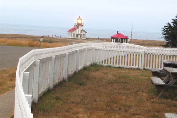
Point Cabrillo is an historic wood-framed Victorian-style lighthouse just north of Mendocino, CA. The air was filled with light fog which was the perfect way to view a lighthouse in my opinion. This type of weather is when sailors depend on the intense rotating beam of light.

That’s a real light with the special lenses, not some electronic beacon. Sadly the Coast Guard will not allow the general public up the steep ladder to see the rotating light. Copyright 2017 Tim Carter
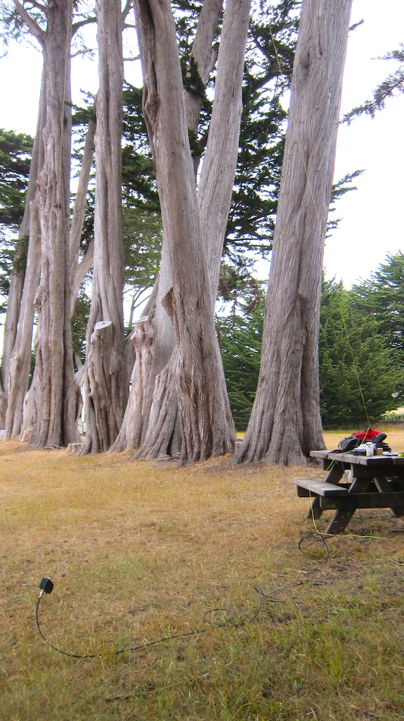
I set up at a picnic table near the park headquarters which is about a mile east of the lighthouse. I was in such a rush to get on the air that it took four attempts to launch my water bottle up and over a specific branch in some very tall trees next to the table.

The branch I wanted to capture was out of the frame. It required a precise throw to snag it. Copyright 2017 Tim Carter
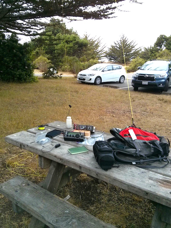
It didn’t take long to get set up and when I spun the dial on my Elecraft KX3 I knew the activation was going to be challenging. The band was as quiet as patrons reading books at the local library.

I’m ready to pluck invisible waves out of the air. Copyright 2017 Tim Carter
Since it was late in the day, 3:47 pm PT, when I turned on the radio, I decided to immediately go to 20 meters. This is usually a dependable band, but today it was anemic.

The activation only happened by gathering what I could on 20 meters and then I switched to 30 meters. I only did CW and not single side band (SSB). With propagation as bad as it is, it’s nearly impossible to do SSB with a low-powered setup.

Here’s my log:

W0PHX 20M 2257Z
KG5CIK 20M 2259Z
K5RK 20M 2300Z
VE7CV 20M 2302Z
K5RK 30M 2305Z
W6LEN 30M 2306Z
K7ZO 30M 2307Z
K6PAM 30M 2309Z
VE6UX 30M 2314Z
WB7QR 30M 2315Z
VE4VJR 20M 2323Z

Once again the POTA Facebook group came to my rescue. You need ten contacts to successfully activate a park. I got eleven.

I decided to pack up once I knew I had the needed contacts as I wanted to go see the lighthouse. I decided to walk the mile down to the coastline as the past week I’ve gotten very little exercise. It was well worth the walk.

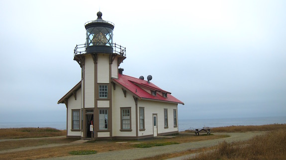
Isn’t this a gorgeous building? Copyright 2017 Tim Carter
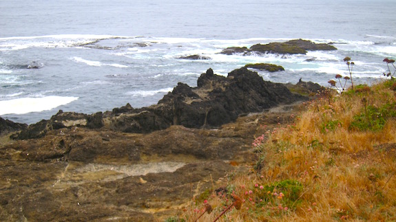
These rocks are just below the lighthouse. The were created millions of years ago as molten rock welled up on the ocean floor. Continental drift has brought them 3000 miles to the west coast of the North American plate. Yeah, I majored in geology in college. Copyright 2017 Tim Carter
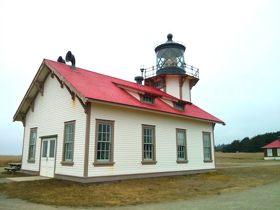
The roof shingles are wood but they’ve been painted the bright fire-engine red. My guess is this is how it’s been for over 100 years! Copyright 2017 Tim Carter


Ft. Humboldt POTA Activation – Eureka, CA

On August 7, 2017 I found myself driving through Eureka, CA on my way to the San Francisco Bay area. Two short business meetings spaced out over thirteen days provided me with about eight days to travel by car from Portland, OR to Google’s San Francisco offices. I had never been to Oregon nor Northern California and brought my outdoor radio equipment to have some fun.

It was an overcast breezy and chilly day with the temperature in the lower 60s F. My goal was to try to be the first to activate Fort Humboldt state park as part of the Parks on the Air (POTA) program. The official designator for POTA for this state park is KFF-3434.

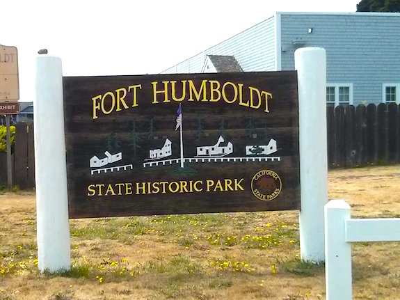
CLICK the sign to discover the history of this bluff up above the mighty Pacific Ocean. Copyright 2017 Tim Carter
This state park was all but deserted when I arrived. I spied some picnic tables under trees that were on the edge of a large open field. Being an ask-for-forgiveness type of guy, I headed for the farthest picnic table that was pretty much out of sight of the park employees.

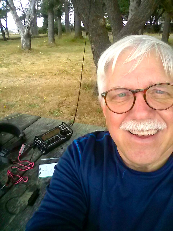
You can’t see the tree behind and to the left of me where my end-fed antenna was hanging. It performed well today! Copyright 2017 Tim Carter
I’ve been doing outdoor radio for enough years to know to avoid the water-bottle-eating thick evergreen trees that swallow my water bottle I use to get my halyard up into tree branches. Fortunately there was a leafless deciduous tree about 30 feet from the picnic table I wanted to use. It took me three throws to get the perfect branch so my 29-foot wire would hang vertically in the tree.

I had sent a message to the Facebook POTA group that I was there and about to get on the air. I made a mistake citing the UTC time because I thought I was still in New Hampshire. A few chasers thought they had missed me as the time I posted was three hours past!

CLICK the image to see what’s going on at POTA! Copyright 2017 Facebook, Inc.

I decided to do CW at first as that’s my passion with outdoor radio. I fired up my Elecraft KX3 powered by my trusty BioennoPower power pack. My antenna is just a simple 29-foot wire with a 9:1 unun at the end to get the impedance down to a level the internal tuner in the KX3 can match. I was able to get a 1:1 match on 20 meters with no problems.

The band conditions have been so wretched all summer, that the only reason I got my minimum 10 contacts was because of the faithful followers who monitor the POTA group on Facebook. Twenty meters was short today and none of my friends on the east coast could hear my signal.

I know I was spotted by several operators and even with that I was only able to gather ten QSOs. Three of those ten were with W6LEN but on different bands. Thanks Jess Guaderrama for making this activation possible! Here’s my log:

N9MM 20M 2227Z
 KN7D 20M 2228Z
VE7CV 20M 2230Z
KG5CIK 20M 2232Z
W7GZS 20M 2234Z
W6LEN 20M 2239Z
WD5IWN 20M 2243Z
K7ZO 20M 2252Z
W6LEN 40M 2259Z
W6LEN 30M 2321Z

As you can see, I just made it. Ten contacts are required for a successful activation. Nothing like cutting it close.

I had been outdoors in the chilly breeze in shorts and sandals for over ninety minutes. I was starting to think about getting a hot cup of coffee. That meant it was time to pack up.

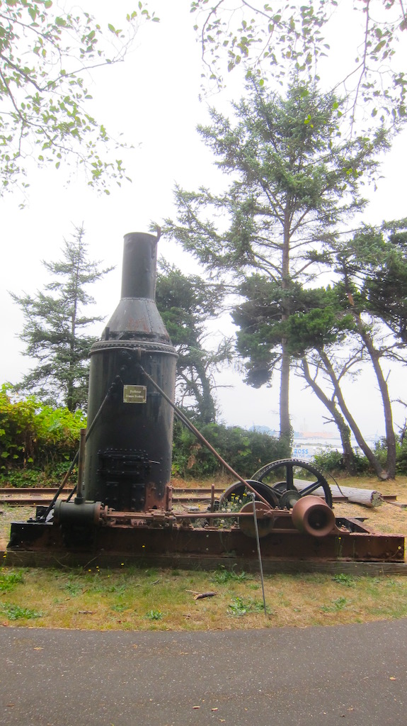
But before I left the park, I wandered over to look at some of the historic pieces of machinery that are housed here. Eureka, CA was the epicenter of the logging industry for the ancient California redwood trees from 1850 up to the 1990s.

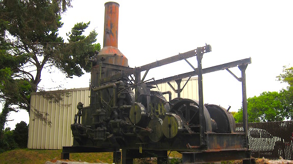
Check out some of the amazing pieces of machinery in this collection. Mother Nature is slowly reclaiming them. Perhaps they should be brought inside at some point like the two working tiny steam locomotives they have here at this magic park.

This is a smaller steam donkey that was used to drag giant logs from the forest. Copyright 2017 Tim Carter
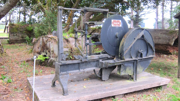
The sign on this machine said it was a Shingle Mill. I suppose it made redwood shingles use to cover the sides of buildings like my friend Russell Waters home in Montrose, CA. Copyright 2017 Tim Carter
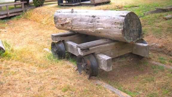
DUH! Why not use logs as rails in the forest? Very clever!!! Copyright 2017 Tim Carter
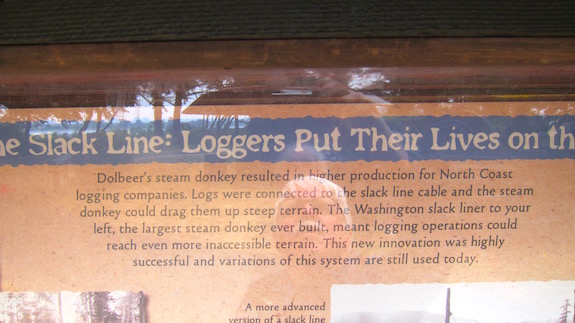
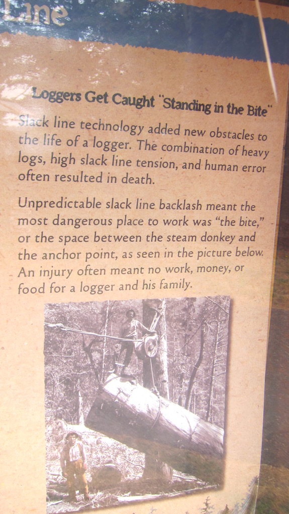
The sign said this was the largest steam donkey ever made. It was ginormous as you can see by the size of the pickup truck in the lower right corner. Copyright 2017 Tim Carter
Custom Ham Radio Hats

My mail came late yesterday and I didn’t bother to go get it.

This morning I opened the box at the top of the drive and in it was a square lightweight box addressed to me from a Jude Gelinas from New York.

What could it be?

My first thought was it was from some obscure public relations (PR) woman as not a week goes by that I don’t get a new tool, or home-building product sample from any number of PR folks.

I’m the AsktheBuilder.com guy and PR people pitch me constantly about new tools, products and services for contractors and homeowners.

My vanity call sign is based on my business. Get it?

www Ask The Builder

Wrong! It was a wonderful custom ham radio hat!

Here’s the hat. Jude can put any text you want on the hat and I’m sure any symbol. Reach out and ask her. CLICK THE PHOTO NOW to see any number of designs she’s done. Copyright 2017 Tim Carter
Jude is a licensed radio operator like me. Her call sign is W2AYV. It was her dad’s call sign and she got it as a vanity call in his honor. That’s very cool.

Jude also does custom t-shirts and embroidered polo shirts. CLICK HERE to see her Etsy store.

Here’s me modeling the handsome hat! I’ll be taking it with me on my upcoming outdoor radio trip to Oregon and N. California next week. CLICK MY FACE NOW to see a variety of Jude’s designs. Remember, she can make anything if you can draw or describe it. Copyright 2017 Tim Carter
I called Jude and sent her an email to this story.

She got back later in the day and it turns out my very very good friend Dan Murray is the instigator of all this happiness!

Thanks so much Dan!

Mt. Washington Road Race 2017

I didn’t see the sun rise on Saturday June 17, 2017 as I was up early to drive to Mt. Washington. The clouds were thick, low and it felt like it could rain at any moment.

With the official start to summer just days away, this was the first radio event of the 2017 season for me up on the Rock Pile as it’s affectionately called by those who frequent Mt. Washington. Hundreds of other people were driving to the base of the mountain to participate in the Mt. Washington Road Race.

My immediate thought as I was pulling out of my driveway was that if it was this bad at my house, it was going to be a brutal day on Mt. Washington, a peak that’s known for some of the worst weather in the world.

But Mother Nature had a treat in store for me and all others that were making the pilgrimage to this sacred part of the White Mountains. When I passed Pinkam Notch, just a few miles from my destination at the Mt. Washington Auto Road, the clouds disappeared revealing a glorious sunny day!

Professional, serious and casual runners were going to see if they could run or run/walk up the seven-plus mile torturous serpentine roadway that rises up nearly 5,000 vertical feet in that distance.

The Central New Hampshire Amateur Radio Club has provided the emergency communications for this event for years and it was great to see lots of familiar faces in the small shed that serves as the wood shop during the week and the command center for net control on event weekends.

As I walked to the shed to get my assignment, I grinned as I passed by the sectional aluminum mast that held the antenna for the primary net control radio.

This radio is the communications hub connecting all the radio operators spread out from the summit and finish line all they way down the flanks of the Northeast’s tallest mountain.

The video above shows this same antenna being erected five years earlier at the Newton’s Revenge bicycle race at Mt. Washington. I recalled the end of the video as I walked past the mast.  The same piece of romex cable was holding the mast straight as an arrow on this balmy morning.

If you’re not familiar with the communications protocol during a race like this, the radio operator at net control has lots of responsibility. Should a runner / walker get into trouble and need aid, one of the many operators along the course would immediately reach out to net control who would dispatch a roving team of medics.

A week before the event I had contacted Cliff Dickinson, N1RCQ, asking to be assigned to the infamous cow pasture just below the summit.

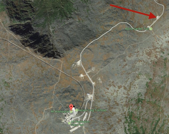
This is a satellite view of the summit area of Mt. Washington. The red arrow points to the parking lot at the cow pasture where I was stationed. Copyright 2017 Google Inc.

It was a selfish request because I wanted to set up my Elecraft KX3 HF radio and attempt to activate Mt. Washington State Park while I was waiting for the runners to get up to my position.

Last year I participated in the American Radio Relay League’s (ARRL) National Parks on the Air year-long event. When it ended on December 31, 2016, I  gravitated to the ongoing Parks on the Air event.

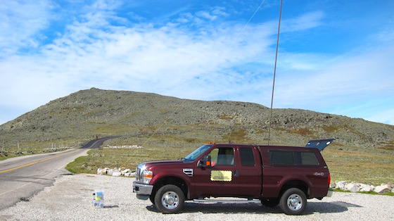
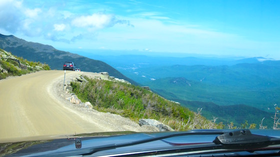
This area adjacent to my truck is the cow pasture. It’s about a two-acre area just below the summit of Mt. Washington that’s fairly flat. It’s hard to believe cows were once here because there’s not much to eat! Copyright 2017 Tim Carter

Once I arrived up at the cow pasture, it didn’t take long for me to get my own sectional aluminum mast antenna set up. Dangling from the tip was a 29-foot wire that sloped towards the east southeast.

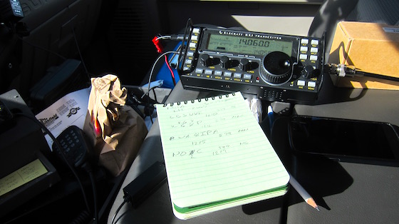
Here’s my Elecraft KX3 inside my truck. It was a balmy calm morning. That’s very rare for Mt. Washington. Copyright 2017 Tim Carter

The propagation was not the best, but I was hearing stations on 20 meters. My first contact was with Emily Saldana, KB3VVE in New Bloomfield, PA. I was very happy my signal was getting out!

After completing a few more QSOs, I got out of my truck and just enjoyed the peace and tranquility of the moment. It’s one of the reasons I love working these public service events up on Mt. Washington.

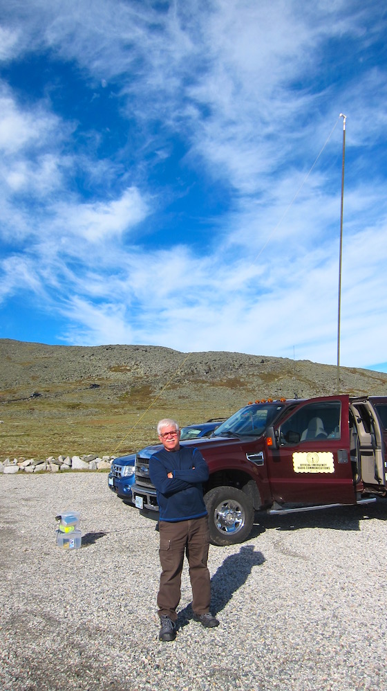
A fellow operator took this photo of me enjoying the rare sunny morning just below the summit. Copyright 2017 Tim Carter
If you’re a radio operator like me, you get to drive up the mountain about two hours before the event starts. Those who get an assignment up near the top like I did can enjoy the solitude of the mountain for almost two and a half hours.

The foot and bicycle races normally start at 9:00 a.m. and it takes even the strongest participant fifty minutes to get to the cow pasture. This peace and quiet is not possible when the Auto Road is open to public traffic as cars, trucks and motorcycles are constantly going up to and down from the summit.

Some runners and walkers were not prepared for the day. Normally it might be cloudy, windy and cool by the time they got to the cow pasture. On this day it would be sunny and warm. Dehydration and cramps were common.

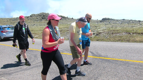
George Etzweiler is in the yellow t-shirt surrounded by proud family members. He was 97 years old and he made it to the summit. Congratulations George! Copyright 2017 Tim Carter
I was delighted to see that George Etzweiler was once again making the trek up to the summit. George is the oldest person to complete the race. This year he turned 97. He’s inspirational to say the least.

As the runners thinned out and I had time to concentrate on working high frequency doing Morse code, I was able to successfully activate the site. The Parks on the Air program requires that you make a minimum of ten QSOs and I was able to get fourteen.

Once the last runner went past, I was released from duty and headed back down the mountain. The sun was still shining and the view to Berlin, NH was stunning.

Those white dots in the valley are the houses and buildings up in Berlin, NH. Copyright 2017 Tim Carter
I don’t think I’ll ever grow weary of working public service events on this fabled peak. If you’ve not done it, you should consider it.

Cookie Crumble 2017 Scores

CALL SIGN NAME SCORE
KB3VVE Emily Saldana 12054
KE3V Kevin McKenna 11734
AF1N Ralph Williams 10684
W0IS Richard Clem 7896
W2LJ Larry Makoski 7720
W3ATB Tim Carter 5787
KC3FVN Keith Comp 5783
N3CU Ken MacIntire 5322
KA3D Dan Farrell 5273
W1PID Jim Cluett 5141
K9PH Phil 4673
VA3KOT John 4139
KA1PPV Joseph Molon 4019
KS4YX Gil Huggins 3965
K3SVA Gene Messick 3783
N2CX Joe Everhart 3708
W0PHX George Burger 3564
NC6B Kent Olsen 3053
WA0LIF Dick Lauhead 2714
K2FI David Weigart 2448
AF6TF Tim Fairbain 1633
KM3D Harry Bump 1441
K9RBH Richard Hockett 1351
VE9BEL Bernard Lebel 1070
K7CCC Dave Hassler 1016
M0ZKK Matthew Mayman 1000
WK2S Art 936
KD5OSN Kirk Binning 870
KC7FCW Heidi Morton 775
AJ4UQ Thomas Glaab 350

NPOTA Greater Boston Activations

Yesterday I chucked my small backpack with all my outdoor radio gear into my Ford Super Duty 4×4 truck and headed to Boston, Massachusetts. I also had stowed my BioennoPower power pack, my portable aluminum mast and its support and other miscellaneous gear.

While loading up I had no idea what the day would bring. However, as the sun was setting and I was talking with a few operators 3,000 miles away in Oregon and California with barely enough power to light up two tiny night lights, I realized I had unknowingly advanced my amateur radio skills by ten years in just ten months.

My goal was to set up my radio at five different National Park properties and have conversations with at least ten other radio operators from each of these locations in and around Boston. With only four days left in the year-long National Parks on the Air (NPOTA) event sponsored by the American Radio Relay League (ARRL), I was running out of time.

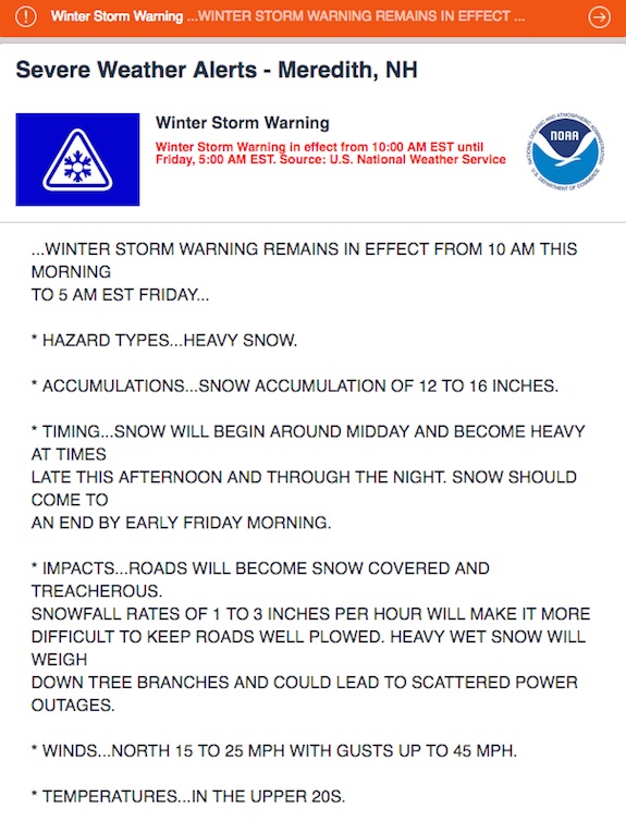
I had wanted to do this radio day on December 30, 2016, but a frightening weather forecast motivated me to advance my plans. A major Nor’easter was climbing its way up the East Coast and had its sights set on New England. Yesterday was perhaps the only day anyone was going to comfortably do outdoor radio in New England for the remainder of 2016!

This is a pretty grim warning. While most of it could be rain in Boston, the issue is getting to and from Boston! (C) Copyright 2016 Accuweather.com

This is a pretty grim warning. While most of it could be rain in Boston, the issue is getting to and from Boston! (C) Copyright 2016 Accuweather.com

It was an aggressive goal with only about ten hours of daylight and I had already wasted one hour of it before even jumping in my truck for the two-hour 100-mile-plus drive down to Mordor from my home in central New Hampshire. That’s what my family calls the greater Boston area because the traffic is so insane compared to tranquil central New Hampshire.

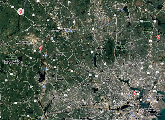
The sites I had selected were scattered all about the greater Boston area with one of them right in the shadows of the giant RF-emitting skyscrapers of downtown Boston.

Look for the orange balloons around the image. That's where my adventure took me. You only see four of the five sites here because the Lamprey River is farther north up in New Hampshire. I ran out of daylight and never made it there. (C) Copyright Google Inc. - Google Maps image

Look for the orange balloons around the image. That’s where my adventure took me. You only see four of the five sites here because the Lamprey River is farther north up in New Hampshire. I ran out of daylight and never made it there. (C) Copyright Google Inc. – Google Maps image

Here’s the list of the sites I decided to visit:

I decided to use my trusty Elecraft KX3 transceiver for my radio. It has a self-contained antenna tuner that allows me to transmit on any frequency between 80 and 6 meters when I connect my 29-foot wire antenna to it. A simple 9:1 unun at the end of the antenna wire allows tames the resistance on the wire so the Elecraft tuner can do its magic.

When I write down, or log, contacts with other operators I use just simple paper and a pen. I don’t want to rely on electronics in the field for important activations like this when many other operators are counting on me to record our conversations. Electronics can malfunction and with no paper backup you have no idea who you talked to.

Each operator who contacts me gets a point for each of the units I operate from. It’s all for bragging rights. Many thousands of radio operators across the USA, Canada and the world are participating is this event and value each and every park unit they can put in their own log books.

Concord National Wild Scenic River

I decided to activate this unit first for a number of reasons. It was the furthest from downtown Boston and just off Route 3. If you look at the above map I think you’d agree it made the best sense to start here and travel southeast into the maw of Boston then head north to end up at Saugus Iron Works and catch the Lamprey River site on the way back home.

Google Maps came in quite handy when I went to scout a location for this site. I found a wonderful small gravel road that ended immediately next to the Concord River.

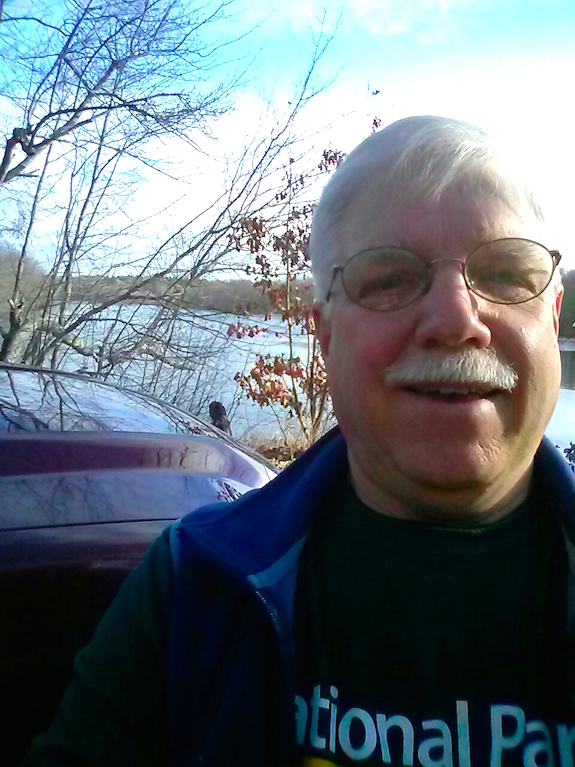
I hate how the lens on cell phone cameras distorts your face for the up-close selfies. You can see the Concord River over my right shoulder. (C) Copyright 2016 Tim Carter
I hate how the lens on cell phone cameras distorts your face for the up-close selfies. You can see the Concord River over my right shoulder. (C) Copyright 2016 Tim Carter
It only took a few minutes to get my antenna up into an overhanging tree. I was stunned that the ground was bare. Just two hours before I left 14 inches of snow in my yard.

My plan was to get the minimum required ten contacts, or QSOs as we call them, and then pack up to move to the next site. Ordinarily I might stick around a single location for several hours working as many contacts as possible on as many bands in both Morse code and voice. We call using our voice on the radio phone or single side band in the hobby.

I started using Morse code and within sixteen minutes I hit my minimum of ten contacts. I made two additional contacts just for good keeping. The timing was good as no one else was calling for me. It was time to pack up and head a few miles away to where the shot heard round the world was taken.

Minute Man National Historic Park

It only took about fifteen minutes at the most to get from the Concord River site to the parking lot of the Minute Man Visitor Center. The center was closed for the winter, but there were quite a few people who were at the park walking along the old road where the colonists engaged and then chased the British soldiers back to Boston harbor.
There was a magnificent oak tree next to the parking lot that accepted the first throw of my water bottle. It soared up about 40 feet into the bare branches and came straight down to the ground.
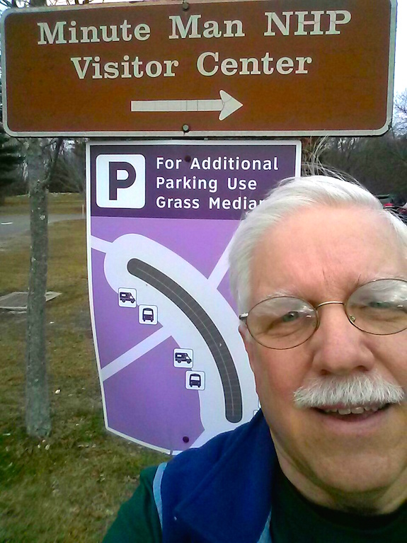
I was having a bad hair day. The tree I used was just behind me about 120 feet away. (C) Copyright 2016 Tim Carter
I was having a bad hair day. The tree I used was just behind me about 120 feet away. (C) Copyright 2016 Tim Carter

I decided to start with a longer-range frequency, twenty meters, to give some of the chaser operators a chance at contacting me. It worked well as my minimal 10-watt signal was reaching Alabama, Wisconsin, Texas, Indiana, Mississippi and a host of other states with no issues.

Here at Minute Man I did a combination of voice and Morse code collecting fourteen total contacts in twenty-eight minutes. While this may seem like a large number, it’s not. Some NPOTA activators gather hundreds of contacts in a couple of hours.

My last contact was at five minutes before noon. I was hungry as hours ago before leaving home I had just one very tiny delicious pumpkin muffin Kathy, my wife, made the day after Christmas.

It was time to pack up and head to Bunker Hill. I grabbed a bite to eat along the way.

Boston National Historic Park – Bunker Hill

Several years ago I visited Bunker Hill for the first time. I only had a few minutes and that was going to be no different today. All one has to do is go there and you’d see why General George Washington chose it as a location to set up his cannons to terrorize the British fleet in the harbor below. I’m told his men set up on the wrong hill as there was a better one adjacent to Bunker Hill. But I could be very wrong about this.

It was partly sunny by the time I found a parking spot and walked up to the grassy area surrounding the towering monument.

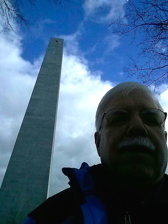
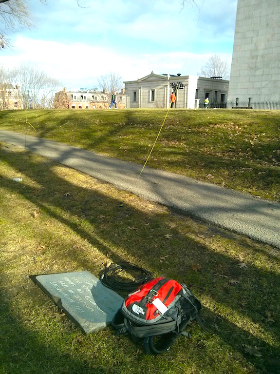
The phone camera's light meter is locked onto the white clouds. It's an impressive obelisk made from gorgeous granite. (C) Copyright 2016 Tim Carter

The phone camera’s light meter is locked onto the white clouds. It’s an impressive obelisk made from gorgeous granite. (C) Copyright 2016 Tim Carter

I had a bad feeling about this location. It’s surrounded by millions of people and using things that create radio interference. When you have a giant antenna, a powerful transmitter and other accessories at your home you can overcome this issue. I had a small radio that put out a maximum of 15 watts and a thin wire antenna dangling from a tree.

I had just successfully launched my water bottle tied to my bright yellow lanyard up into the oak trees that surround Bunker Hill. It's hallowed ground as quite a few men died on this knob of earth above Boston Harbor. (C) Copyright 2016 Tim Carter

I had just successfully launched my water bottle tied to my bright yellow lanyard up into the oak trees that surround Bunker Hill. It’s hallowed ground as quite a few men died on this knob of earth above Boston Harbor. (C) Copyright 2016 Tim Carter

Lady Luck dealt me a winning hand. I only operated for twenty minutes and got the minimum ten contacts. I was desperate to get more, but they were not to be had. I was also getting cold as the sun had gone behind some clouds and the wind was picking up.

It was time to move on to Saugus Iron Works. Little did I know but the fun was about to start.

Saugus Iron Works National Historic Site

It only took about 30 minutes to claw my way through traffic to get to this very interesting national treasure. This unassuming spot was the center of the iron production for the colonies one hundred years before the Revolutionary War! Think about that for a second. That’s as much time spread as between now and the start of World War One! By 1670, the blast furnace at this site had gone cold forever.

The small parking lot had perfect tall trees to accept my wire antenna. It took me two throws to get the exact branch so I’d have a nice vertical wire hanging next to my truck.

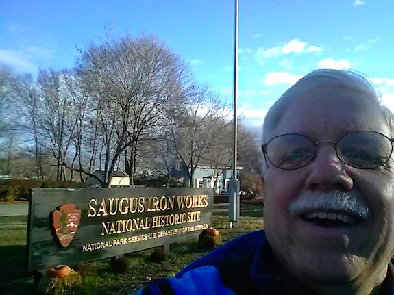
The color in this photo and my expression were to foretell the future of what was to happen. (C) Copyright 2016 Tim Carter

The color in this photo and my expression were to foretell the future of what was to happen. (C) Copyright 2016 Tim Carter

It was just before 3 pm before I was set up and ready to transmit. The sun was low in the sky. Now was a perfect time to use a long-range frequency and voice mode to help other operators put this relatively rare park unit into their log books. Remember, the NPOTA event ends in just four days!

Once I got on the air, I had to untangle a decent pileup. That’s the name for what happens when many operators try to make contact with just one operator as he transmits in a somewhat rare location. It turns out many needed Saugus Iron Works and it’s quite possible it would be the last time it would be activated.

As I worked my way through the pileup more than one operator thanked me and told me this was a new park unit for them. They were polite and happy.

I remember clearly looking through the windshield at the sun as it sank lower in the sky. For a few brief moments I thought about how this was going to be my last NPOTA activation. I knew that there was no way I was going to make it to the Lamprey River before it got dark. I had no intention of getting home after 8 p.m. and since I activated the Lamprey River twice in the past two months, I wasn’t unhappy about not going there.

In just fifty-two minutes I made forty-two contacts at Saugus Iron Works. I was elated! I had made more contacts at other NPOTA sites back in the summer, but this last one was more fulfilling because of the feedback I received from the other operators thanking me.

Just before 4 p.m. I was packed up and ready to leave. As I was winding up my antenna, I thought about how the NPOTA event had transformed me. Many thoughts were swirling through my head, all of them good ones.

I decided that I’d sleep on it and do a separate story about how this spectacular NPOTA event coupled with a tiny radio, a battery no bigger than a box of band-aids and a tiny wire antenna brought me, and I believe thousands of others, more pleasure than one could ever imagine. Thanks to the ARRL staff that made it possible!

Lamprey Wild and Scenic River WR23 Activation

The middle of November in New Hampshire is normally a raw and wet time of year. One can expect temperatures in the 40 F range, rain and wind. It’s a chill that cuts to the bone.

But on Saturday November 19, 2016, Mother Nature treated Nick Mollo, KC1KDY, and me to a stunning sunny, warm and wind-free day at the Lamprey Wild and Scenic River in Epping, NH.

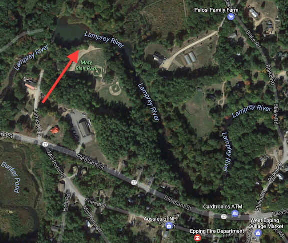
The tip of the red arrow shows exactly where we were set up. During baseball season, this is not the place to be doing QSOs! (C) Copyright 2017 Google, Inc. All Rights Reserved

We were at the western edge of this National Park designated area just hundreds of feet away from where the river had been dammed in the past. Mary Blair Park is on the river’s south shore just below where mills and factories stood in the past.

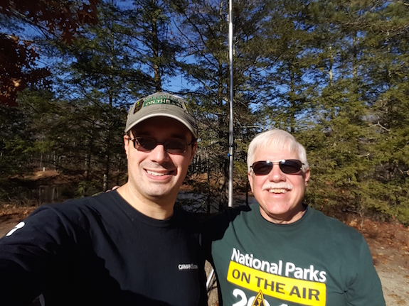
Nick is on the left with the NPOTA hat. (C) Copyright 2016 Nick Mollo

Nick is on the left with the NPOTA hat. (C) Copyright 2016 Nick Mollo

We chose to set up our radios along the banks of the river as it kisses the edge of Mary Blair Park.

Moments before I launched my water bottle up into the tree about 40 feet. Now I'm attaching my 29-foot wire antenna to the lanyard to pull it up. A 9:1 unun is attached to the bottom of the wire. (C) Copyright 2016 Nick Mollo

Moments before I launched my water bottle up into the tree about 40 feet. Now I’m attaching my 29-foot wire antenna to the lanyard to pull it up. A 9:1 unun is attached to the bottom of the wire. (C) Copyright 2016 Nick Mollo

For some reason the locals in Epping, NH don’t seem visit this jewel of a park to soak up its serenity. Nick and I only saw one other person there the entire time we operated.

I arrived before Nick and after exiting my truck, all I could hear was the water in the river gurgling over a small set of rapids just to the west. It was so very peaceful.

Nick and I had talked about doing a joint activation of the Lamprey River. It’s one of only three locations in New Hampshire where a radio operator can set up to participate in the soon-to-end National Parks on the Air (NPOTA) event.

Here's Nick hard at work. I believe he got well over 100 contacts while sitting in the shade! (C) Copyright 2016 Tim Carter

Here’s Nick hard at work. I believe he got well over 100 contacts while sitting in the shade! (C) Copyright 2016 Tim Carter

Nick loves to talk to people across the USA, and other countries, using a microphone. I prefer to use an iambic paddle to transmit Morse code.

Nick's making final adjustments before turning on his 100-watt radio. (C) Copyright Tim Carter

Nick’s making final adjustments before turning on his 100-watt radio. (C) Copyright Tim Carter

Using a reliable Buddipole™ antenna, Nick had no trouble gathering signals from the ether.

I decided to sit directly in the sun as I knew that this day might very well be the last really warm day of the year. It turns out I was right as 72 hours later 3 inches of snow covered my yard!

Here I am focusing listening to the dihs and dahs coming out of my Elecraft KX3 speaker. (C) Copyright 2016 Nick Mollo

Here I am focusing listening to the dihs and dahs coming out of my Elecraft KX3 speaker. (C) Copyright 2016 Nick Mollo

We had planned to operate just ninety minutes as I had other things to do that day. But it turns out I stayed for almost two and one-half hours. I didn’t regret it for a moment.

To minimize interference with one another, Nick and I operated on different parts of the electromagnetic spectrum. I was on 20 meters at first while Nick contacted others using 40 meters. After about an hour, we switched.

I ended up with about 32 contacts with being on the air for just about an hour or less. At first I had trouble making contacts, but once a few operators discovered me and told the world I was on the air using my favorite spotting tool, I had a fairly steady stream of activity.

The NPOTA Facebook page helps to ensure you get the minimum ten contacts to activate a NPOTA unit. Nick used his cell phone to tell the group we were about to transmit.

It was great to meet Nick and I hope to do another eyeball QSO party with him at some point when Mother Nature treats us to a delightful warm sunny day!