The Beginners Guide can be found after the following story. I encourage you to read the story first and look at the photos before reading the Beginners Guide. The Beginners Guide was last revised on October 22, 2017.
Tim Carter – W3ATB
The Head of the Charles Regatta is a world-class public service event for any amateur radio operator. It all started in 1965 and it’s held in Boston, MA every October.
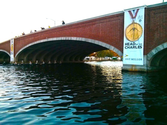
Here’s how the organizers of the event describe it at their website:
“Since its origin in 1965, the Head Of The Charles® Regatta has welcomed the world’s best crew teams to the banks of the Charles River for the ultimate two-day rowing competition.”
I’ve worked quite a few public service events, including the Boston Marathon and if you’re an amateur operator that wants to challenge your skills, the Head of the Charles is one you don’t want to miss.
Yesterday, October 16, 2015, I worked the regatta for the first time. I was out on the wind-swept water of the Charles River in an odd open fiberglass pontoon boat as part of a three-man team. My tactical call sign was Safety Launch 3.
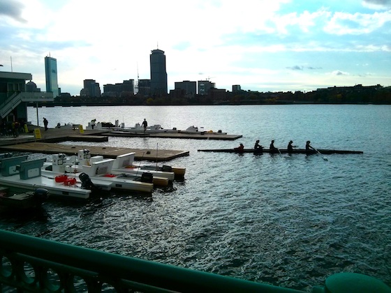
You can see a few of the odd open pontoon boats docked here at the MIT boathouse. A crew is pulling into the dock from an early practice on the water. Photo credit: Tim Carter – W3ATB
Amateur radio operators provide critical communications during the event in case crew members tumble into the cold waters of the Charles River and need to be rescued.
I’ll share my story of the day’s events and then I’ll provide you with invaluable tips that I wish I had known about prior to arriving in Boston.
Departure Time – 5:30 AM
While the competition is a two-day event, the hundreds of teams from around the USA and the world practice on the Friday before the event turning it into a three-day event for the hundreds of volunteers like me.
I decided to only work the practice day to get my feet wet. I’m glad I did because all volunteers need to be present for 6:00 AM meetings at the various boathouses dotting the shoreline of the infamous Charles River on the two competition days.
On the Friday practice day, that arrival time is pushed back to 8:30 AM. I decided that I’d leave my central New Hampshire home at 5:30 AM so I’d arrive in Boston just after 7:30 AM. It’s only a one hour and fifty-minute drive so I thought I’d pad in some time for rush hour.
Since I rarely drive into Boston on a work day morning, I discovered that the commuters must leave their homes at 4:00 AM to try to avoid the snarled roadways that feed into the metropolis.
Stressed out after three, not two, hours of fighting stop-and-go traffic I pulled into an empty parking spot at the MIT boathouse in the famous Basin of the Charles River.
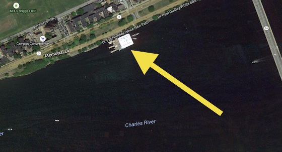
This is the correct boathouse to meet at. Note it’s on the upstream side of the bridge. There’s another boathouse on the downstream side of the bridge. I’m hoping my Beginners Guide inspires the event organizers to make better use of satellite images and custom Google maps that have exact icons showing exactly where certain positions are on the course. Look below at a sample of a custom map I created for the Finish Line area complete with photos of what you’ll see when you stand in the location of one of the custom icons.
It’s just upriver from the Route 2A bridge that spans the waterway soon to be clogged with hundreds and hundreds of the sleek sculls. I discovered I had to move my truck to a parking lot about a half mile away, but that had to wait until after the brief organizational meeting down next to the dock in the boathouse.
The boathouse was clogged with volunteers of all sorts getting other volunteers checked in. Safety launch boats and other launches were being readied for the day.
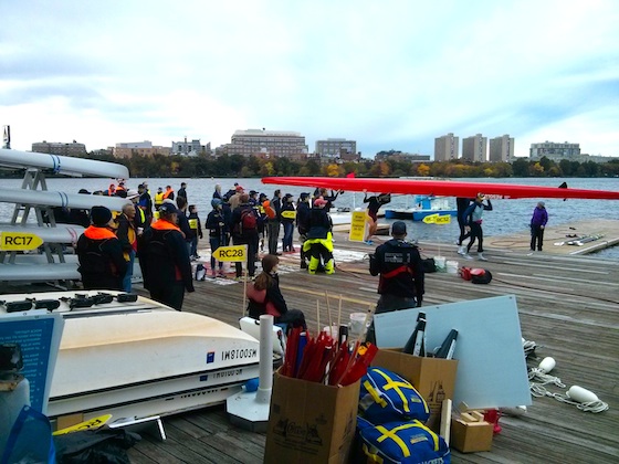
Many of the launches were manned by women and men who’s job it was to try to keep the sculls from crashing into one another along the three-mile section of the Charles River where the regatta takes place.
As the day progressed I discovered these other launches would be anchored near bridges and tight turns in the river. Using megaphones the workers would alert the crews and coxswain about impending danger.
Visibility at the arched bridges that span the Charles can be limited as late in the day an eight-person scull nearly crashed into the launch I was in as we both entered, from different directions, a bridge archway.
WX – The Ham Acronym for Weather
The weather forecast for Boston yesterday was spot on. It was cloudy and windy in the morning. The air temperature was in the mid 50’s F, but there was a stiff 15 mph wind whipping across the water from the west. It felt much much colder than it was. A passing light rain shower happened just before 9 am and I was fretting being out in the rain all day.
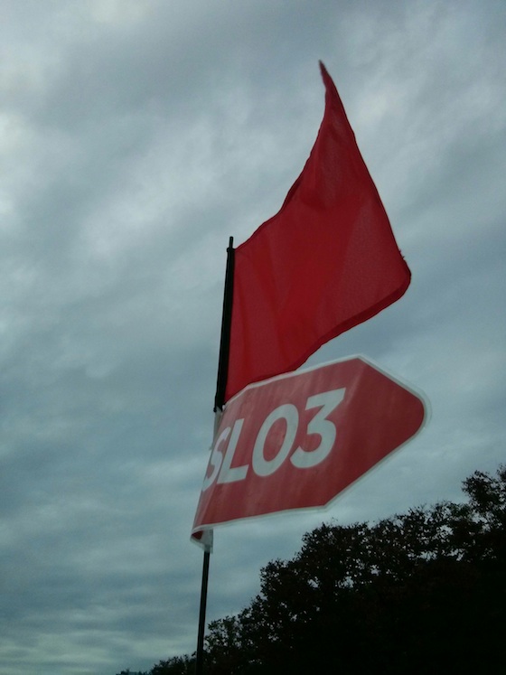
Here are the flags that flew from a pole attached to the seat of my launch. You can see how cloudy it was and the pennants are unfurled flapping in the stiff wind. Photo credit: Tim Carter – W3ATB
As the morning passed, the sun made a welcome appearance and it was quite sunny until sunset. The wind didn’t let up all day although it was much stronger in the morning than the afternoon.
The weather almanac shows it reached 61 F in the afternoon, but I was wearing long underwear and four layers of clothes on my body core and was just barely warm enough. You can’t bring too many clothes to this event.
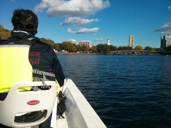
Here’s what the weather looked like after lunch. It was a great day on the water. Photo credit: Tim Carter – W3ATB
Puttering Along
Each safety launch is assigned a section of the regatta course to patrol. There were only five safety launches out on practice day, but on Saturday and Sunday there are usually no less than ten or more of the funny open pontoon boats scattered on the Charles River.
Our captain, Kevin, was an experienced pilot and this was his third year working the event. We kept to the Cambridge (north) side of the river and hugged the shore because some lane buoys were often just 100 feet, or less, from the shoreline.
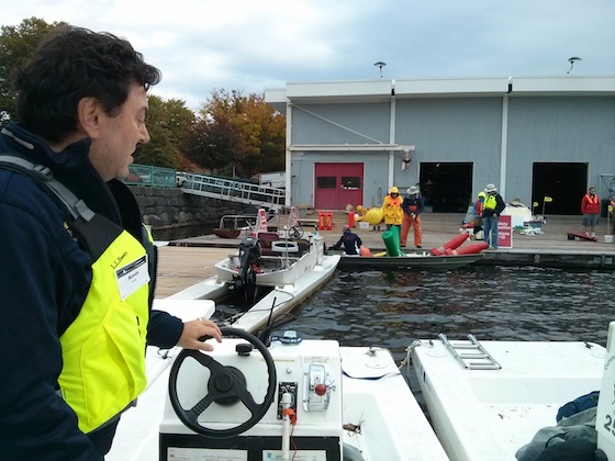
Here’s Kevin checking out the launch controls before we left the dock. Photo credit: Tim Carter – W3ATB
We spent the day motoring at no-wake speed going up and down the river always scanning the rowers looking for someone who was in trouble. Fortunately no one ended up in the water all day. That’s what we, as volunteers, want. No medical emergencies were reported all day. That’s also a good thing.
Radio Traffic
The radio operators in charge of the event set up three different frequencies to handle the radio traffic. Two of them utilized local repeaters and the third frequency was a local simplex radio-to-radio frequency.
Signal propagation can change from day to day and hour to hour. We discovered that the Bravo – or secondary repeater – produced a much better clarity so all of us switched to it by Noon.
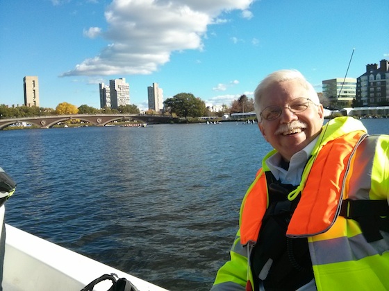
Here I am with wind-swept hair. The Weeks Bridge is in the background. It’s just down river from the historic Harvard Boathouse. Photo credit: Patrick the BC student First Aid crew member
I was equipped with two Yaesu VX-7R hand-held radios. Both had the three frequencies pre-programmed into the memory. That makes it easier to switch from one of the three frequencies we were using.
What it’s Like on the Water
It’s hard to describe what it’s like being on the water and watching the sculls go faster than the launch.
That’s why I taped a video. Watch it:
End of Day
The crews vacate the river after the sun sets. Each safety launch is released from duty once their section of the river is clear of the sculls.
We pulled into the dock at the MIT boathouse as twilight was deepening. I turned in my life preserver and Kevin and I walked the half mile back the parking lot where we could saddle up and head home.
He had a two-hour drive back to CT and I was headed north up I-93 to central New Hampshire.
I thoroughly enjoyed my day at the event and will be back next year. If you’re an amateur radio operator, I encourage you to volunteer. You’ll be a better person in many respects if you do, and you’ll get a handsome jacket or down vest and hat for your efforts.
The Amateur Radio Operator’s Beginner’s Guide to the Head of the Charles Regatta
If you’ve never worked the Head of the Charles (HOC) Regatta as a ham radio operator, the following should help you.
IMPORTANT BEGINNER TIP: If you’re a new ham operator and have never worked a public service event the scope of the Head of the Charles, by all means request to be paired up for the day with a seasoned operator. There’s NO SHAME in doing this. It will relieve your anxiety and it may save someone’s life if you were to panic in an emergency situation while alone. I’ve seen it happen.
Assignments
There are two types of assignments:
- onshore
- on-the-water in a safety launch
The list of assignments for 2017 was:
- net control – experienced hams that make up the Communications Committee
- Red Cross 1
- State Police UCC
- Umpire
- Magazine Beach plus three walking teams
- Weld Bridge plus three walking teams
- Reunion Village
- Harvard Boathouse plus one walking team
- CBC plus two walking teams
- Finish Line plus three walking team
- Northeastern Boathouse – (first aid tent near corner of playground 500 yards downstream of the actual boat house)
- Thirteen Safety Launch boats on the water – (there are only five on Friday practice day)
The walking teams include a ham operator and first aid volunteers to offer assistance should a scull capsize near a shoreline. They can provide initial care and call for more help if a paramedic is needed.
Finish Line Area
Here’s a sample map I made to show a few of the radio communications positions. The giant parking lot you’ll see in gray is filled with countless sculls and their trailers.
Click the tiny arrow box in the upper left corner of the below map to see the slide-out legend that explains what each of the colored icons represents. Click a few of the icons to see actual photos of what it looks like when standing at that position.
CLICK HERE to see the actual map with it’s legend explaining what each of the colored icons above represents.
Event Parking
Parking in Boston and Cambridge can be a challenge. The universities seem to provide parking passes for a few parking lots near key meeting locations.
I was able to park in an approved lot about 1/3 of a mile from the MIT boathouse. It was a short walk and quite safe.
Parking for any assignment near the Finish Line is available at some businesses along Western Ave just a short walk from the giant finish-line area where the crews store their sculls.
You have to pay for these spots. I paid $30 to park in 2017. It was well worth it knowing that I would not get towed from a public street-parking location. If you decide to park on any street, pay very close attention to the signage and times parking is permitted.
My guess is it might cost you $250 or more to get your car back if it gets towed.
I parked at the Skating Club of Boston on Western Avenue when I worked at the Finish Line in 2017. There’s a convenient foot bride at the western edge of the parking lot that allows you to cross over Soldiers Field Road safely.
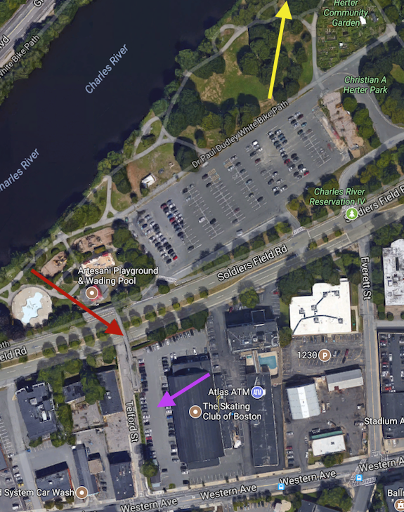
Here’s a handy Google Maps satellite image of part of the Finish Line area. The magenta arrow points to where I parked my car at the Skating Club of Boston. You enter the lot off Western Avenue. The red arrow points to the foot bridge that crosses Soldiers Field Road and dumps you into the giant gray parking lot. The yellow arrow points to the trailer and Red Cross area that makes up the Finish Line. On race weekend that giant parking lot and all the grass area in the park next to the river is filled with hundreds of sculls. Copyright 2017, Google, Inc.
The ramp dumps you out in the southwest corner of the massive parking lot where all the sculls are stored on trailers.
Walk across to the northeast corner of the parking lot to get to the Finish Line.
If you work on the Saturday and Sunday you should never have an issue getting into Boston at 5:30 AM to make your 6 AM meeting time.
If you work the Friday practice day as I did, plan for SEVERE traffic congestion within a 10-mile radius of the regatta course. It took me an hour to go the last ten miles of my journey.
Take extra time before the event to acquaint yourself with the exact location of the parking lots and how to navigate the dreadful one-way roads in Cambridge and Boston.
Add in enough time to walk from the parking lots to your assigned meeting place.
Request Screenshots For Meeting Locations
Don’t trust Google Maps to provide you with the correct location for any names and/or addresses of the places the ham organizers tell you to be at for morning meetings. Google Maps sent me to the wrong MIT boathouse down river from the correct one.
Request from the communication team leaders satellite maps from Google Maps like the one below that has an annotation oval or arrow showing you the exact meeting places / parking lots / etc.

Clothing
I’m told past regattas have ranged from hot to snow, sleet and driving rain. Only a tiny handful of radio operators would be under any sort of cover for the day.
If you’re out on the regatta course, you’ll have NO COVER. The safety launch boats are wide open like a row boat.
If it’s raining, plan that you’ll be out in the rain all day.
If you get wet and cold, you’ll be useless to the crews in the sculls.
Wind is an issue. It cuts like a knife coming across the water.
The seasoned workers I saw had some or all of this:
- highly water-resistant ski pants / jackets
- rubber boots to keep feet dry
- special fisherman overalls to keep legs and body core DRY
- many multiple layers
- waterproof shoes or work boots
- knit hat
- gloves
- sun glasses
Whatever clothes you bring must fit in a backpack you can carry all day. Store extra clothes in waterproof bags inside the back pack. There’s plenty of room on the safety launches for large backpacks or even a duffle bag if that’s what you want to carry.
Food / Drink
Lunch is provided by the HOC event organizers. It was delivered to those of us who were out on the water. I suspect the same held true for all the other land assignments.
However, you may get it at 11 am or at 2:30 pm. Bring your own food for the day just in case.
Bring snack food.
Bagels and doughnuts were provided at some of the early-morning meetings. I took two extra bagels and put them in my backpack. I was glad to have them as I had eaten breakfast at 5 AM. They made for a great mid-morning snack.
There may not be a morning meeting at all if you’re assignment is onshore. You may find expensive vendor food and $4-per-cup coffee at any number of vendor tents.
Radios & Gear
Hand-held radios work fine for this event.
I brought two of my expensive Yaesu VX-7R radios on the safety launch. That was a risky gamble in case there was a catastrophic accident aboard my launch.
It might have been smarter to bring two Baofeng $30 radios that could sleep with the fish at the bottom of the Charles River in the event I and the radios tumbled into the water.
Losing a favorite high-performance HT overboard would not be a pleasant experience.
I should have brought one of my Baofengs to see how well it performed. My guess is it would have had no trouble hitting the two repeaters.
Test Your Radios
Test your radios as you walk from the parking lot to the morning meetings to ensure you have programmed in the correct frequencies and settings.
BRING YOUR RADIO MANUALS or download a digital copies into your smart phone.
If you’re on a safety launch, attach a flotation pillow or put some bubble wrap inside your backpack. You want it to float in case your backpack ends up in the Charles River. Be sure there’s a name tag on your back pack.
Store your secondary radio in a sealed zip-lock freezer bag so it’s waterproof. Put some air in the bag to help your backpack float.
Speaker microphones come in handy.
Do NOT use VOX.
Check your radio to ensure it’s not sending out the 1750 Hz burst tone.
Geography
It’s very important for you to know where you are at all times. If there’s an emergency, you can bet the first thing net control will ask you is,”WHERE is the EMERGENCY?”
If you’re on a safety launch, ask the pilot if he knows the names of all the bridges. The pilots are given very detailed maps of the regatta course and I’m certain the maps show each bridge name
You need to know the names of the bridges if you’re on a safety launch. You need to know where you are if you’re on a walking team.
You need to communicate which side of the river you are on. If unsure, say “upstream” or “downstream” side of the bridge you’re at.
You need to know distances. How many feet or yards are you away from a bridge? Always be aware if you are up or down river from a certain bridge.
You need to know what side of the Charles River you’re on, or the nearest shoreline. It will either be the Boston or Cambridge side. Boston is on the south side of the river. Cambridge is on the north side of the river.
If you provide the wrong location for where the emergency is, precious moments could be lost that could make the difference between life and death for a crew member.
Attitude
Bring a great attitude with you and soak up the excitement, youth and vitality of the crews and the many sculls on the water at once.
Remember always that the crews and event organizers are quite aware of your presence even if they don’t say a word to you. They appreciate your efforts to keep them SAFE.
They realize you’re there to HELP them in the event something goes wrong. Don’t expect anyone to thank you, but if it happens it’s icing on the cake.
Respect the operators at net control and keep the frequencies open at all times as you never know when a full-blown emergency can happen.
If you have questions or if you’re a seasoned operator who’s worked this event, please ask questions in the comments below or provide MISSING INFORMATION or TIPS there.
Thanks and enjoy yourself when you work this event in the future.

A few other hints:
1. As written above, you are either on the Boston side (South) or the Cambridge side (North) of the river. And you are East or West of a particular bridge. In case you’ve forgotten, the sun rises in the East and sets in the West. At (solar) noon, the sun is South of you. Get this right and you are a MUCH better emergency communicator.
2. Pause one second when you start a transmisson from your HT, now say something TERSE. Compare these two transmissons: “I think a guy in the boat I’m looking at is having some sort of problem.” “Rower in distress: Boston-side, 100 yards East of the Weeks Foot Bridge.”