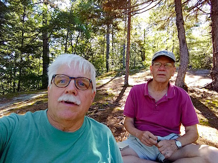
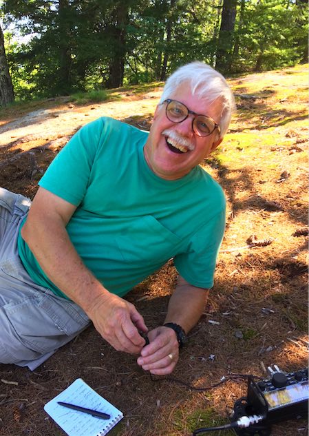
Here I am in the green t-shirt with Jim in the background holding my Palm Micro-Pico iambic Morse code paddles. He’s almost in a zen state because it was a perfect day at a perfect place. Copyright 2018 Tim Carter
Bald Ledge NH – Outdoor Radio Adventure
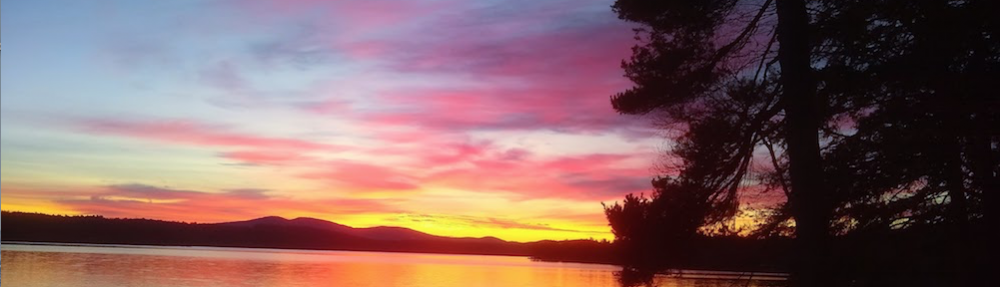
Today Jim Cluett, W1PID, and I hiked to the scenic Bald Ledge overlook about one mile east of Sky Pond in central NH. It was a perfect late-summer day with the temperature just above 80 F and a crystal-blue sky.
We intended to participate in the QRP-Afield event hoping to contact other radio operators who were using low power as were we.
To get to the scenic overlook, you hike up a rugged Class VI road that’s not maintained by the town. Soon you have to turn left at a crude roadway blocked by an orange metal gate.
Then you have to walk about a half mile to where the trail through the woods begins. If you pass the small sign, you could be in trouble. I decided to get the GPS coordinates this time in case you want to find the small trail.
Related Links
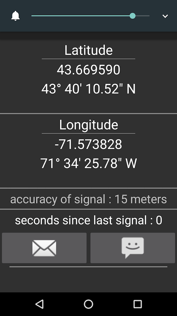
Here are the coordinates that will get you to the trail through the woods to the Bald Ledge scenic overlook. Copyright 2018 Tim Carter
We passed a few hikers who were coming back from the overlook. When we arrived, we were the only ones there. Jim got absorbed in the view and I did all the work to get us on the air.
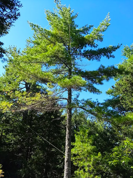
This is the tree that supported my 29-foot wire. Attached at the bottom was a 9:1 unun. Copyright 2108 Tim Carter
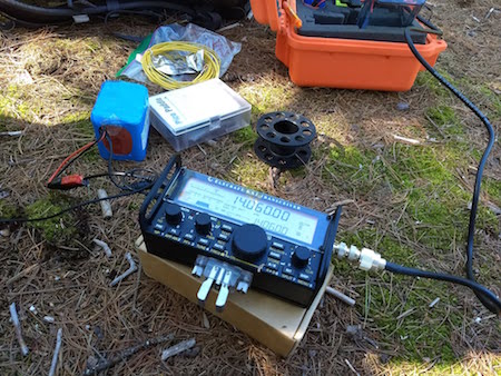
We used my KX2 and all other gear to get on the air. It did a superb job today and the sun rewarded us with fair propagation. Copyright 2018 Tim Carter
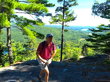
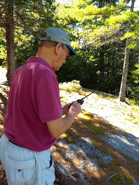
Here is Jim walking back up from looking at the view. I had just finished setting up and he was anxious to make the first contact. One must respect one’s elders so I didn’t complain and handed him the Pico paddles. Copyright 2018 Tim Carter
Here’s the view of the Sandwich Mountain Range that captivated Jim.
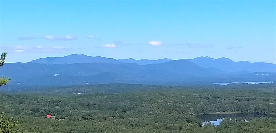
This is the view to the Sandwich Mountain Range from Bald Ledge. Look at the cool screenshot from the PeakFinder app below that tells you what you’re looking at. Copyright 2018 Tim Carter
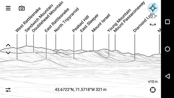
PeakFinder App – Very cool. Download it. Well worth the purchase price. Copyright 2018 PeakFinder
We heard stations right away and here’s our log:
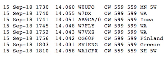
Here’s our log. Copyright 2018 Jim Cluett
We had lots of fun and decided to leave.
You can see that low-powered outdoor radio (QRP) can be scads of fun. I’m lucky to have a friend like Jim who tolerates my tall tales. We have so much fun on certain outings it should be illegal. Copyright 2018 Jim Cluett
Our timing was perfect because just as we started back into the woods, a large group of twelve people and three dogs showed up. That would have been mayhem with all of my equipment out and questions coming at us faster than flies showing up at a picnic.
Jim wanted to set up his APRS HT radio to track our journey home. It worked well.
Great story. Yesterday I operated 20M SSB from Mine Falls Park in Nashua. It was my initial trip using my Shack In A Sack rig by bycycle. Now ill be working on updates before our SOTA to Mt Wachuttests.
Patirck KC1HDN