Bald Ledge Scenic Vista

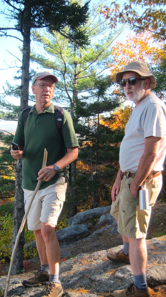
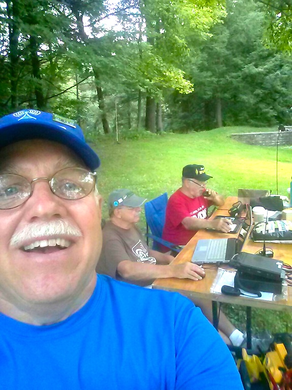
On Wednesday, October 19, 2016 I hiked with Jim Cluett, W1PID and Dave Benson, K1SWL up to the Bald Ledge scenic vista. We were blessed with a bright sunny day with temperatures pressing up against 70 F. In the sun it felt more like 80 F.

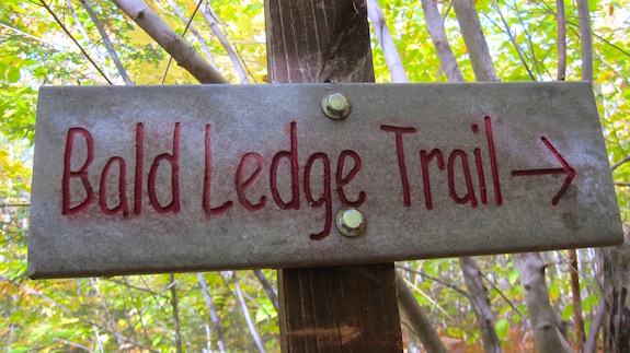
This plain sign does a great job of downplaying what you're to see should you venture down its path. (C) Copyright 2016 Tim Carter

This plain sign does a great job of downplaying what you’re to see should you venture down its path. (C) Copyright 2016 Tim Carter

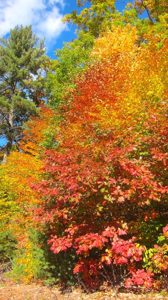
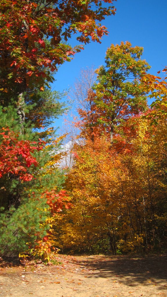
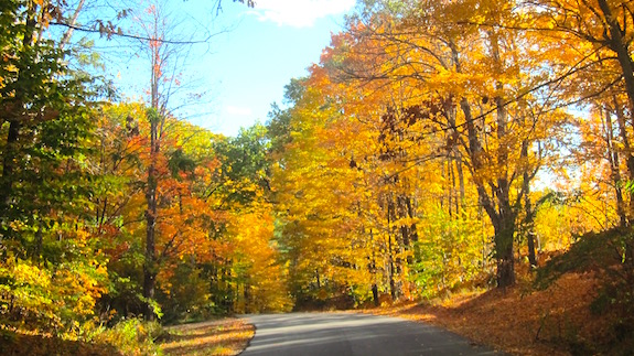
The fall color was at its peak and it was mesmerizing to be walking through the woods to experience Mother Nature’s handiwork. Jim and Dave were going to try to see how many QSOs they could extract from the ether during the CWT sprint.

This is a fast-speed contest and there’s no way my CW, or Morse code, skills are at that level to compete. I was just there because I love the outdoors, Bald Ledge is one of my favorite hikes and the view this day would be stunning.

Bald Ledge was created by the last period of continental glaciation here in North America. The enormous glacier, thousands of feet thick, slowly crept over the landscape grinding and tearing at solid bedrock. It did this over thousands of years starting at the North Pole on its way to New Hampshire eventually covering all of New England and much of the upper Midwest of the USA.

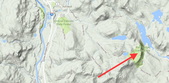
It’s direction of travel was from the northwest here in our part of New Hampshire and as it passed over mountains it created a gentle slope facing northwest but plucked rock from the southeast-facing slopes of all the terrain around much of eastern New England. This plucking action created steep rock faces just like Bald Ledge. You can clearly see this in a topographic map. Here’s just a small section of a topographic map of New Hampshire.

The red arrow points to Bald Ledge. (C) Copyright 2016 Google Maps Google Inc.

The red arrow points to Bald Ledge. (C) Copyright 2016 Google Maps Google Inc.

This was to be a simple hiking trip for me to soak up all the splendor as autumn is my favorite season. You’ll see why as you peer at the following photos.

We started our journey from 90 acres I own in New Hampton, NH. (C) Copyright 2016 Tim Carter

We started our journey from 90 acres I own in New Hampton, NH. (C) Copyright 2016 Tim Carter

Here's more of the 90 acres. (C) Copyright 2016 Tim Carter

Here’s more of the 90 acres. (C) Copyright 2016 Tim Carter

Looking across the Pemigewasset River from Old Bristol Road in New Hampton, NH. (C) Copyright 2016 Tim Carter

Looking across the Pemigewasset River from Old Bristol Road in New Hampton, NH. (C) Copyright 2016 Tim Carter

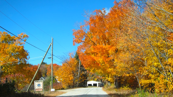
Stunning color heading up Dana Hill Road in New Hampton, NH. (C) Copyright 2016 Tim Carter

Stunning color heading up Dana Hill Road in New Hampton, NH. (C) Copyright 2016 Tim Carter

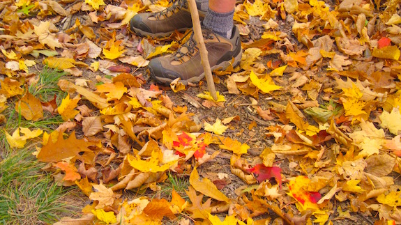
Jim's hiking boots on the Class VI road leading to Bald Ledge. (C) Copyright 2016 Tim Carter

Jim’s hiking boots on the Class VI road leading to Bald Ledge. (C) Copyright 2016 Tim Carter

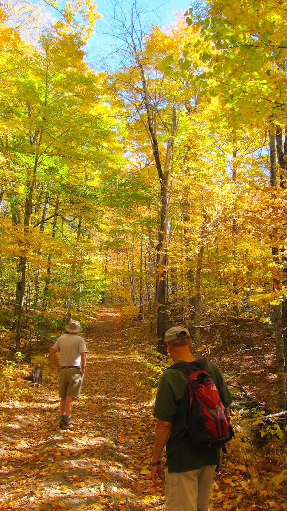
Dave and Jim walking up through a tunnel of color on the Class VI road. (C) Copyright 2016 Tim Carter

Dave and Jim walking up through a tunnel of color on the Class VI road. (C) Copyright 2016 Tim Carter

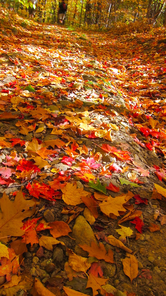
"We're walking on a carpet of color," mused Jim Cluett, W1PID. (C) Copyright 2016 Tim Carter

“We’re walking on a carpet of color,” mused Jim Cluett, W1PID. (C) Copyright 2016 Tim Carter

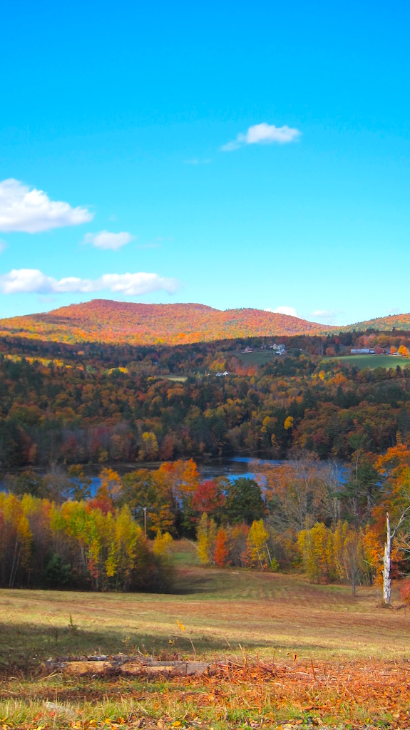
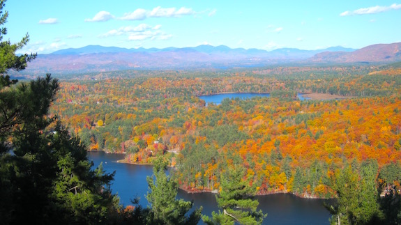
This is the primary view. In person, your eyes convert this to an 85 mm lens view. The mountains in this photo seem so far away. In person, they're much much closer. (C) Copyright 2016 Tim Carter

This is the primary view. In person, your eyes convert this to an 85 mm lens view. The mountains in this photo seem so far away. In person, they’re much much closer. (C) Copyright 2016 Tim Carter

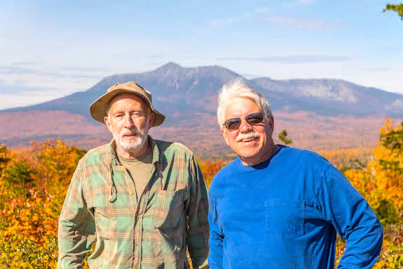
Jim (left) and Dave (right) enjoying the vista before getting ready to get on the air. (C) Copyright 2016 Tim Carter

Jim (left) and Dave (right) enjoying the vista before getting ready to get on the air. (C) Copyright 2016 Tim Carter

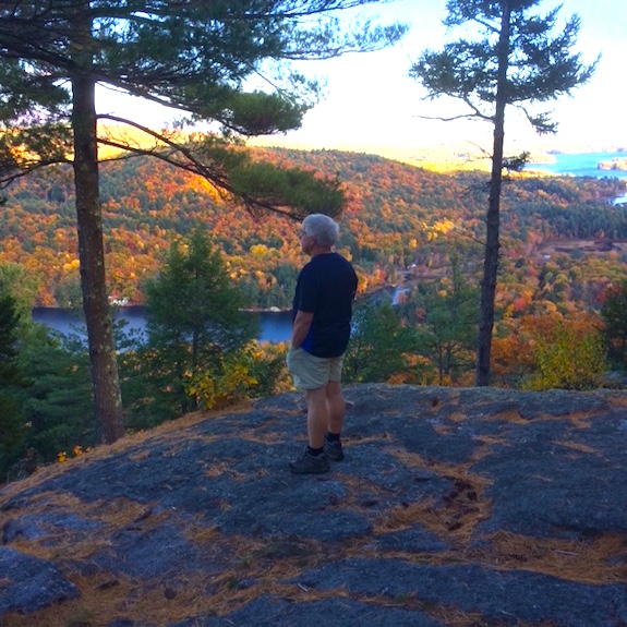
Jim caught me in a trance looking out at the Squam Mountains that protect Squam Lake from fierce winter winds. (C) Copyright 2016 Jim Cluett

Jim caught me in a trance looking out at the Squam Mountains that protect Squam Lake from fierce winter winds. (C) Copyright 2016 Jim Cluett

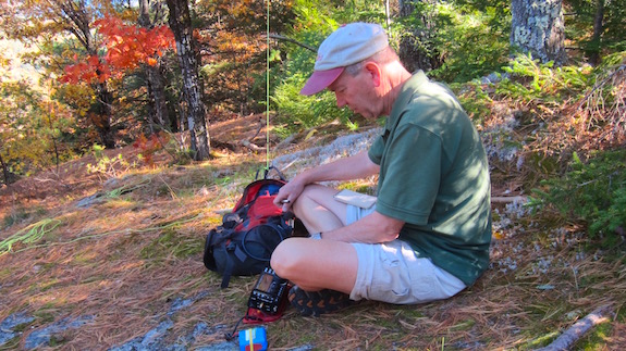
Jim is on the air and capturing invisible radio waves that bring him immeasurable pleasure. I wish you could be with him to see how much happiness a QSO creates for him. (C) Copyright 2016 Tim Carter

Jim is on the air and capturing invisible radio waves that bring him immeasurable pleasure. I wish you could be with him to see how much happiness a QSO creates for him. (C) Copyright 2016 Tim Carter

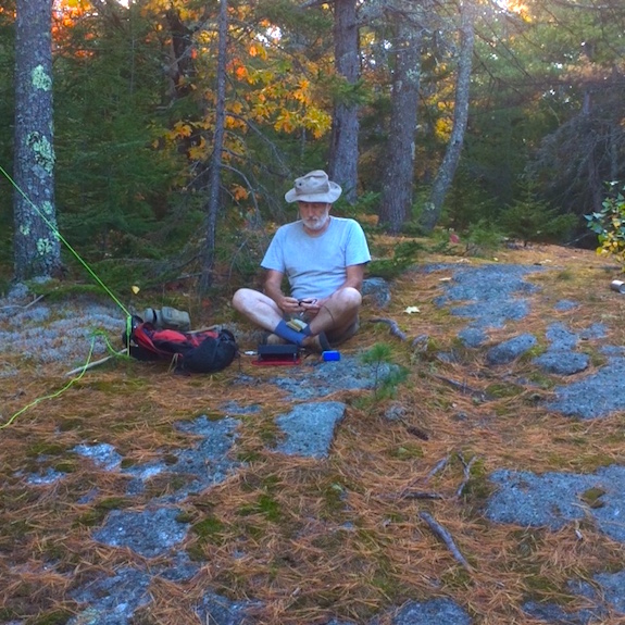
Here's Dave doing fast CW. In just a matter of minutes he made contact with five other radio operators. (C) Copyright 2016 Jim Cluett

Here’s Dave doing fast CW. In just a matter of minutes he made contact with five other radio operators. (C) Copyright 2016 Jim Cluett

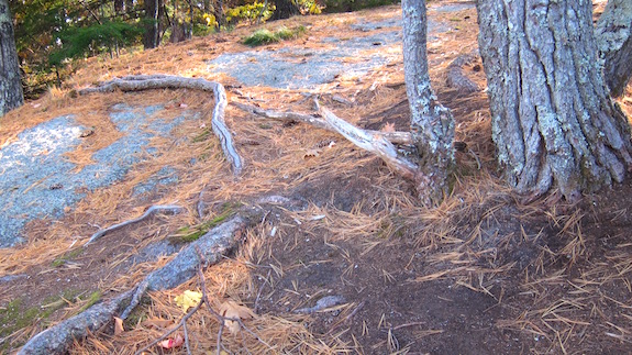
A quite tall tree is growing on top of solid bedrock at the vista. It's gnarled roots stretch and grasp the cracks in the rock looking for nutrients and water. They've done a magnificent job for years. (C) Copyright 2016 Tim Carter

A quite tall tree is growing on top of solid bedrock at the vista. It’s gnarled roots stretch and grasp the cracks in the rock looking for nutrients and water. They’ve done a magnificent job for years. (C) Copyright 2016 Tim Carter

After hiking back to the cars, we were treated with this eye candy. "I need four more pairs of eyes," exclaimed Jim while we talked to each other on mobile radios in our trucks and cars. (C) Copyright 2016 Tim Carter

After hiking back to the cars, we were treated with this eye candy. “I need four more pairs of eyes,” exclaimed Jim while we talked to each other on mobile radios in our trucks and cars. (C) Copyright 2016 Tim Carter

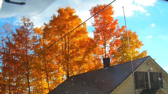
I wish my wife Kathy had been with me. This is one of her favorite color combinations. The fall of 2016 in central New Hampshire was absolutely one of the best. (C) Copyright 2016 Tim Carter

I wish my wife Kathy had been with me. This is one of her favorite color combinations. The fall of 2016 in central New Hampshire was absolutely one of the best. (C) Copyright 2016 Tim Carter

Katahdin Woods and Waters NPOTA Activation

This photo was taken before I turned on my KX3. My smile was soon to turn upside down into a frown. (C) Copyright 2016 Mark Wellman

Dave Benson, K1SWL, is on the left. This photo was taken before I turned on my KX3. My smile was soon to turn upside down into a frown. (C) Copyright 2016 Mark Wellman

To activate Katahdin Woods and Waters National Monument as part of the American Radio Relay League’s (ARRL) 2016 National Parks on the Air (NPOTA) event, you have to want it bad.

Really bad.

More so than the chasers that want you in their logbooks so they can claw their way up and over other operators trying to get to the top of the NPOTA leader board. Because this new National Parks property is so remote, you don’t want to invest all the time and effort to get here only to create disappointment for yourself and the NPOTA chasers.

But it can happen, and it almost happened to me because of my newfound outdoor radio bravado.

It’s Far Away

Consider this. After crossing the New Hampshire / Maine border and then driving northeast for just under three hours, you’ll only find yourself just north of Bangor, Maine on I-95. Once you streak by the last Bangor exit, off ramps become scarcer than QSOs during solar doldrums. Those few exits you see usually have no gas stations or restaurants. You still have another hour of driving before you can get off the interstate highway to make your way to Katahdin Woods and Waters.

When you see the exit sign for Millinocket, it’s time to get off I-95. To get to Katahdin Woods and Waters, you have to travel west and then head north on Maine Route 11 from East Millinocket, Maine.

Set your trip odometer as you make the turn onto Route 11 because by the time you get back to this tiny outpost of limited civilization after touring Kathadin Woods and Waters National Monument there’s a good chance you’ll have traveled no less than 120 miles. I say this assuming you don’t get lost on the unmarked logging roads you’re about to traverse.

Fill your tank with gasoline, bring food, water, toilet paper and have a Maine Road Atlas close at hand. A GPS unit that creates a route memory allowing you to find your way back is not a bad idea if you’re map-reading challenged. You’re headed into the wilderness and don’t count on getting any help from anyone should something go wrong.

As you drive north towards this new National Park asset, you’re hugging the shoreline of the east branch of the Penobscot River.  Every now and then you’re treated to a stunning view of a quintessential New England river replete with giant boulders, fast water and shorelines lined with evergreen and hardwood trees that seem to scratch the sky.
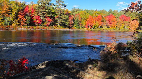
The colors of the trees were the most vibrant I've ever seen. (C) Copyright 2016 Tim Carter

The colors of the trees were the most vibrant I’ve ever seen. (C) Copyright 2016 Tim Carter

After traveling north on Route 11 for about twenty miles, you’ll arrive in Staceyville, Maine. There are no signs. There’s no business district. There’s but one house on your left where Route 11 takes an abrupt right turn pointing you towards Sherman, Maine and I-95.

Turn left at this house and as you leave the blacktop, you’re on Swift Brook Road. Forget about looking for a road sign. You know you’re headed in the right direction because across the hay field to your left you’ll see it – the majestic jagged peak of Mt. Katahdin slicing into the sky.
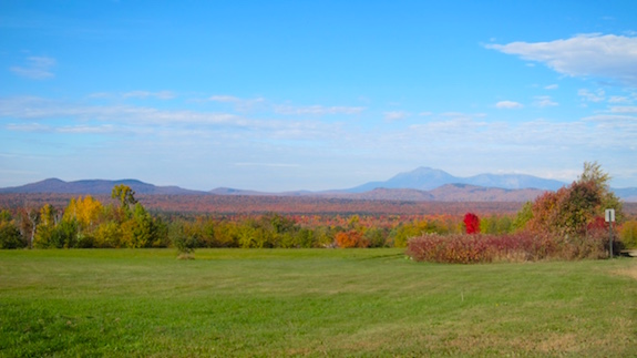
There it is on the right side of the photo. It's so much more impressive in person. (C) Copyright 2016 Tim Carter

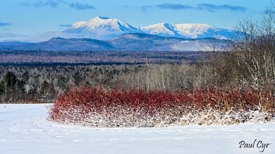
There it is just above and to the left of the red tree. Yes, it really was that color. Mt. Katahdin is so much more impressive in person. (C) Copyright 2016 Tim Carter

It’s time to drive west along this bone-and-strut-jarring gravel logging road for 16 miles before you get to the 15-mile dusty gravel circular Katahdin Woods and Waters Loop Road. Signage is poor to non-existent on these logging roads. When you see orange ribbons of surveyor’s tape hanging from bushes or brush, be sure to slow down. These warn you about potholes or depressions deeper than the Mariana Trench.
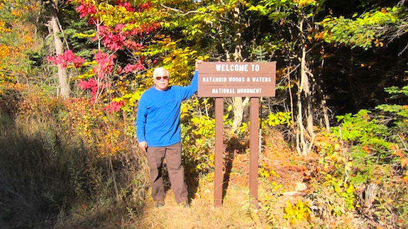
I guess one day they'll have a giant welcome sign like you see at most National Park properties. For now, this is it along the narrow logging road. (C) Copyright 2016 Dave Benson

I guess one day they’ll have a giant welcome sign like you see at most National Park properties. For now, this is it along the narrow logging road. (C) Copyright 2016 Dave Benson

Rumor has it the locals steal or destroy the signs because many didn’t want this new national monument in their backyard. Several intersecting roads tempt you to turn onto them. Should you make that mistake, it’s quite possible all anyone will find in the future will be your bones and a pile of rust that once was your car or truck and your radio gear.

You’re deep in the wilderness, trust me.

I was making my journey with Dave Benson, K1SWL and we had the good fortune to arrive in this remote part of Maine when fall color was at its peak. We both successfully activated this National Park unit on October 8, 2016.

I only got twelve QSOs, just two over the minimum required for an official activation. Dave scored thirty-seven contacts.

Eleven of my twelve QSOs happened only because Dave was there.
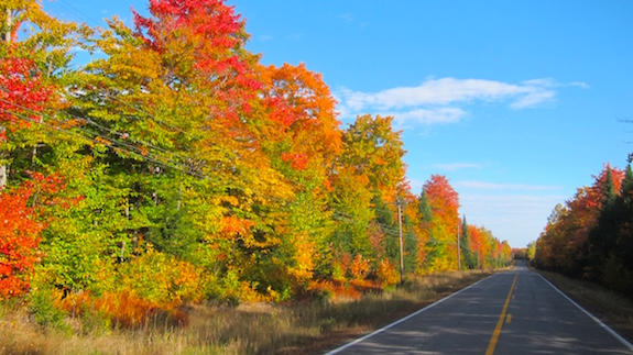
Driving north up Route 11 was like going through a gauntlet of mystical color. I've never seen such vibrant fall color in my life. (C) Copyright 2016 Tim Carter

Driving north up Route 11 was like going through a gauntlet of mystical color. I’ve never seen such vibrant fall color in my life. (C) Copyright 2016 Tim Carter

But before I tell you about what happened to Dave and I on this magical autumn day deep in the wilds of the great state of Maine, there’s something you need to know. This day turned into a humbling experience for me and a teaching one for you if you’re thinking of wandering into the woods to witness the magic of outdoor radio.

My previous eight months of successful NPOTA activations had overfilled my confidence tank to the point I thought I was invincible.

The Base Line

My amateur radio experience is as thin as a business card. I was first licensed in 2003 and just dabbled in 2-meter work for a year. Lacking a mentor, I dropped out of the hobby until 2011 when I did a public service event on the flanks of Mt. Washington in New Hampshire.

A year later I obtained my General privileges and started to try to learn CW with the help and patience of Jim Cluett, W1PID. My progress was very slow because I wasn’t putting in the required time to become proficient. I really didn’t start to do HF radio until the fall of 2013 and then only sporadically.

In other words, I’m still quite wet behind the ears and know enough about power, antennas, radios and all things HF to be highly dangerous around myself.

My first NPOTA activation happened on a brisk day in February, 2016 at Saint Gaudens National Historic Site. I was just an observer watching how to work your way through a pileup. I had never heard one before and was stunned by what happened. Jim and Dave Benson, K1SWL were there on that winter day and worked together to garner almost 90 Morse code, or CW, contacts in just over one hour.

I drove home thinking I’d never ever be able to handle a pileup. It seemed so very hard and complicated.

Two months later I traveled out west and successfully activated, on my own, Yosemite National Park, Death Valley National Park and Joshua Tree National Park.

In July of 2016, I did a ten-day road trip to Ohio from New Hampshire and completed eight activations. While others participating in this event have garnered more conversations, or contacts, during an activation while they’re at one of the 400+ National Park units, I thought my 113 contacts at the Flight 93 National Monument were quite impressive for a relative beginner. Never before had I ever garnered that many QSOs in a day, a week, or a month!

I did all of my activations with an Elecraft KX3 and a simple 29-foot wire antenna that most times hung vertical from a tree. The simple wire was attached to a 9:1 unun.  A trusty 4.5 Ah BioennoPower lithium-iron-phosphate battery provided ample power to have success at each site. My KX3 is capable of 15 watts output power, but on most activations I only used 10 watts.
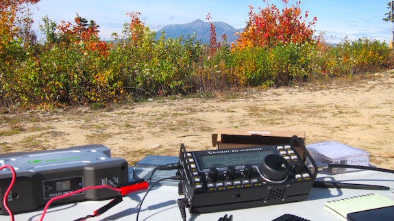
Here's my Elecraft KX3 at Katahdin Woods and Waters. I brought a larger BioennoPower battery pack because I thought I'd be crashing through a six-hour pileup. (C) Copyright 2016 Tim Carter

Here’s my Elecraft KX3 at Katahdin Woods and Waters. I brought a larger BioennoPower battery pack because I thought I’d be crashing through a six-hour pileup. (C) Copyright 2016 Tim Carter

By the time I did my last activation, once again at Saint Gaudens in late August of 2016, I felt that chasers would descend on me at Katahdin Woods and Waters like ants on cookie crumbs at a picnic. Success breeds success, right?

The NPOTA event had become so popular that thousands of operators are constantly monitoring the frequencies, spotting websites, and social media pages like the ARRL’s NPOTO Facebook page so they can make contact with activators like me who are out in the elements setting up their equipment in the historic and/or gorgeous National Park sites.

#FAILURE

Dave and I were the first people to arrive at a glorious scenic overlook just east of Mt. Katahdin that morning. Once we turned left onto the 16-mile loop road, we had to travel about six miles to get to a stunning slope that gave you a 200-degree vista of Baxter State Park. Along the way we were treated to gorgeous fall color and views of Mt. Katahdin.

I was so overwhelmed with the beauty I neglected to notice there was an absence of tall trees. Evidently most, or all, of this new National Monument had been heavily logged, probably in the past eight or ten years before it was gifted to the park service.

I believe the woman that donated the 87,000 acres that is now Katahdin Woods and Waters completely timbered it within the past ten years to extract lots of sweet moola. (C) Copyright 2016 Tim Carter

I believe the woman that donated the 87,000 acres that is now Katahdin Woods and Waters completely timbered it within the past ten years to extract lots of sweet moola. You can see the loggers forgot a few. (C) Copyright 2016 Tim Carter

Mt. Katahdin was so striking it reminded me of the Grand Tetons in Wyoming that rise up from the Earth like a whale breaching in the ocean.

The scenic overlook was small and very primitive. Katahdin Woods and Waters is virtually undeveloped. It’s just coarse gravel roads everywhere. There’s no visitors center. There’s no developed camping sites. There’s nothing but dust, potholes, moose and beauty.

The overlook was tiny and had two standard picnic tables and parking alongside the road for maybe five cars or pickup trucks. There was a simple pit toilet structure about 200 feet from the overlook.
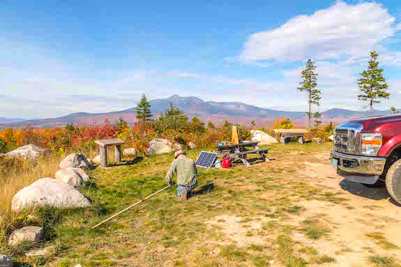
Here's the scenic overlook. It was tiny. Dave is getting his Buddypole antenna ready. (C) Copyright 2016 Mark Wellman

Here’s the scenic overlook. It was tiny. Dave is getting his Buddypole antenna ready. (C) Copyright 2016 Mark Wellman

I set up about 120 feet away from Dave down a slight grade near the pit toilet because he needed a picnic table to support his wood antenna bracket. It didn’t take us long to get on the air.
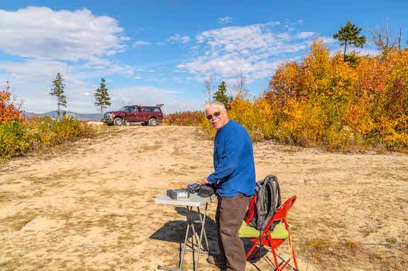
You can see my truck up at the scenic overlook. That tall tree beyond my truck was too far away from the scenic overlook to use. I know what you're thinking. (C) Copyright 2016 Mark Wellman

You can see my truck up at the scenic overlook. That tall tree beyond my truck was too far away from the scenic overlook to use. I know what you’re thinking. (C) Copyright 2016 Mark Wellman

The only tree I could find to support my simple 29-foot wire antenna was perhaps 16 feet tall and it’s top branches were as thin as a cocktail straw. I had a bad feeling that soon ballooned into extreme frustration.

NOTHING

I connected the antenna to my Elecraft KX3 and started to spin the VFO knob to see what was happening. Dave and I decided to work separate bands and modes so as to create minimal conflict. He was going to start doing CW on 40 meters and my job was to try to do SSB, or phone, on 20 meters

Somehow we had limited and sporadic cell phone coverage. I was able to get some text messages out to Emily Saldana, KB3VVE. She’s an avid NPOTA chaser and does some activating. I was hoping to get her into my log and have her announce to the world what frequency I was transmitting on. I also tried to contact Jim Cluett, W1PID, to have him spot me.

If you’re new to this great hobby, spotting is done on several websites one of them being DX Summit. An operator who hears you and makes contact with you can then tell the world via these websites who you are and what frequency you’re on.

If you get spotted, the NPOTA chasers come at you faster than a shooting star blazes across the night sky. Your success as a NPOTA activator often hinges on being spotted.

But it wasn’t to happen. Emily couldn’t hear me. My antenna was wretched. It was worse than wretched. My meager 15 watts was not able to get my signal out.

I was able to hear other stations, but they couldn’t hear me. I tried calling out to anyone on the common frequency a low-powered station like me uses. It was 14.060 MHz.

I called and called and called. Nothing. I was on my way to get skunked.

Broken Tiny Wire

After forty minutes, I started to hunt around for a strong station that might be doing the same thing. Finally I found WB9EGZ.

Wow.

One stinking contact. Had you bet me what might happen on this day, I was sure I’d have sixty or more QSOs in my log book in the first ninety minutes based on the pileups I had at my past activations.

Because Katahdin Woods and Waters is a very rare NP unit and the weather was about to change for the worse in this remote part of Maine, I thought everyone would be trying to work Dave and I.

My guess is they would if they could hear us.

I discovered the source of the problem after getting home. The one wire in my 9:1 unun had snapped and was not making a connection with the center post of my coax cable.

No wonder no one could hear me.

The defect happened because the person who made the unun had use a wire stripper that cut partway through the wire. What’s more, the silicone caulk they used to try to secure the toroid to the inside of the plastic box had failed.

The toroid was able to move around and this movement broke the connection.

Rookie Mistake

I should have known immediately that something was wrong with my equipment, but my lack of experience blamed something else. It would have taken less than one minute and a small phillips screwdriver to check the unun.

It would have taken less than five minutes to resolder the broken wire.

It would have been smart to have a tiny toolbox with me that had an assortment of tools, parts, wire, solder, soldering iron, etc. to make emergency field repairs.

The Buddypole™ and 100 Watts

Dave is a legend in outdoor radio and QRP operation. He’s the founder of Small Wonders Lab and he invented the Rockmite QRP radio. He’s been in the hobby for decades and he’s probably forgotten more than I’ll ever know about this great pasttime.

He came prepared for this outing. He knew intuitively that FAILURE was not an option after coming this far to such a remote place.

This is why he brought a trusty IC-706 100-watt radio, a giant 15 Ah BioennoPower battery and a nice solar panel to force as many electrons back into the battery as possible as he sucked them out of the baby-blue battery with each transmission. He had an Elecraft KX3 as well, but chose not to use it.

Dave’s antenna was a trusty Buddypole™ that was high in the air. Dave made a special plywood holder that was clamped to the picnic table. A fiberglass extendable painters pole was in the holder and the Buddypole™ was attached to the end of the pole. All said the tip of the antenna was at least 30-35 feet in the air.
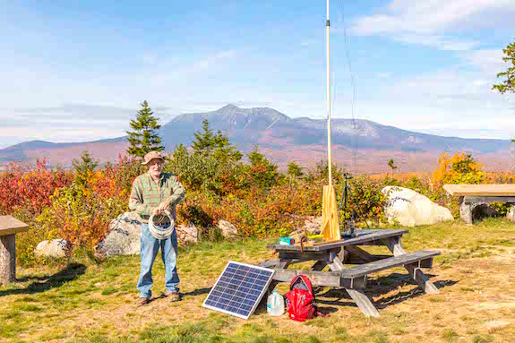
Dave is just about ready to get on the air. There's so much to be said for experience and wisdom. (C) Copyright 2016 Mark Wellman

Dave is just about ready to get on the air. There’s so much to be said for experience and wisdom. Look at the stunning carpet of hardwood trees on the east-facing flank of Mt. Katahdin! It looks like someone spilled Trix cereal. (C) Copyright 2016 Mark Wellman

Dave thought it through where we were going to be. On this stunning autumn day we found ourselves in one of the most remote parts of the USA with few north of us, others across 3,000 miles of ocean to the east, and our target chasers hundreds and thousands of miles to the south, west and southwest of us.

What’s more, the sun had been cantankerous the past few months and propagation had been dismal at best. To make the trip worthwhile for himself and the chasers depending on us, Dave knew that you needed to have equipment that would perform.

He knows that antennas are everything. You can pull contacts out of the ether with a tiny 1-watt radio IF you have a great antenna. This is why he brought a nice Buddyypole™ antenna. To make the antenna work as good as possible he also deployed the necessary  counterpoise wires. These were stretched out upon the ground to complete his antenna setup.

My thinking as I packed my gear two days earlier was pretty simple:

  • I *assumed* all would work out based on my past experience.
  • I *assumed* my pixie 29-foot antenna wire would perform as it had all year.
  • I *assumed* the 10 or 15 watts from my Elecraft  KX3 would carry the day.

I was wrong.

“Come Up and Use the 706”

As the morning transitioned to lunch, more and more visitors descended upon us to soak in the sun and astonishing view of Mt. Katahdin just four miles west of us. Most were husband/wife couples who were friendly and most curious.

The most common question asked of me by these tourists was, “What are you doing?” I’m a very social person and I love to get a laugh out of strangers if I can. It’s a selfish sport so my wife Kathy tells me.

As these strangers would walk up to us, I always looked at their faces. If I saw smiles and got a good vibe, my answer  to this common question was, “We’re talking to beautiful women.”

Because there are plenty of female operators in our great hobby, I find this to be a valid statement. I also have found it’s a great way to break the ice with strangers and get a laugh. Laughter seems to put everyone at ease.

One woman smiled and said, “That’s the best pickup line I’ve heard in forty years.” She laughed out loud and smiled at me.

Sadly that little bit of humor wasn’t enough to put out the raging fire of frustration I was experiencing. Dave knew I was in trouble.

Dave came down to visit with me at one point to check on my progress. After telling him about my one contact he said, “Why don’t you come up and use the 706?” I’ve already got my needed ten contacts even though I had to hunt and pounce for them.”

I was desperate. I didn’t hesitate to abandon my table and walk up to sit at his picnic table with the more powerful IC-706 and gorgeous tall antenna. We reconfigured the antenna to see what could happen on 20 meters.

Within a few minutes I was working nothing but DX stations into Europe. Just about every station gave me a signal report of 20 over 9. I ended my activation working a newer friend, Carter Craige N3AO. His wife Kay was the recent past president of the ARRL. Carter sent me best wishes as we finished up the CW QSO.

What a difference more power and a real antenna makes.

What’s In It for You?

Dave shared much more about what to do and why during the trip and I’ve been blessed to have another legendary outdoor radio operator, Jim Cluett, W1PID, mentor me.  I hope you’re blessed to have generous and patient mentors like Dave and Jim.

Getting ready for this trip I failed to recall one of the most important things Jim taught me about outdoor radio a few years ago while we were out for outdoor radio hikes.

“Everything about outdoor radio is against you. The elements, the challenges of low power, the less-than-perfect lightweight antennas, the bugs, forgetting some mission-critical component all make for a miracle if, and when, you log a contact or two or three. When you’re up in your shack you have such an advantage.”

While that may not be the exact thing he said, it’s the spirit of many a conversation we’ve had about what it takes to be a success outdoors.

Looking back, it’s all about your expectations for a particular outing. If you’re going out on a short hike by yourself and you just want to grab a contact out of the ether for your logbook, then 1, 5 or 10 watts and a wire antenna may allow you to achieve your goal.

But if you have hundreds of chasers in the waning weeks of a huge event trying to put a rare NPOTA unit into their logbooks and they’re counting on you to be there for them, then perhaps you need to up your game.

Perhaps you need to take tools and even inexpensive spares. It costs less than $10 to make an unun.

You can bet the next time I invest three days of my time driving hundreds of miles to and from Kathadin Woods and Waters, or any other remote National Park unit, and have hundreds of chasers wanting to put me and that unit in their logbook, I’ll remember Jim’s words of wisdom. I’ll be packing plenty of power, a respectable antenna, tools, parts and whatever it takes to make contacts.

Please realize that even though this tale seems serious and sort of doom and gloom, I had a magnificent time and would go back again in a heart beat.

But you know what I’ll have with me!

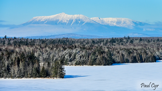
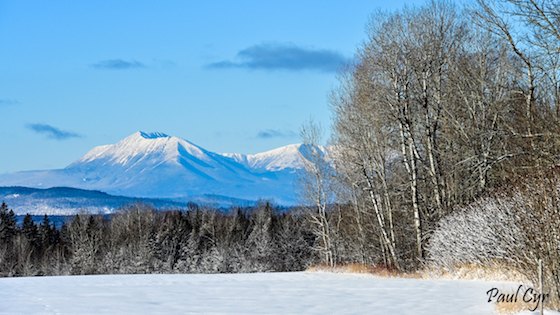
Author’s Note: The following four photos of Mt. Katahdin and the surrounding countryside were taken by Paul Cyr on January 3, 2022. I’ve never met him in person nor his brother Mike who is a subscriber to my FREE Ask the Builder newsletter. Both hale from Presque Isle, Maine, and are quite close to Mt. Katahdin. Paul is an excellent photographer. He’s allowed me to publish these photos. I URGE YOU to go to his portfolio to see other photos that should be in National Geographic magazine. 
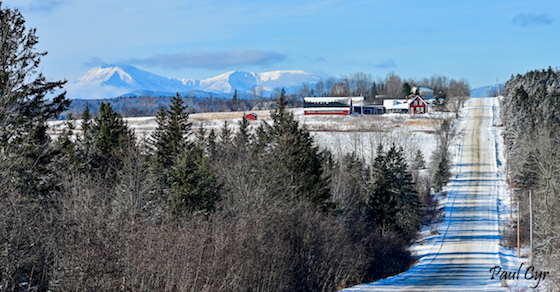
mt. katahdin mt. katahdin mt. katahdin mt. katahdin

NPOTA Saint Gaudens NPS Centennial Activation

Yesterday, August 25, 2016, I had the pleasure of activating Saint Gaudens National Historic Site with Barry Green, W1JFK and Frank Towle, KC1AAQ. It was my fourth time at this delightful jewel National Park Service (NPS) property.

It was even more special because the three of us were there on the 100th birthday of the National Park Service. It was created by presidential order on August 25, 1916.

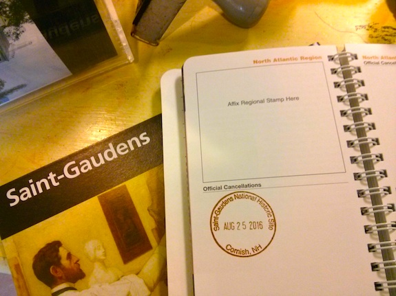
You can see my official stamp in my NPS Passport book. Photo credit: Tim Carter

You can see my official stamp in my NPS Passport book. Photo credit: Tim Carter

The three of us decided to do an activation of this site weeks before. Frank had activated it with me two months earlier and it was Barry’s first NPOTA activation. Barry is an expert DXr and does SSB. Frank gravitates to digital HF radio and I’m the CW junkie. So the three of us were able to work together in an attempt to make a handful of chasers happy on this historic day.

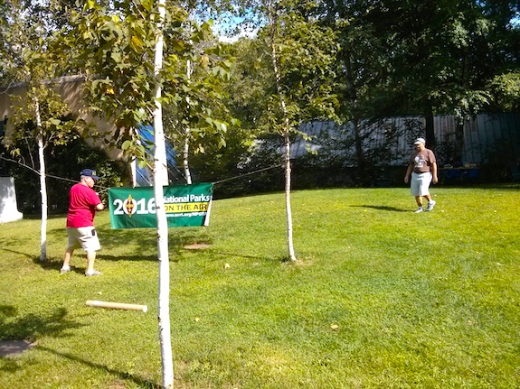
Barry is hanging the NPOTA banner just eight yards from the sidewalk leading to the front door of the visitor center. Frank is walking over to help. Photo credit: Tim Carter W3ATB

Barry is hanging the NPOTA banner just eight yards from the sidewalk leading to the front door of the visitor center. Frank is walking over to help. Photo credit: Tim Carter W3ATB

But as with all best-laid plans, the ionosphere had other things in mind for us. We all struggled to make contacts over the three hours we were on the air. With the help of gracious spotters and us transmitting endless CQs, the three of us garnered only 40 total contacts.

Barry and Frank are on the air! The weather was grand and we got a small sprinkle of rain just before we were going to go home. Photo Selfie credit: Tim Carter - W3ATB

Barry and Frank are on the air! The weather was grand and we got a small sprinkle of rain just before we were going to go home. Photo Selfie credit: Tim Carter – W3ATB

Barry and I got the requisite minimum of ten QSOs each to officially activate, but Frank didn’t make it even though he logged an operator in Liverpool, England.

My Elecraft KX3, BioennoPower Powerpack and 29-foot wire with a 9:1 unun allowed Barry and I to communicate. Frank brought his own radio, power supply and computer to make his digital magic possible. As usual, the Bionenno Powerpack did the trick. Even after three hours of nearly continuous operation, the LCD screen still showed the lithium-iron-phosphate battery as full!

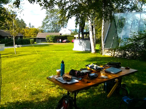
This is our setup with the view towards the mansion. The visitor center is just to the left of the operating table. Photo credit: Tim Carter - W3ATB

This is our setup with the view towards the mansion. The visitor center is just to the left of the operating table. Photo credit: Tim Carter – W3ATB

It was a busy day at Saint Gaudens as the park was open to the public for free. While we were very visible to the park visitors as they explored the visitor center, none came over to inquire why a fluorescent green string and black wire were doing hanging down from the tree just above us.

While I didn’t realize it at the time, I got an omen from the band god as I was attempting to get my halyard line up into the trees. It took me four attempts to get the perfect branch and my first errant throw came dangerously close to hitting the greenhouse you see in the above photo.

Ranger Paul is patiently watching as I try not to damage NPS property. Photo credit: Barry Green - W1JFK

Ranger Paul is patiently watching as I try not to damage NPS property. I’m swinging a small water bottle that’s attached to a 3-foot piece of parachute cord. That cord is then tied to the smaller fluorescent green halyard line. Photo credit: Barry Green – W1JFK
Barry and I switched off doing SSB and CW and after we both gave it two shots, a few rain drops started to descend from the sky. It was about 1:35 pm and we had decided to leave at 2 pm to get back home by 4 pm. Water hitting expensive electronic equipment was reason enough to call it a day.

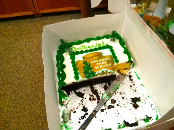
Cake, champaign and contacts. What a great day! BURP! Photo credit: Tim Carter - W3ATB

Cake, champaign and contacts. What a great day! BURP! Photo credit: Tim Carter – W3ATB

We packed up and Rick the head ranger invited us inside for some birthday cake. We graciously accepted. What a surprise to find champaign there as well!

Barry, Frank and I all agreed it was a day well spent. Thanks to the NPS and the ARRL for making the fun NPOTA event possible. Happy Birthday National Park Service!

2016 Flight of the Bumblebees FOBB

Jim Cluett, W1PID, and I decided to operate together for the annual Flight of the Bumblebees. It’s a low-intensity and fun contest.

Operators like Jim and myself are some of the bees because we go out into the wild and operate portable. All who are participating in the event want to put as many bees in their logbooks as possible because each bee comes with a 3X multiplier.

Jim and I met for lunch and caught up. We hadn’t seen each other for about a month because I went on a ten-day trip to the Midwest and then came back to work day after day on my outdoor deck reconstruction project.

“There’s no rush getting on the air because the bands have been horrible,” Jim said while we munched on healthy sandwiches.

“As the day goes on, we should have better and better luck.” He assured me.

It was decided to try to operate from a nice covered shelter at Profile Falls in Bristol, NH.

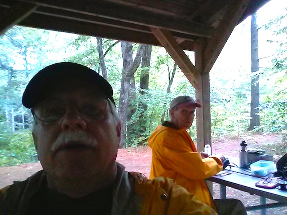
Here's a dark selfie taken inside the Profile Falls shelter. Rain was threatening. Photo: Tim Carter - W3ATB

Here’s a dark selfie taken inside the Profile Falls shelter. Rain was threatening. Photo: Tim Carter – W3ATB

For some reason we keep forgetting this exact location is the Black Hole of RF Death. We also discovered it’s a great place to have your car become a smash and grab statistic. In the shelter was a nice retired man who volunteers to watch over the cars that are in the parking lot for those wanting to hike to the falls.

After forty-five minutes of frustration, I had only two contacts here and I believe Jim had three. On a normal day in that time he could have had ten or twenty.

We packed up and decided to head to some land I own just four miles east northeast of Profile Falls.

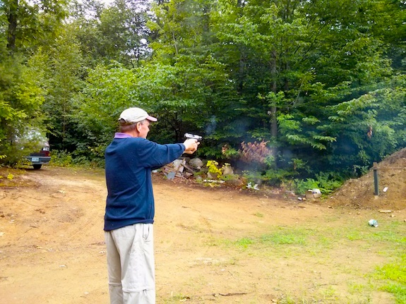
Once there, we decided to vent our frustration throwing lead and copper at a 3/8-inch solid steel gong. It worked. Soon we were in much better spirits.

Here's Jim hitting the steel gong one of many times. It was our best day ever shooting. Perhaps propagation has something to do with firearms skills too! Photo: Tim Carter - W3ATB

Here’s Jim hitting the steel gong one of many times. It was our best day ever shooting. Perhaps propagation has something to do with firearms skills too! Photo: Tim Carter – W3ATB

With only about forty-five minutes left in the contest, we decided to get back on the air.

Twenty meters was alive! I made six contacts in about 24 minutes and Jim made, I think, about nine or ten.

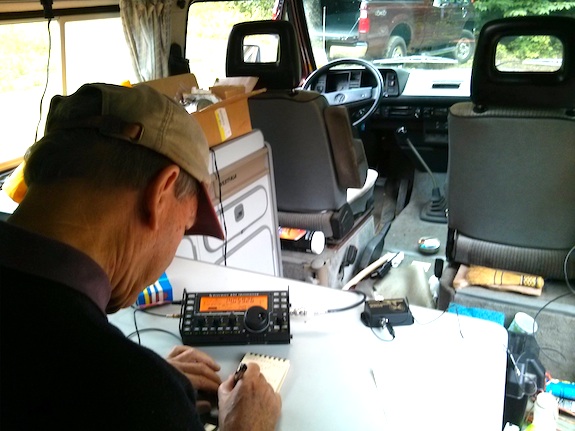
Here's Jim logging a contact late in the contest. We were sitting in his cool VW vanagon that he uses as his roving RF station. It's got enormous good karma and patina. Photo: Tim Carter - W3ATB

Here’s Jim logging a contact late in the contest. We were sitting in his cool VW vanagon that he uses as his roving RF station. It’s got enormous good karma and patina. Photo: Tim Carter – W3ATB

Our Bumblebee scores were pathetic, but that’s not what counts. We pegged the fun meter mixing invisible radio waves with puffs of gunpowder smoke!

KB3VVE and KC3FVN at the Appalachian Trail

I talk to strangers on elevators.

Really. It drives my wife Kathy insane.
You need to know that to understand how it was that I came to meet Emily Saldana, KB3VVE and her husband Keith Comp KC3FVN in person on a warm summer day in the middle of rural Pennsylvania.

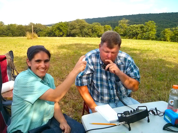
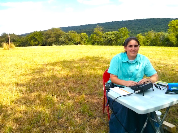
Emily is applying massive amounts of high-energy RF spray so her husband Keith Comp gets the needed ten contacts to officially activate the Appalachian Trail. Photo credit: Tim Carter - W3ATB

Emily is applying massive amounts of high-energy RF spray so her husband Keith Comp gets the needed ten contacts to officially activate the Appalachian Trail. Photo credit: Tim Carter – W3ATB

I’m an extrovert and I’m also attracted to people that exude energy.

I know what you’re thinking. What in the world does any of this have to do with three radio operators, Emily, Keith and myself, and the Appalachian Trail.

Everything.

If you watch the daily activity on the American Radio Relay League’s National Parks on the Air Facebook page, it will take little effort on your part to see that Emily is an energy extruder.

In the Beginning

When the year-long National Parks or the Air (NPOTA) event launched on January 1, 2016, it immediately caught my eye. I’m one of the many amateur radio operators that loves to take tiny radios outdoors on hikes.
Everything I need to operate almost indefinitely in the field can fit into a small daypack with room to spare. I call it stealth radio. I look like the average hiker on a trail, but in just a few minutes I can be on the air talking with someone else hundreds or thousands of miles away.

Having dabbled in the Summits on the Air (SOTA) over the past few years, I instinctively knew that the NPOTA event would catch on fire faster than dry pine needles in a drought.

The reason was simple. NPOTA rules made it far easier for an operator to transmit from a location. All an outdoor operator like me has to do is drive to one of the listed National Park sites, set up within the boundaries of the site, and contact at least ten different radio operators. Once you do this, you’ve officially *activated* that site. It’s not hard at all to contact ten different operators in most cases.

Remember, you don’t have to hike to do an activation. Some radio operators have radios installed in their cars and trucks as well as an antenna already attached to the body of the vehicle.

They can just drive to a park, and immediately start to transmit from inside the comfort of their vehicle. This opens the event to tens of thousands of operators who simply can’t hike for any number of reasons.

Because many of the NPOTA units are somewhat close to one another in different parts of the nation, it’s quite possible to do one or more activations in a single day. Some of the operators participating in this event have activated six or more sites in a single day!

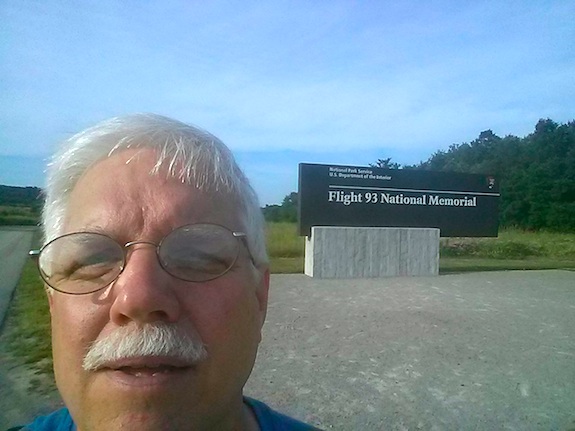
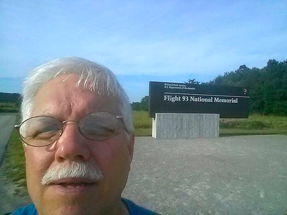
That’s what happened the day I met with Emily and Keith to activate the Appalachian Trail in Shermans Dale, PA. Just hours before I had been over one hundred miles away and had activated the solemn Flight 93 National Memorial in Shanksville, PA.

Tim at Flight 93

Fast Forward

Several months ago I saw on the ARRL NPOTA Facebook page that Emily was trying to get better at sending and receiving Morse code. Radio operators refer to this method of communicating as CW.

CW is a short acronym for continuous wave. When sending CW, the operator breaks the continuous tone into short bursts of different length to create letters, numbers, punctuation, etc.

Emily and I did a very short CW conversation on the air. We then started to schedule regular practice sessions.

While these practice sessions were happening, I was planning to drive to my 50th grade school reunion in Cincinnati, OH. The event was to be held in the middle of July, 2016.

I thought to myself, “You know what, I think I’ll make this a NPOTA activation trip too!”

It didn’t take but a few minutes to realize that I could drive through the southern tier of Pennsylvania and activate several NPOTA units on both my outbound and inbound treks.

Emily and Keith live in south central PA.

The Plan

“Emily, I’ll be traveling near where you live in a few months. Would you have any interest in meeting up for an ice cream cone?”

That’s how it all started. It didn’t take long for Emily to suggest that she and her husband do a joint activation with me next to the Appalachian Trail in a hayfield very close to where they live.

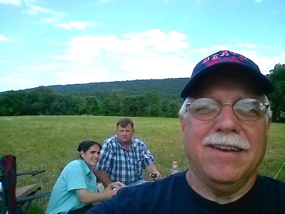
I think you can figure out who is who. Photo selfie credit: Tim Carter - W3ATB

I think you can figure out who is who. Photo selfie credit: Tim Carter – W3ATB

It was a fantastic idea and I jumped at the opportunity.

Emily and I met in the parking lot of a local pizza parlor and then drove the two miles to the hayfield. It only took us about fifteen minutes to set up a small table and two chairs just ninety feet from the trail. Fortunately we were in the shade of a lone scrubby tree that provided the necessary support for my 29-foot vertical wire antenna.

Here's Emily at the small table practicing using the micro Pico paddles to send CW. It only took her about 20 seconds to get comfortable. You can see the Appalachian Trail marker to the left of Emily in the hay field. Photo credit: Tim Carter - W3ATB

Here’s Emily at the small table practicing using the micro Pico paddles to send CW. It only took her about 20 seconds to get comfortable. You can see the Appalachian Trail marker to the left of Emily in the hay field. Photo credit: Tim Carter – W3ATB

We decided that I’d get on the air first since Emily and Keith had already activated this site months before on a cold winter’s day.

When we were planning the outing it was decided we’d use my Elecraft KX3 radio, my 29-foot wire antenna and 9:1 unun, and my lightweight Bioenno Power lithium iron phosphate battery. Emily and Keith were to supply the shade.

Using my marginal CW skills, it only took me about twenty-one minutes to contact fourteen other operators. Emily was kind enough to write down, or log, the contacts. I could have had many more, but decided to stop so that Emily and Keith could also officially activate the site.

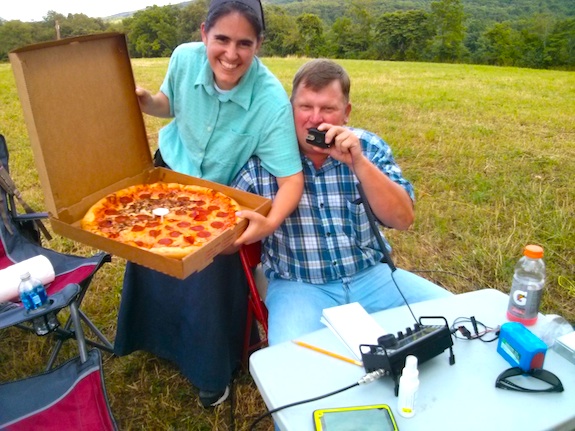
A few minutes after Emily was on the air transmitting and receiving CW, Keith showed up with much needed nourishment. Pizza and radio waves go together like chocolate and peanut butter! Thanks Keith for the delicious pizza!

Believe me, it was GOOD! Photo credit: Tim Carter - W3ATB

Believe me, it was GOOD! Photo credit: Tim Carter – W3ATB

Keith doesn’t do CW yet so he grabbed the microphone and started to talk to other operators from hundreds of miles away. At first he was having no luck.

We discovered the radio was in the wrong mode. We were having so much fun laughing and joking we forgot to switch the radio from CW to voice mode.

It didn’t take long for Keith to log his required ten contacts.

The three of us had a wonderful time and were sorry it was time to pack up and go. Emily and Keith invited me to their local club meeting and we made it there with just about 10 or 15 minutes to spare.

As I drove into the night to my hotel after I left the club meeting, I replayed the past few hours over in my head. It brought a big smile to my face because I had made two new friends.

That’s what happens when you mix lots of laughter, invisible radio waves, slices of pizza and three radio operators in a hayfield. Many thanks to the ARRL and National Park Service for creating the NPOTA event that brought us three together!

KA9BBQ Matt Steffen and Flight 93 National Memorial

NPOTA Flight 93 Activation by W3ATB

Each time I think I’ve syphoned the most pleasure out of the magical happiness machine of ham radio, I get yet another surprise.

On Tuesday July 19, 2016 I found myself once again alone at the hallowed ground of the Flight 93 National Memorial. Little did I know that on this day, I’d help another operator achieve a personal goal.

Flight 93 Memorial W3ATB

A week earlier I found myself at Flight 93 for the first time. I had come to do a National Parks on the Air (NPOTA) radio activation and decided to visit the Memorial Plaza before getting on the air. I walked away misty-eyed hoping I could honor the forty patriots who gave the ultimate sacrifice just under fifteen years ago at this very spot.

I did a successful activation that day, but had to cut my time short because I needed to be in Columbus, Ohio by 5 pm. Many hours of driving were ahead of me.

But on July 19, 2016, I had nearly three hours of time to help other NPOTA participants put the rare Flight 93 unit into their logs. It’s a challenging site to activate because it’s both a battlefield and a burial ground.

Flight 93 Hallowed Ground Requires Respect

The wounds here are fresh and deep. The National Park Service accepts radio operators to this site, but they prefer respectful setups as far away from people and parking lots as possible.

As soon as I got on the air, many operators tried to call me at once. In amateur radio parlance, we call it a pileup. I was piled on for about two hours straight.

Five Watts Does the Job

I was using my Elecraft KX3 radio and a 29-foot wire antenna attached to a 9:1 unun. The KX3 has a splendid internal tuner that will handle this setup.

I did both Morse code (CW) and phone (SSB). If you’re not an amateur operator, phone means talking through a microphone to other operators just like you might use your cellphone.

You Never Know Who’s Reaching Out

Matt Steffen, KA9BBQ was one of the many operators who I contacted in the two-hour stretch.

But I had no idea what our brief exchange on the air meant to him until about two hours later when he sent the following email to me:

Hi Tim,

FIRST I thank you so much for the activation.

Chasing the parks is a blast. I have been a ham for just over a year now and learning a great deal. Mostly self taught and having a great time.

Learning CW now, having recently completed the CW OPS class, I find it both exciting and intimidating. Trying to tune my ear is difficult with everyone (seemingly) using the computer to send and receive CW the speeds they send is too fast for my brain to decode.

I was at a ham fest over the weekend and was talking to a fella about CW. He said “Yeah, I work a lot of the NPOTA stations CW and get right through.” Then I asked him what his rig was. “OH I am all digital. My FLEX does it all.”

Asked him what kind of key he was using and he snapped back, “I’m ALL digital.”  I asked him “No key ?” He replied there is no need for that and went on to explain how he has 250+ confirmed DXCC mostly on CW with his Flex and his digital ham station set up.

Being polite, and not being to impressed, I listened then thanked him for sharing and moved on.  Digital has a place in this wonderful hobby for sure but in CW ???  I prefer to pursue and struggle to learn CW without the aid of a complete DIGITAL HAM station.

Today I got the courage up to try to make contact. Yes, you were the first.

So very sorry about that. Tuning around on 20 meters I heard your CQ at a speed I could copy and to my surprise a NPOTA site. So I took a deep breath and sent my call out and wow you came back to me with a report 5NN. Yikes now what ?

Well I got nervous and I tried to send you your signal report of 5nn and my location IL then TU  DE KA9BBQ – when I finished it sounded like a barrage of CW at a much faster speed and suddenly I felt out of place. I really believe we had a good contact but found my self being to nervous to touch the paddle again.

If I missed out on the contact at least I tried right there will be another day to try again.

Was my first attempt at cw as a rookie success or should I now start saving for that FLEX and digital station?  Just kidding.

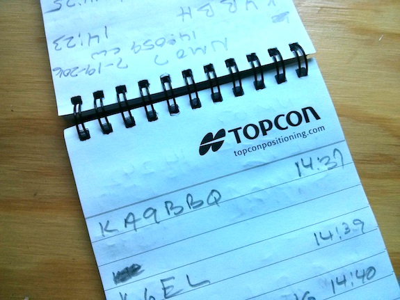
I cut and pasted from my log book – below.

KA9BBQ – 100 Watts  Inveted “V” @ 16ft

Station: W3ATB
QSO: 2016-07-19    14:38:23 UTC
Band: 20m Freq: 14.059.00 MHz Mode: CW
RST: 59s/59r    PWR:  qrp    Ant: ?
Note: NPOTA NM07 / Yikes first try at CW

GOD bless, safe travels, good luck and good DX !

MATT
KA9BBQ

SERVING & PROTECTING

As a side note-

With all the tension on the street I find chasing NPOTA and learning CW so very relaxing when I change out of my uniform.

Spending time with the radio headphones on is a welcomed distraction from hearing how another one of us serving and protecting has lost their life.

No soap box here – just saying I put my life on the line daily many, many times without a partner performing my job at the highest of levels while dealing with issues never shown on the news.

In my environment I’m respected yet the stress and threat is so very real especially on my shift – from the hours of 11PM – 7 AM.

I don’t know what more I could possibly add. Matt’s excitement about having his first official CW QSO was oozing from that email.

Congratulations Matt! You did a great job and I heard all you sent.

Here’s proof you’re in my field log for that day! I’ll have it up on the Log Book of the World (LOTW) in just a few days.

KA9BBQ log entry

The Magic of NPOTA

“I just QSOd Devil’s Tower, Wyoming NPOTA – MN23, 14.275!!!!!! Wa-hoo! Another park, and a first for me to Wyoming!!!”

That’s the text message I received from Aleda Nichols, KC1CCU, last night as I was relaxing in my living room after dinner. If you were to meet Aleda you’ll notice right away she’s a shy person, but her passion for amateur radio is deeper than the Mariana Trench.

Screenshot_2016-05-28-06-56-09


Just hours before I had sent out an email to the 100-plus members of my Central New Hampshire Amateur Radio Club prodding them to get involved with the National Parks on the Air (NPOTA) event that’s being sponsored by the American Radio Relay League (ARRL). The NPOTA event is helping to draw attention to the 100th anniversary of the National Park System.

Dormant Operators Erupt

Aleda’s not the only operator that’s excited about NPOTA. There are hundreds, actually thousands, of licensed radio operators who have been touched by the magic of NPOTA.

Yesterday on the ARRL’s NPOTA Facebook group page, Norm Fusaro wrote, “Who among the group has gotten someone interested in ham radio or enticed a dormant ham to get active through NPOTA?”

One of the comments was from Laura S.

She wrote, “I myself was dormant. I hadn’t turned the radio on in years. Now I spend almost everyday in front of it chasing! In two weeks I have had 58 different parks confirmed… I’m thinking I have a problem now.”  😉

Think about that for a moment. What would make a woman who’s not touched her radio for years, sit down and then flick on the switch?

There are plenty of contests, special event stations transmitting week in week out and other things happening but these didn’t do it for her.

It was NPOTA.

Screen shot 2016-05-28 at 7.27.14 AM

What’s the mystical allure of NPOTA that’s creating the buzz among those that are participating in it? Can you think of a past radio event that’s created so many new friendships in an atmosphere of robust, but toned-down competition?

Ask ten different operators and you’ll undoubtedly get ten different answers. But here’s my take as a relative newbie to the hobby.

NPOTA appears to have taken the best parts of contesting, Summits on the Air (SOTA), outdoor radio both medium and low-power, social media and stirred it up in the cauldron with Logbook of the World to create a powerful elixir that’s spreading happiness from sea to shining sea.

On a Personal Level

I was immediately attracted to NPOTA when it was announced. My passion for the hobby is QRP outdoor radio, but I’ve only been doing it for just under three years. What’s more my operating skills are minimal at best.

The high speed and stress of normal contests are not fun for me. Some who participate in them seem to have a blood lust.

I had dipped my toe in SOTA a few years back activating a hill I can see from my home, Belknap Mountain, and I liked it. It was easy to visualize setting up my radio at one of the hundred or so NPOTA sites around the USA. No doubt it would be fun and relaxing.

Two seasoned operators and I decided to do a NPOTA activation back in February when Mother Nature dished up a delightful day when normally the weather could have been bitter cold here in New Hampshire. We drove to one of the three NPOTA units here in New Hampshire – Saint Gaudens – and were blessed with an intense pileup.

I was hooked immediately. I decided at that point I was going to activate as many sites as I could during the rest of the year. A month ago I was days away from activating Yosemite National Park soon to be followed by Death Valley and Joshua Tree.

Social Media

The ARRL set up an official NPOTA Facebook group and it’s an online version of the Cheers bar but without a closing time.

Stop by and you’ll discover spotting announcements the moment someone gets on the air at a NPOTA site. Plans for future activations are announced. And just like you’d find at any bar, you’ll have one or two unloading a small heap of their frustration or trouble that happened hours before.

The Facebook group page has allowed me to connect with more than one new operator and I think I’ve made quite a few new friends for life. I’m thankful to the ARRL for creating the NPOTA event and all the things connected to it.

NPOTA has become a touchstone for many in amateur radio and I predict it will be long remembered as we float down the river of time.

If you’re one of those dormant operators like Laura, I urge you to get on the air now. Experience the thrill of controlled chaos while in a pileup.

Be brave and do an activation. Get outdoors and experience the unparalleled beauty of our great national parks and historic sites while snagging signals out of the ether.

As Yoda said in one of the Star Wars movies, “Do or do not. There is no try.”


Joshua Tree NPOTA Amateur Radio Activation W3ATB

Two weeks ago I was in southern California. I was starting day eight of a ten-day vacation with my youngest daughter Kelly. We were going to see as much of Joshua Tree National Park as possible and I was going to try to activate it as part of the National Parks on the Air year-long celebration the American Radio Relay League was sponsoring in conjunction with the National Park System.

Just days before I had activated Yosemite National Park and Death Valley National Park. Basking in the success of those two activations, I was excited about the possibility to set up my Elecraft KX3 and my 29-foot wire antenna that connected to a 9:1 unun somewhere in Joshua Tree. I need a tree to put up my stealth antenna.

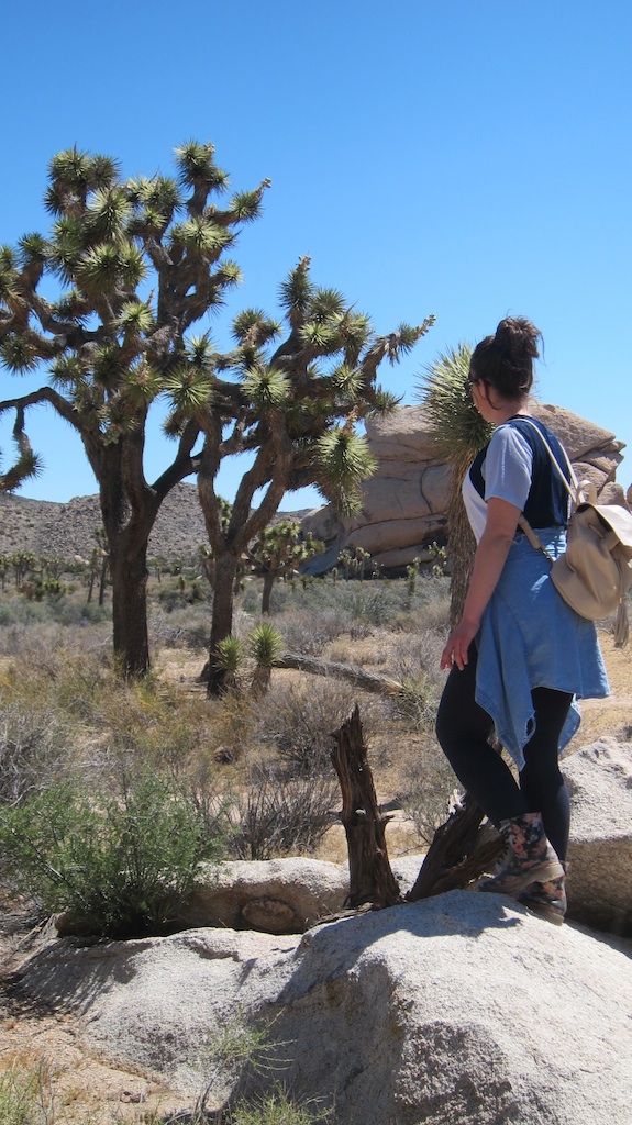
I’m used to tall trees where I live in New Hampshire. Many are over 100 feet tall. The trees at Joshua Tree National Park are more like saplings. Most are maybe 15-feet tall at the most.

Here's a typical joshua tree. It's perhaps 16 feet tall maybe. They love to grab onto string and not let go. Voice of experience talking. Photo credit: Tim Carter

Here’s a typical joshua tree. It’s perhaps 16 feet tall maybe. They love to grab onto string and not let go. Voice of experience talking. Photo credit: Tim Carter

But first and foremost it was more important to me to make sure Kelly got to see everything she wanted to see. This national park was to be the highlight of the entire trip, so I was determined that radio would take a backseat and if I didn’t get the chance to operate, well, there’d be another day perhaps.

This might be the last time ever I’d have a chance to be here with Kelly, and there are always radio waves in the ether to capture. It was an easy decision to make.

We were staying at a rental home just two miles from the west entrance into Joshua Tree. I’ve been to many national parks out west in my life and I have to tell you it was the oddest national park to enter I’ve ever seen.

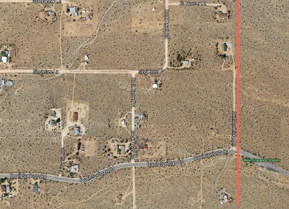
As you drive up Park Boulevard from the visitor center in downtown Joshua Tree, CA to get to the entrance gate the road changes its name to Quail Springs Road. It’s just a normal residential street with all sorts of houses and driveways feeding off the main road. Then all of a sudden you’re at the park gate. There were normal residential houses within a stone’s throw of the park boundary. Crazy but true!

See that red line? That's the park boundary. See all the houses? Amazing. Image credit: Google Maps (C) 2016

See that red line? That’s the park boundary. See all the houses next to it? Amazing. Image credit: Google Maps (C) 2016

It was to be a perfect day. The weather was to be sunny with a temperature ranging from 70 to 90 F. The temperature difference happens because parts of the park are much higher in elevation than others. The higher you go, the cooler it gets.

A waitress at a local restaurant told us we were here at a good time. In just a month it starts to get uncomfortably hot. She said, “It can be 90F at 6 am and can easily get to 115 F or higher in the park by midday.” That’s deadly heat in my opinion.

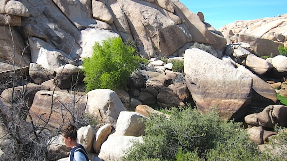
After touring the park for about four hours, Kelly and I found a great place to eat lunch in the center of the park on some picnic tables. There was no shade, but we survived. She decided to find some shade in a jumble of tall rocks and suggested I try to get on the air.

The biggest problem at Joshua Tree national park is the trees. As I said before, they’re all about 16 feet tall or less. I need tall trees to get my antenna up in the air.

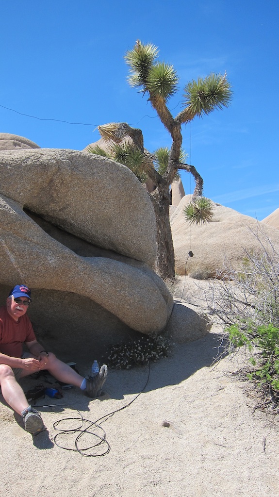
Here is my FAILED attempt at midday to try to activate Joshua Tree National Park. It was a horrible failure. No wonder - look at the wretched antenna. Photo credit: Kelly Carter

Here is my FAILED attempt at midday to try to activate Joshua Tree National Park. It was a horrible failure. No wonder – look at the wretched antenna. Photo credit: Kelly Carter

There were no decent trees where we were eating lunch so I tried to use a telescoping fiberglass fishing pole I brought to create a sloping antenna. I set it up in a crack in a rock that had a slight overhang creating a small spot of shade.

It was a complete and utter FAILURE. My antenna had to be the most wretched one ever deployed by a radio operator. I couldn’t hear one signal and tried, with no success whatsoever, sending CQ to get one QSO.

Nothing happened except me generating a considerable amount of frustration that I hid from Kelly.

I packed up and we continued to see all the sites we could. The best scenery in the entire park was at Barker Dam. Kelly and I both agreed on that. It’s a medium-sized canyon that has a natural narrow spot in the bedrock that allowed an early cattleman back around 1900 to build a small dam.

You can barely make out the dam in the upper left corner of this photo. But you can no doubt see the water marks on the large rocks! The water gets to be at least 15 feet deep at the dam creating a small lake perhaps one acre in size when this area gets rainfall. Photo credit: Tim Carter

You can barely make out the dam in the upper left corner of this photo. But you can no doubt see the watermarks on the large rocks! The water gets to be at least 15 feet deep at the dam creating a small lake perhaps one acre in size when this area gets rainfall. Photo credit: Tim Carter

It was close to 5:30 pm when we finally got back to our rental home. We were both tired.

“Dad, why don’t you go back up into the park and try to do your radio thing again?” Kelly knew I wanted to activate the park.

I was tired, dusty and my stomach was starting to remind me that the peanut butter sandwich hours ago was a meager offering to the waistline god.

When we had gotten in the door to the rental, Kelly had asked for my camera to see the photos I had taken during the day. It was on the dining room table where she left it.

In my haste to leave, because I knew I’d eat up at least an hour, I burst through the door without my camera. To add insult to injury, my cell phone battery had been sucked almost dry of power because I had failed to turn it off while in the park.

I could see the red danger level in the battery and plugged it into my car charger for the short trip up the road to try to get some electrons back to where they belong in the battery.

Soon I was to regret not having a camera.

The excitement started to build as I drove to the park entrance. Would I be able to find a tree near the road that might work for an antenna?

I had to drive about two miles or so up into the park before I located a small turnoff on the north side of the road that had a somewhat decent tree that might work.

Within ten minutes I was set up, but mumbling the entire time, “This is a WASTE OF TIME. There’s no way this antenna is going to work.”

The tree was maybe 15 feet tall. It was child’s play getting my halyard line up and over a branch. I knew the best thing to do was to slope it to the east to have any chance of getting out with my meager 10 watts.

I was just about ready to go and fortunately I had one bar of cell service and texted my CW mentor Jim Cluett, W1PID, in NH. I told him I’d be on 14.060 in about a minute.

The last thing I had to plug in was my micro Pico paddles. I did that and in the rush I touched the ‘dah’ paddle generating a tone.

INSTANTLY Jim came back with his call sign. It was so strong it was if he was next to me with his volume up as high as possible.

I was stunned. Magic may happen.

It did.

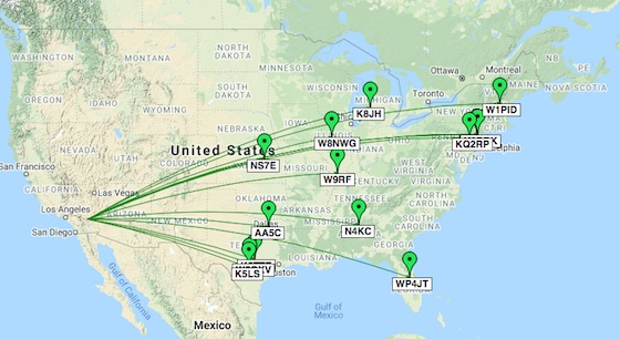
I made 14 QSOs in about 45 minutes with several to New Jersey and one down in Puerto Rico!

Here’s my log:

  • W1PID  05-04 00:09
  • W5GXV 05-04 00:12
  • K2DBK 05-04 00:16
  • AA5C 05-04 00:18
  • K5LS 05-04 00:20
  • KQ2RP 05-04 00:22
  • W8NWG 05-04 00:25
  • WK2S 05-04 00:26
  • W9RF 05-04 00:28
  • K8JH 05-04 00:30
  • WP4JT 05-04 00:33
  • K5TTE 05-04 00:36
  • NS7E 05-04 00:38
  • N4KC 05-04 00:40

joshua tree qso map

All the while I was constantly checking for scorpions and rattlesnakes as I was sitting on the sand right in the middle of scrub, cactus, and the setting sun.

I decided to take a photo of my setup. Once again I had made a mistake. While on the air, I had left my phone on and it was now completely dead. There was to be no photo of this activation.

However, I was beaming with happiness having activated each of the three national parks. I packed up my gear as fast as possible and got back to the house for a fast shower and some dinner.

Later that night I transferred my hand-written log notes to my tablet where I have HamLog running.

My biggest regret was not being able to get a photograph of the horrible antenna setup.

My biggest takeaway was a sloper antenna, just 14 or so feet off the ground is plenty to pull the elixir out of the ether.

Try it yourself and see.

Death Valley NPOTA Amateur Radio Activation W3ATB

Your vision of Death Valley National Park might be like the one I had if you’ve never visited it before. I equated the name to a place so harsh nothing lives there, not a bush, tree nor creature of importance.

I was wrong. Dead wrong.

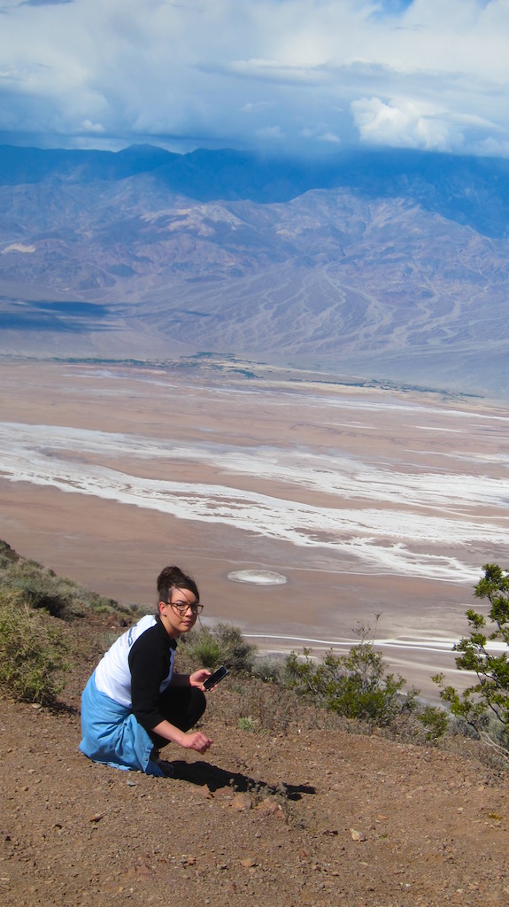
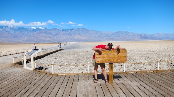
Here's my youngest daughter admiring a flower from the Dante's View high above Badwater Basin several thousand feet below. Photo credit: Tim Carter - W3ATB

Here’s my youngest daughter admiring a flower from the Dante’s View high above Badwater Basin several thousand feet below. Photo credit: Tim Carter – W3ATB

Believe it or not, there’s a natural oasis, probably more than one, within Death Valley National Park and I happened to be staying there for two nights. It’s the The Ranch at Furnace Creek. I was there with my youngest daughter. We were on a whirlwind six-day trip through three of California’s national parks – Yosemite, Death Valley and Joshua Tree.

This vacation was special for me for a number of reasons. First and foremost I was going to be spending time with my two daughters. Second, I had never before been to Death Valley nor Joshua Tree National Parks. Both somehow escaped my attention on my many past forays out west over the past forty-five years.

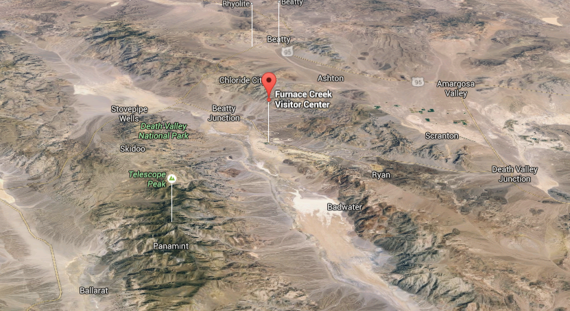
Here's a 3D shot of Death Valley National Park and the surrounding desolate desert in southeastern California. Image credit: Google Maps (C) 2016

Here’s a 3D shot of Death Valley National Park and the surrounding desolate desert in southeastern California. Image credit: Google Maps (C) 2016

Within thirty minutes of arriving within the boundary of Death Valley, I knew that it was going to be jaw-dropping beautiful. We were nearing the end of a punishing 9-hour drive from Yosemite National Park. The drive would have been just a little over four hours had the Tioga Pass road at the north end of Yosemite been clear of snow.

My college degree is in geology and there’s more geologic eye candy here than any place I’ve ever seen. The variety of rocks and the range of their colors took my breath away.

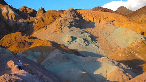
Here's some rocks colored by volcanic activity and enhanced by the setting sun. I took this photo in the magic hour before sunset at the Artist's Palette loop road south of Furnace Creek. Photo credit: Tim Carter - W3ATB

Here’s some rocks colored by volcanic activity and enhanced by the setting sun. I took this photo in the magic hour before sunset at the Artist’s Palette loop road south of Furnace Creek. Photo credit: Tim Carter – W3ATB

Before we left New Hampshire on this ten-day vacation, my daughter agreed that she’d have no problem me playing radio for several hours at each park. Just a little over 48 hours before I had successfully activated Yosemite National Park. I was anxious to try to activate the three parks we’d be visiting as part of the year-long NPOTA event.

Once we checked into our two-unit spartan room at The Ranch at Furnace Creek, Kelly and I took a walk through the compound. Just 600 feet to the west of our room was the swimming pool, golf course and a very large lawn area that was available to a motel-like structure where more guests put their heads on pillows.

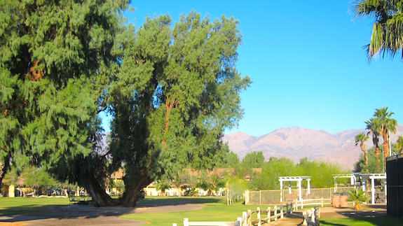
I was astonished to see two massive salt-water cedar trees in a large patio area next to the lawn. Each had to be at least 40-feet tall – more than enough to string up my thin wire antenna.

Can you believe these are thriving in the center of Death Valley? Photo credit: Tim Carter - W3ATB

Can you believe these are thriving in the center of Death Valley? Photo credit: Tim Carter – W3ATB

The next day I set up once early in the morning before Kelly and Ieft to explore the park. I got skunked. The band simply wasn’t open.

Here I am under the giant tree. I moved out of the shadow just long enough to get the photo. Photo credit: Unknown Motorcylce Tourist from San Francisco

Here I am under the giant tree. I moved out of the shadow just long enough to get the photo. Photo credit: Unknown Motorcycle Tourist from San Francisco

Later in the afternoon, I came back around 3:45 PT and set up right under the one giant salt-water cedar tree. Magic was about to happen.

I went to 20 meters, texted my outdoor radio mentor Jim Cluett, W1PID that I was on 14.060 and he spotted me. Spotting is everything if you want a successful activation as part of the NPOTA. I’ve got a few other tips below.

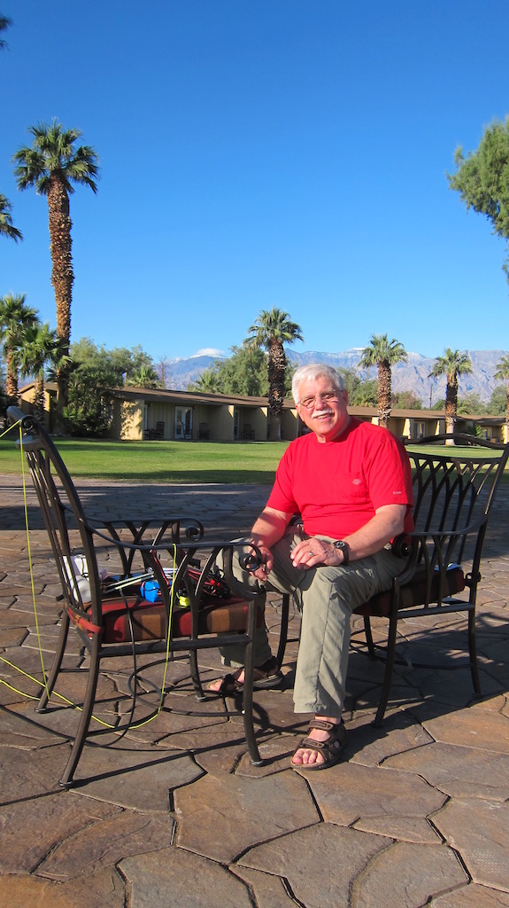
The comfy chairs that set out around the fire rings at The Ranch made this the most comfortable activation of the three. At the others I was on the ground wondering about scorpions and snakes. Photo credit: Tim Carter - W3ATB

The comfy chairs that set out around the fire rings at The Ranch made this the most comfortable activation of the three. At the others I was on the ground wondering about scorpions and snakes. Photo credit: Tim Carter – W3ATB

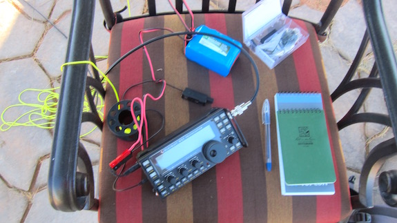
Once I was spotted, my Elecraft KX3 was put to work. I had it attached to a 29-foot wire that hung vertically from the massive salt-water cedar tree. The end of the wire was connected to a 9:1 unun and a 25-foot coax cable snaked across the ground to my radio. My understanding of the connections within the unun lead me to believe the coax cable acts as a counterpoise in this configuration.

Here are the stations I made contact with at Death Valley:

  • K5RK      05-01 22:58
  • K8NWD  05-01 23:03
  • W7OM    05-01 23:03
  • W1PID    05-01 23:04
  • W0IS      05-01 23:08
  • W6LFB   05-01 23:08
  • W4OV    05-01 23:15
  • N1IX      05-01 23:17
  • WT8C   05-01 23:18
  • KE0HWZ 05-01 23:20
  • KD8DEU 05-01 23:23

Once I put the micro Pico paddles down after my last QSO, I was elated. Never before had I done that many QSOs in such a short time outdoors. It was a balmy afternoon and I realized I had reached yet another new level in my amateur radio journey.

I'm at BadWater Basin - the lowest spot in the USA. Kelly and I walked out about 3/4 mile out onto the salt flat behind me. Don't tell anyone how beautiful Death Valley is. Talk up all the scorpions and rattlesnakes. Photo credit: Kelly Carter

I’m at Badwater Basin – the lowest spot in the USA. Kelly and I walked about 3/4 mile out onto the salt flat behind me. That’s very close to the epicenter of the actual lowest spot in the USA. Don’t tell anyone how beautiful Death Valley is. Talk up all the scorpions and rattlesnakes. Photo credit: Kelly Carter

If you plan to do an activation at Death Valley, I highly recommend working under the giant trees I used. The area is fairly private and the tourists shouldn’t bother you. Don’t think about putting up a tripod antenna setup. Just put up a simple wire antenna as I did. It’s stealthy and it works.

You’ve got cell phone service at The Ranch so you can have a friend back in civilization spot you. Take advantage of that. Forget about activating this place between June 1 – September 30, 2016 unless you bring some eggs you want to fry on the stamped concrete next to where you’re operating.

Here's a panoramic shot from Dante's View. Sorry it's so small! Photo credit: Tim Carter W3ATB

Here’s a panoramic shot from Dante’s View. Sorry it’s so small! Photo credit: Tim Carter W3ATB


Yosemite NPOTA Amateur Radio Activation


On Friday morning, April 29, 2016 I had the distinct pleasure to be high on a ridge just a hundred feet inside the southwest border of Yosemite National Park. I was there with my Elecraft KX3 ready to communicate with at least ten other radio operators. If this happened, I’d successfully *activate* Yosemite National Park.

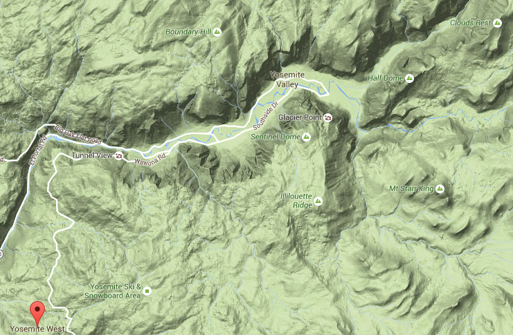
The red balloon in the lower left shows where I was. Image credit: Google Maps (C) 2016

The red balloon in the lower left shows where I was. Image credit: Google Maps (C) 2016

I was in Yosemite on vacation with my two daughters and my son-in-law Brent Walter. Yosemite was the first of three national parks I’d see with my youngest daughter over the next five days. Once we finished at Yosemite, we were off to Death Valley and Joshua Tree National Parks. It was my goal to set up my radio in all three parks as part of the year-long National Parks On The Air (NPOTA) event that’s celebrating the 100th anniversary of the National Park System.

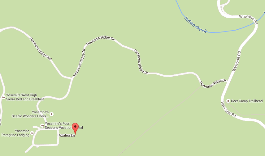
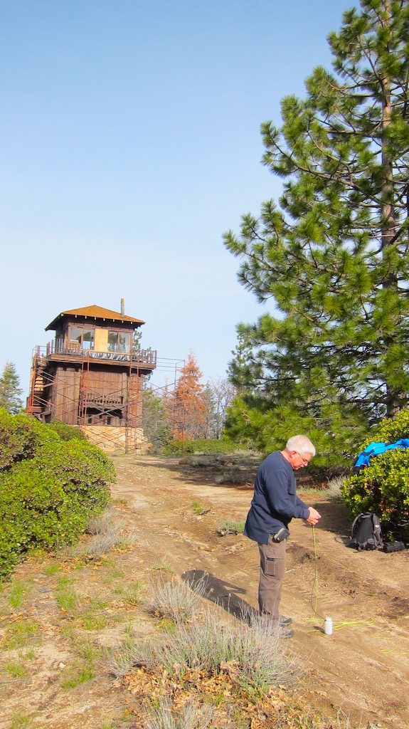
Yosemite West is an interesting location. It’s a private single-family housing development that abuts the national park. At the end of one of the small dead-end streets, Azalea Lane, there’s a dirt road that leads up to a park fire-watch tower and cellular phone tower.

This is a map of Yosemite West. It's a private development right next to the park. The red balloon is where I parked my rental car. Image credit: Google Maps (C) 2016

This is a map of Yosemite West. It’s a private development right next to the park. The red balloon is where I parked my rental car. Image credit: Google Maps (C) 2016

The owner of the house I was staying in revealed this perfect operating location to me the day we arrived. Without his guidance, I would have never known about this ideal operating location. Previous amateur radio operators had tried to activate Yosemite setting up down in the steep-walled granite valley and had very limited success.

I knew I needed to be up and away from the valley walls for my meager 10 watts of power to get the attention of other operators. It worked, just barely.

The following photos and video should do a better job of communicating where I was and what I was doing that gorgeous sunny morning in the crisp mountain air.

IMG_8526

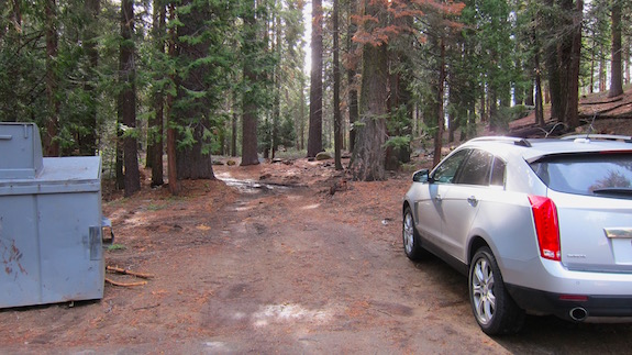
My rental car is parked at the end of the development street. Straight ahead through the gap in the trees is the start of the access road. Photo credit: Tim Carter – W3ATB


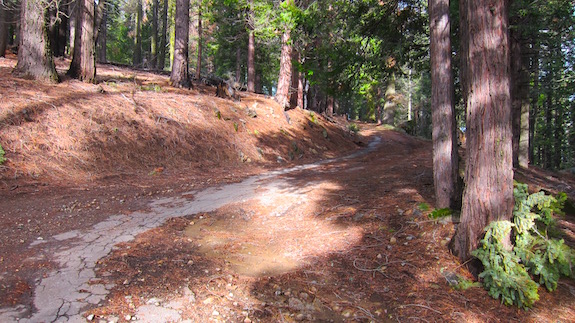
As you walked up the access road, you were surrounded by giant trees and silence. Photo credit: Tim Carter W3ATB

As you walked up the access road, you were surrounded by giant trees and silence. Photo credit: Tim Carter W3ATB


I'm getting ready to launch my water bottle up into the tree. Attached to the line is a cord I use as a halyard to then pull up my antenna. My first throw was perfect. It's not always that way. Photo credit: Brent Walter

I’m getting ready to launch my water bottle up into the tree. Attached to the line is a cord I use as a halyard to then pull up my antenna. My first throw was perfect. It’s not always that way. Photo credit: Brent Walter

My antenna wire is tied to the halyard. I'm ready to hoist the antenna up into the tree. Photo credit: Brent Walter

My antenna wire is tied to the halyard. I’m ready to hoist the antenna up into the tree. Photo credit: Brent Walter

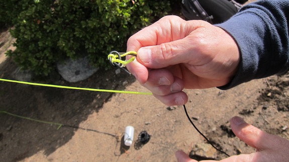
After you hoist up the antenna wire into the tree so it hangs as vertical as possible for great radiation in all directions, you tie off the end of the halyard to a special carabiner made to hold onto the cord. See the jagged teeth and hook setup? Photo credit: Brent Walter

After you hoist up the antenna wire into the tree so it hangs as vertical as possible for great radiation in all directions, you tie off the end of the halyard to a special carabiner made to hold onto the cord. See the jagged teeth and hook setup? Photo credit: Brent Walter

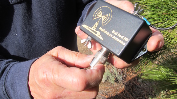
A 29-foot wire is the antenna. The one end of it is connected to a 9:1 unun that reduces the impedance of the wire. This unun and the internal automatic tuner inside the Elecraft KX3 radio allow you to transmit on just about any band from 160 down to 6 meters with the single 29-foot wire. It's a critical combination to allow the magic to work. Photo credit: Brent Walter

A 29-foot wire is the antenna. The one end of it is connected to a 9:1 unun that reduces the impedance of the wire. This unun and the internal automatic tuner inside the Elecraft KX3 radio allow you to transmit on just about any band from 160 down to 6 meters with the single 29-foot wire. It’s a critical combination to allow the magic to work. Photo credit: Brent Walter

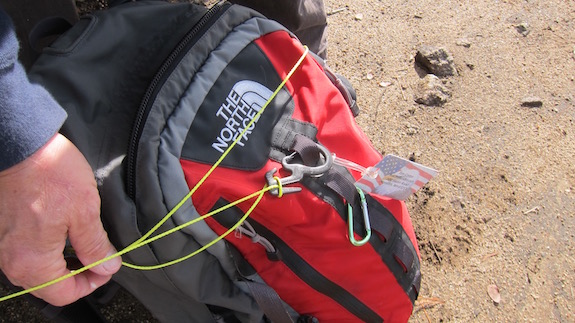
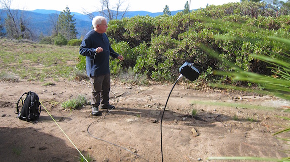
This photo tells the tale. You can see me laying out the coax cable from the 9:1 unun that will eventually connect to the radio. Next to me is my backpack where the yellow halyard line is tied off to the carabiner allowing the antenna wire to dangle from the tall pine tree. Photo credit: Brent Walter

This photo tells the tale. You can see me laying out the coax cable from the 9:1 unun that will eventually connect to the radio. Next to me is my backpack where the yellow halyard line is tied off to the carabiner allowing the antenna wire to dangle from the tall pine tree. Photo credit: Brent Walter

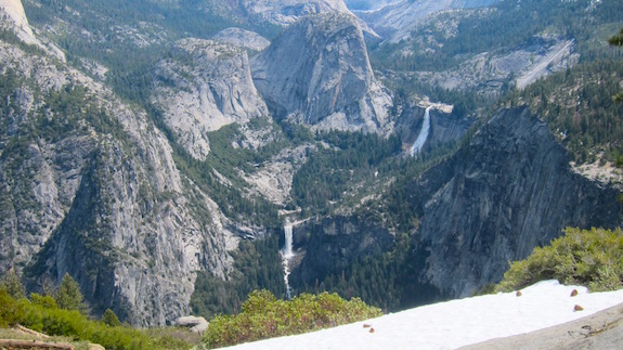
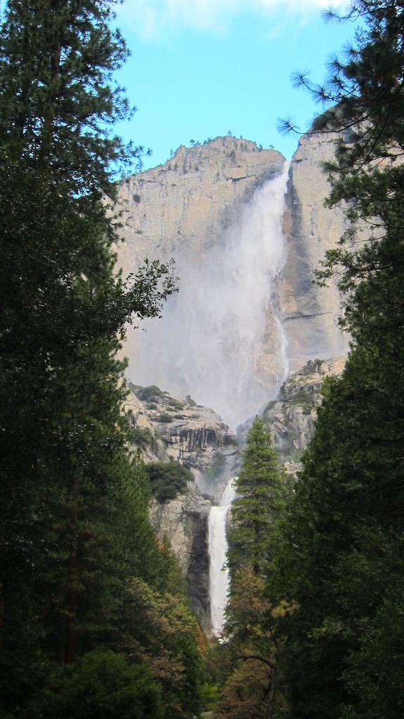
I was just about ten miles to the south southwest of these magnificent falls. Photo credit: Tim Carter - W3ATB

I was just about ten miles to the south southwest of these magnificent falls. Photo credit: Tim Carter – W3ATB

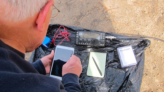
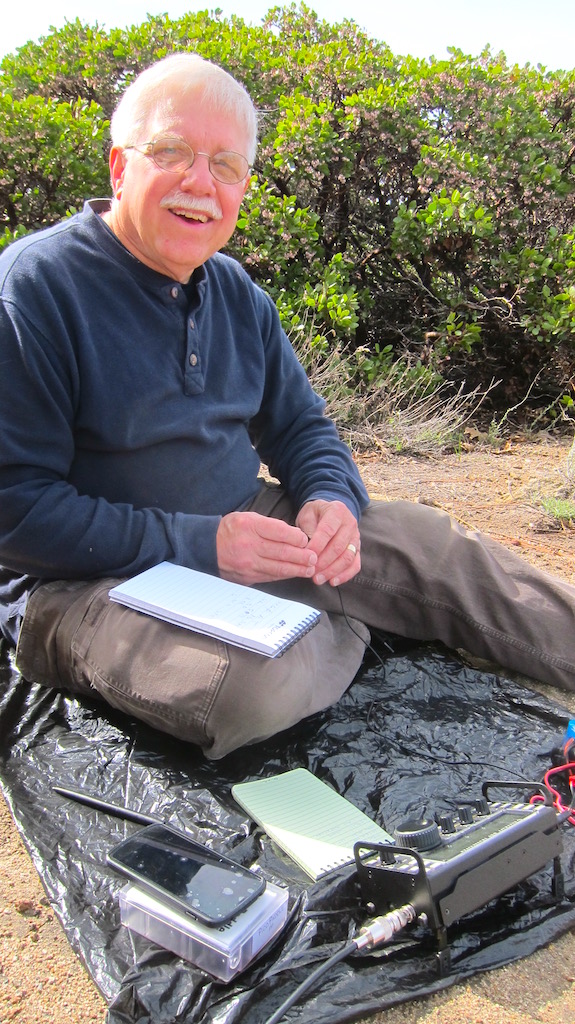
I'm moments away from getting on the air. Here I'm getting ready to show Brent how to use the logging software on my tablet. It worked well! Photo credit: Brent Walter

I’m moments away from getting on the air. Here I’m getting ready to show Brent how to use the logging software on my tablet. It worked well! Photo credit: Brent Walter

I'm completing a conversation with another operator here. You can't see the very small iambic paddles in my hands that allow me to do Morse code. I was happier than I seem in this photo as I made eleven contacts to successfully activate the park! Photo credit: Brent Walter

I’m completing a conversation with another operator here. You can’t see the very small iambic paddles in my hands that allow me to do Morse code. I was happier than I seem in this photo as I made the required ten contacts to successfully activate the park! Photo credit: Brent Walter

Here's upper Yosemite Falls lined up with Lower Yosemite Falls. I lucked out being in the park with water flowing this much. Photo credit: Tim Carter - W3ATB

Here’s upper Yosemite Falls lined up with Lower Yosemite Falls. I lucked out being in the park with water flowing this much. Photo credit: Tim Carter – W3ATB

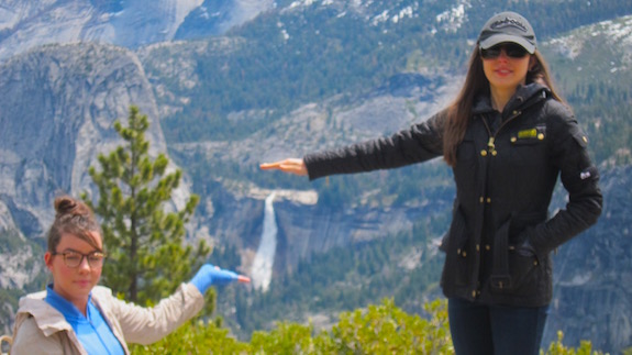
Here's my two daughters trying to hold up Nevada Falls I believe. Poor photography skills are the cause of the proper hand orientation. "I got it." I replied when asked. Photo credit: Tim Carter - W3ATB

Here’s my two daughters trying to hold up Nevada Falls I believe. Poor photography skills are the cause of the improper hand orientation. “I got it.” I replied when asked. Photo credit: Tim Carter – W3ATB


Here’s the list of the radio operators I was able to contact:

  • WG0AT
  • VE6UX
  • WL7DN
  • N3AO
  • W6ZQ
  • WB0WQS
  • N3KN
  • WB6QPG
  • K1ZE
  • KF7WNS