New England Forest Rally Ham Radio

david higgins nefr

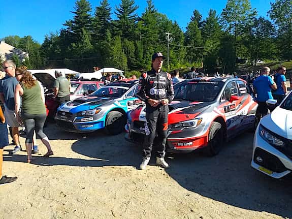
Here’s the world-class driver David Higgins. You get to walk right up and shake his hand at the New England Forest Rally. Copyright 2018 Tim Carter

Author’s Note: If you’ve come here from the July 2023 article in QST looking for the recording of our 80-meter NVIS test, it’s far below. Go ahead and read this article to get a REAL FEEL of what the New England Forest Rally is all about.

New England Forest Rally – Emergency Training Ground

Imagine you’re called upon to use your radio skills to help your community in an emergency. Here’s the scenario you’re faced with:

You and four other radio operators are deployed to an area with no cell phone coverage and no services. A town has been cut off from civilization by some natural disaster and you need to collect and transmit valuable data. You’re tasked with taking everything you need to communicate for hours on end in any weather.

Your most important job is to record data on a minute-by-minute basis that could save someone’s life. You need to be able to hear your team members and they need to hear from you. Your group may be spread out in an area as large as twenty square miles. Your notes must be perfect. Rain, heat, dust, and darkness can’t hinder you.

It gets more complex. You need to transit miles across bumpy dirt roads to this location, set up your equipment in the open with no shelter, work for a few hours and then quickly break down because now the local authorities decide your skills are needed at another emergency site.

You and your team are expected to pack up all your gear and travel to the second, and possibly a third, location and be set up at a specified time. You can’t be late. People’s lives are at stake. You must be able to communicate at these unknown locations no matter the weather or any other conditions. You might do this for twelve or more hours for two or more days.

How would you hone your outdoor radio skills to be able to do all of the above? I do it every summer at the New England Forest Rally (NEFR).

WATCH THIS VIDEO to discover all you need to know about the NEFR:

What is the New England Forest Rally?

The NEFR is a two-day automotive rally that unfolds on both asphalt and dirt logging roads of Western Maine and Northern New Hampshire.

It’s sanctioned by the American Rally Association and happens in July of every year. Professional drivers from across the world come to race with local people like you that want to drive fast.

new england forest rally

A high-performance race car spits gravel and sand leaving the start line. Ryan Freise, KB1VLC, releases the cars paying attention to a special hand-held race timer. Copyright 2017 Tim Carter

Do You Have a Podcast About the NEFR?

Well, I did a 45-minute talk about the NEFR at the 2019 Boxboro, MA HamExposition. I shared in the talk what you need and how it will transform you into a better radio operator. CLICK or TAP HERE for the PowerPoint presentation. Here’s the matching audio for the talk:

Do They Race in the Rain?

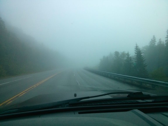
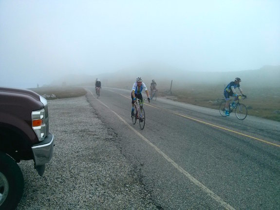
Whatever weather Mother Nature serves up is what everyone deals with. It can be rainy and cool or blistering hot and humid. Bugs of all types are always present and plentiful. Dust is a given – lots and lots of dust.

What Kind of Cars Are in the Race?

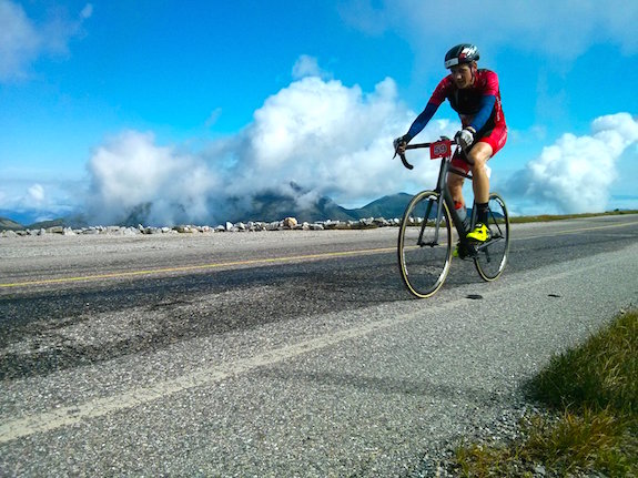
This two-day event features high-performance race cars that might zoom down narrow roads at speeds in excess of 100 miles per hour. Cars drifting around corners, going airborne over jumps and creating giant clouds of dust are commonplace. It’s action-packed and you’re guaranteed to come away from the NEFR, or a similar rally, with a sense of enormous accomplishment.

Who are the Race Drivers?

The NEFR has an eclectic mix of world-class drivers like Travis Pastrana, David Higgins, and Ken Block. You can even race in the event yourself if you can produce a car that contains all the safety equipment and you pay the entrance fee. You don’t have to have a huge sponsor like Subaru, Ford, or Maxxis behind you.

travis pastrana nefr

Here’s Travis Pastrana greeting fans in the parc expose’ before the drivers leave to race for the day. Copyright 2018 Tim Carter

Here’s a video I shot in 2017 of the winner of the event, Travis Pastrana. Listen to his engine RPMs spike at 0:17!

How Many Races Happen in Two Days?

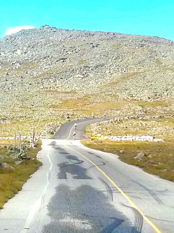
Over the two days, there are no less than 13 individual races. Rally organizers call them stages. The stages may range in length from 4 to 16 miles long.

Are the Rally Cars Special?

The rally cars are special. But it gets more complex. The race cars must be street legal and they have to transit across public roads at legal speed limits in a tight time window from one stage to the next. Failure to make it to the next stage on time causes a driver or team to lose points.

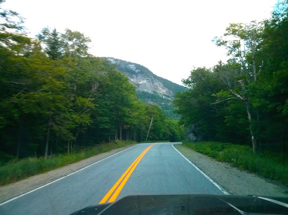
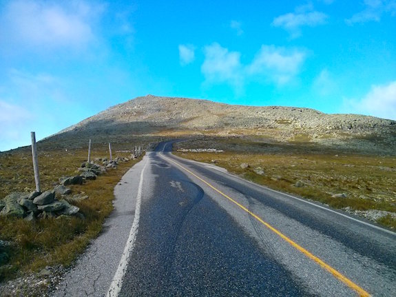
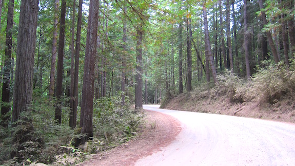
Here’s some of the gorgeous scenery you’ll pass as you transit between stages as you get ready for your next assignment. Copyright 2017 Tim Carter

What Do Radio Operators Do?

As an amateur radio operator, your job is to create and maintain a vital safety communications net over each stage. The drivers, teams, race organizers and spectators need your skills so they can get help in the event of a crash or breakdown.

Your skills may be required if a spectator has a medical emergency.

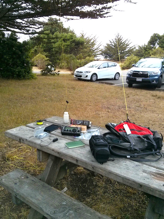
You must be able to be heard when you transmit and you must be able to hear all other operators on the stage. CLICK or TAP HERE to see the best radio equipment setup for the NEFR.

Your duties during an active stage are to record the car numbers and the time they leave the starting line. The radio operator at the start line announces this seconds after each car speeds out onto the stage.

As each car passes you, you must note in your log it passed and the time it passed. It’s very possible for cars to get out of order as one car may pass another or a car may have temporary difficulty on the course and be delayed several minutes.

In the worst case, a car can crash and go off the road and no one really knows about this until the car fails to cross the finish line. Rescue teams will begin to search for the car and driver/co-driver beginning at the last radio operator who logged it passing.

As you can see, you need to be in the moment and you must be able to record data accurately. Forget about fumbling with a cell phone to record the time. Use an old-fashioned wristwatch for goodness sake.

Are Radio Operators in Charge of Official Car Race Times?

No. The official time from start to finish of each car on each stage is recorded electronically using special equipment. Radio operators are relieved of this responsibility.

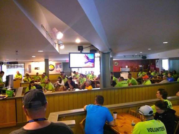
All radio operators and many other volunteers must attend a mandatory meeting on the first morning. Copyright 2017 Tim Carter

Where are Radio Operators Positioned?

Radio operators are placed at the start and finish lines and at other strategic locations along each stage. Each operator must be able to hear the start-line operator and log accurately the sequence of the car numbers as each car zooms away from the starting line.

As each car passes an operator, she/he needs to log the car sequence number, the number of the car printed on the doors, and the time it passes. I’m sure you can see the importance of this in case cars begin to pass a location out of sequence. An out-of-sequence car could mean the missing car has crashed and been swallowed up by the deep forest.

The accurate logs allow the race officials to determine where the missing competitor might be in the case other drivers have not reported a car in trouble.

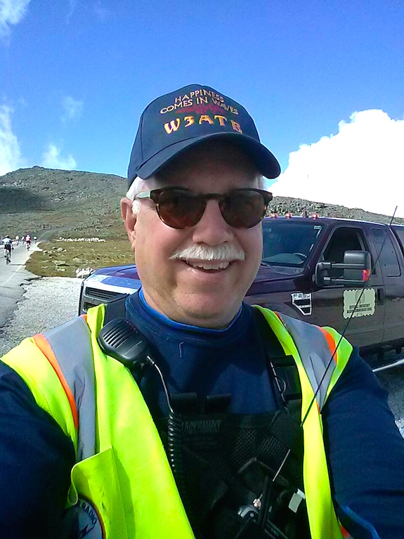
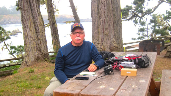
What Equipment Does a Radio Operator Need?

I’ve worked the NEFR for no less than five years. It’s one of my favorite public service events because of the high-octane thrills and the challenges.

I feel there’s a good, better and best way to equip yourself should you want to come join the fun.

It’s possible to be an effective operator using just a regular handheld radio. You’ll need every bit of your five watts and a quarter-wave 2M antenna would be ideal. This past year I worked with an operator from Massachusetts that had a Chinese HT and a 6-inch-long rubber antenna. Surprisingly he was able to do very well with that setup.

David Higgins, a world-class driver from the UK, is checking his tire pressure before he starts a race. This is a 600+ horsepower car. He and all other drivers and co-drivers are counting on you to save them if something goes horribly wrong. Copyright 2017 Tim Carter

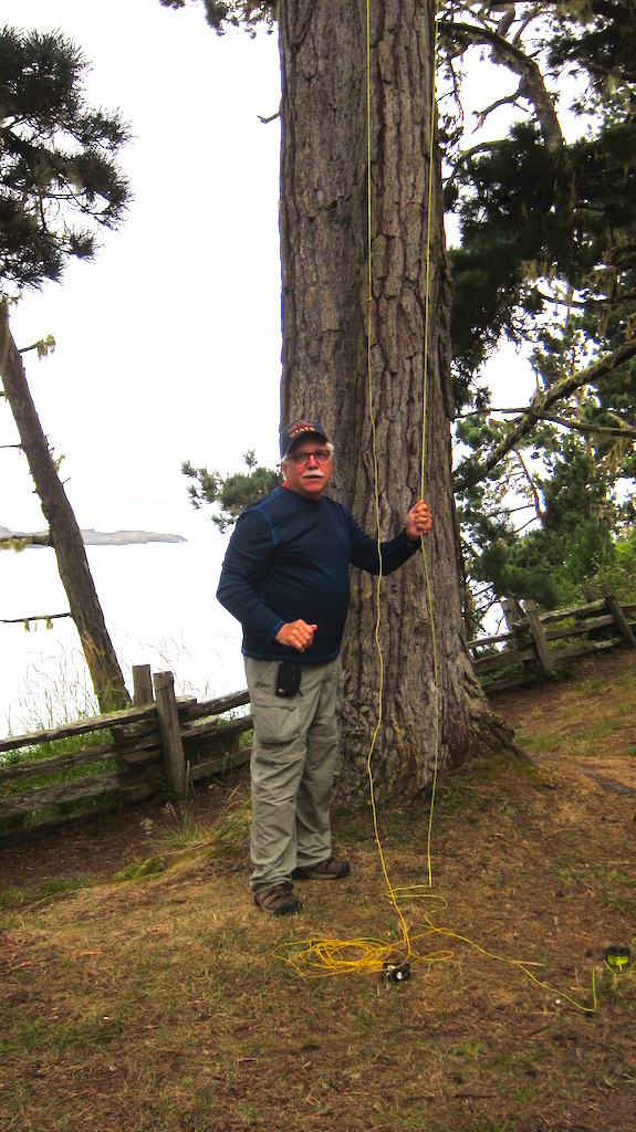
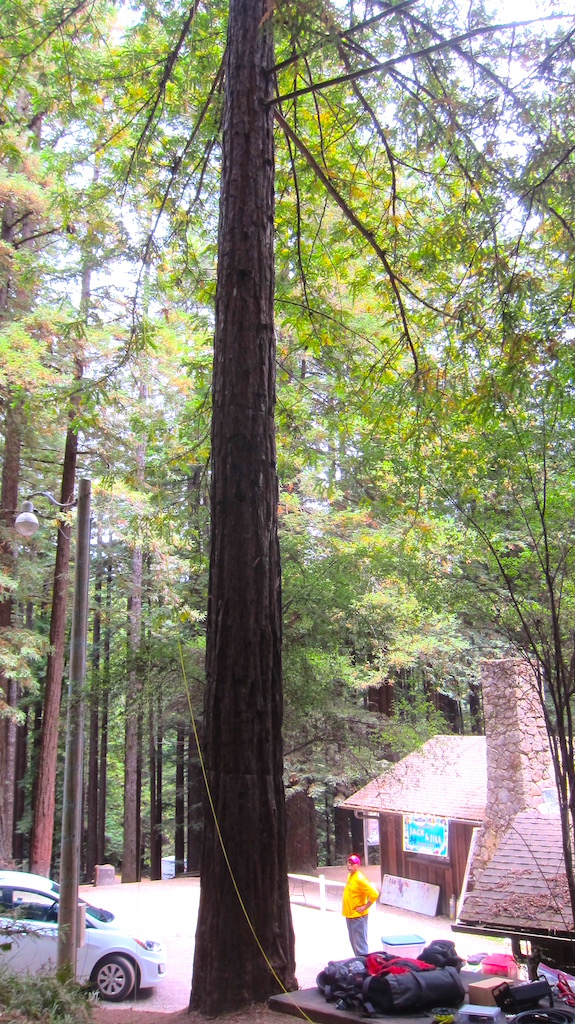
In just about every location you’re at on a stage at the NEFR, you’ll probably have access to a nearby tall tree. I feel it’s better to connect your HT to a roll-up j-pole antenna made from common 300-ohm feed line. If you can make one from 450-ohm ladder line, it will probably perform a little better.

You can use a simple water bottle to get a thin string up into a tree branch. Use this string halyard to quickly pull up your j-pole. This antenna up 25 or 30 feet in the air will give you an enormous advantage.

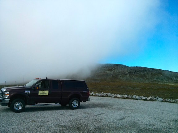
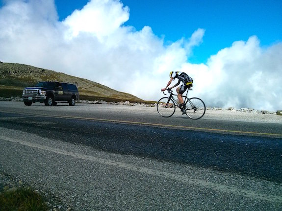
The best setup, in my opinion, is to have a mobile radio in your car or truck that’s got 50 or more watts of power. It’s vital this radio has cross-band repeater functionality. Often you need to be standing away from your parked car or truck to be in a safe position and have great visibility of the race course.

My Yaseu FT-8900 has this simple magical cross-band repeat feature that allows me to use very low power on my HT set at a 70-centimeter frequency going into the 8900, but the mobile radio blasts out my signal on the 2M stage frequency so all can hear. With my HT set on low power, it sips juice from its battery so I know I’ll have power all day long.

If you pair this higher-powered mobile radio with a tall antenna in a tree or mast support near the truck, you’ll be heard and will hear everything.

Do Radio Operators Have to Set Up and Takedown?

The second day of the NEFR is always a test. There are at least three radio teams and the team you’re assigned to may have to work three different stages on the same day.

You might meet at 6:30 am and begin to drive 50 miles to get to where you need to set up. After that stage is complete, you’ve got to hurry and break down all your equipment, load up and move to relocate to the next stage. I’ve worked thirteen hours straight on certain days. It’s fun but exhausting.

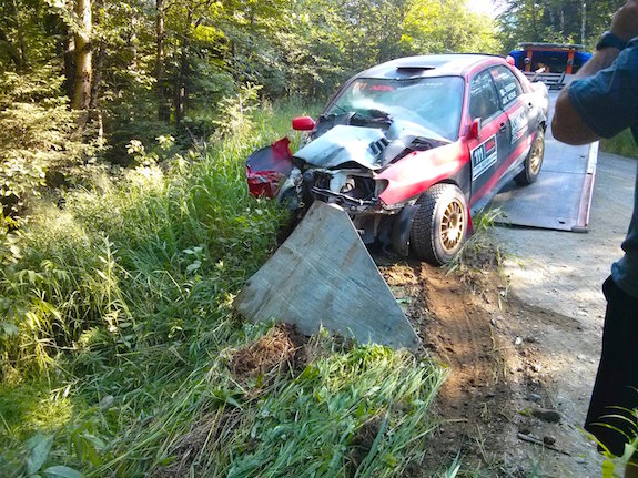
Crashes are a normal event during a rally. You need to be in a safe location out of harm’s way. The driver of this car escaped with bumps and bruises. His co-driver fractured her pelvis. Your skills on the radio can help these people. Copyright 2017 Tim Carter

Operators and other stage workers caravan together as they move to the next stage and it’s quite exciting.

Do Accidents Happen at the NEFR?

Yes, accidents happen and some can be serious. Ken Block’s car caught on fire and was completely destroyed in the 2018 NEFR.

Some are so serious that they make national news. You could have been the radio operator who called in the Ken Block car fire that happened at the NEFR in 2018. This incident made the national news.

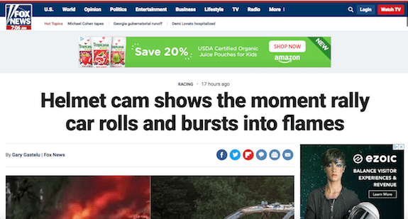
The Ken Block crash made national news. Imagine you being the operator just 100 feet away that called in the emergency! Copyright 2018 Fox News, Inc.

Local towns provide ambulance services in case a crash goes wrong.

It’s a good idea to equip yourself with a fire extinguisher, multiple sealed five-gallon buckets of water, a first aid kit, shovels, weed whackers, an ax, or any other tool you think you may need to help save yourself or someone else in the woods.

The Boy Scout motto, Be Prepared, is of paramount importance in this event. You could find yourself all alone trying to extract someone from a burning car in the worst-case scenario.

errol nh ems

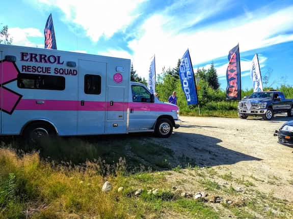
Here’s an ambulance parked at the end of Stage 13, North Road, in case it’s needed. In 2017, a co-driver fractured her pelvis in a crash, so highly trained EMS people are needed. Copyright 2018 Tim Carter

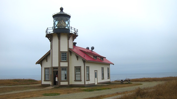
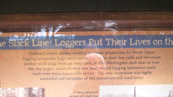
What About 80-Meter NVIS?

We now use 80-meter NVIS antennas on two of the stages. CLICK or TAP HERE to discover more and to listen to our actual test of NVIS on the South Arm stage that had been a problem for nearly 30 years.

What’s In It For You

If I’ve not already answered that subliminal question roiling around in your head, “What’s in this for me Tim? Why should I go out and battle the dust and bugs?”, then I’ll finish with this.

Not only do you get a swell event t-shirt that commemorates your service and sacrifice, but you also get to meet some very interesting fellow radio operators from around the region. You can walk up and converse with world-class rally drivers that travel from around the world to race on these epic gravel roads.

But wait, there’s more! If you’re lucky enough to get assigned to the epic Aziscohos stage like I was, bring your bathing suit! Just 1.3 miles from the start line is a hidden jewel of a stream with three or four personal swimming holes about the size of a hot tub.

tim carter w3atb

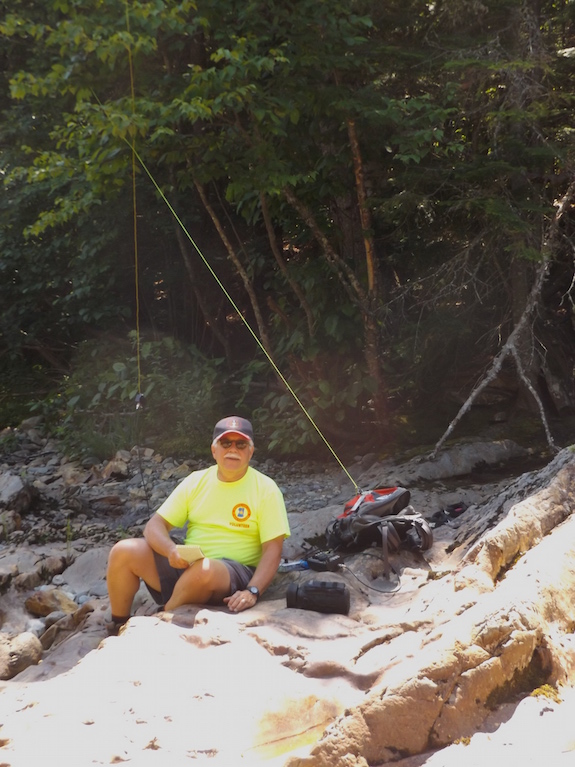
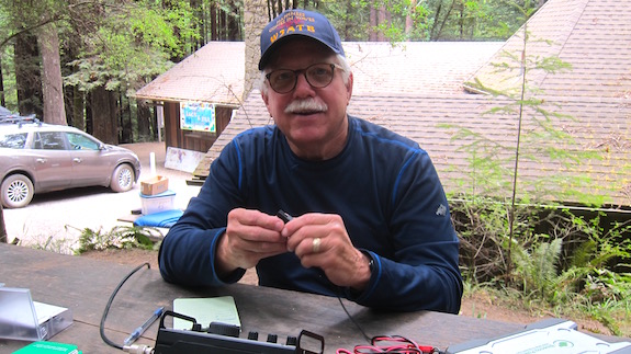
Tim Carter, W3ATB, completing an HF QSO from the center of the magical stream on the Aziscohos stage of the NEFR. Just upstream are three delightful swimming holes! Copyright 2017 Gary Thomas

This stage is normally run twice with a three-hour break between the two races. That’s plenty of time to get in a great relaxing swim or break out your outdoor HF radio and make a few quick QSOs as I did.

If you need further encouragement to come to join the fun, feel free to reach out to me. If you live somewhere other than the Northeast USA, believe me, there are rally races like the NEFR very close to where you are. Just go online and look for them. I guarantee you they need your skills and you’ll not regret going.

screw auger falls

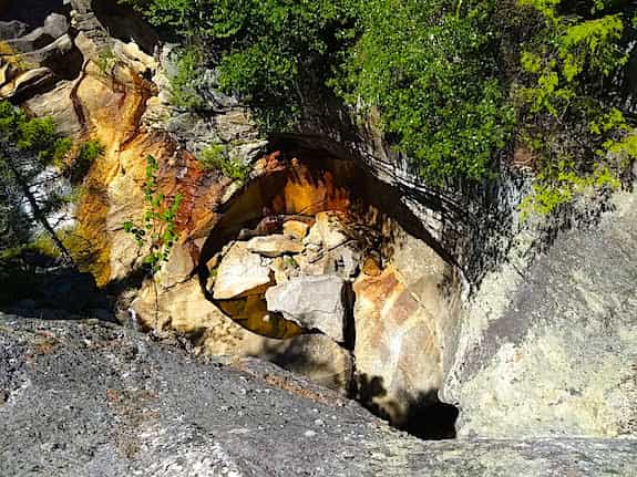
This is the tall falls created by continental glacial meltwater at Grafton Notch State Park. It’s one of the scenic places you can visit between races. Copyright 2018 Tim Carter

Mt. Washington Bicycle Hill Climb 2017

Yesterday I volunteered to be a member of the emergency communications team for the 2017 Mt. Washington Bicycle Hill Climb. It’s an annual event done in conjunction with the private Mt. Washington Auto Road and the Tin Mountain Conservation Center. Cycle professionals and enthusiasts do whatever is necessary to gain 4,875 feet in elevation in as little time as possible.

This is an odd selfie shot. My head is tilted down giving me a horrible triple chin because I wanted you to see the words on my hat. Copyright 2017 Tim Carter

This year’s winning time was an astonishing 51 minutes and 13 seconds by Phil Gaimon. The winning woman rider was Aimee Vasse with a time of 1:05:34.

I’ve worked many times on the Rock Pile as it’s called by all the locals. Many don’t realize the history behind the name because they don’t pay close attention as they ascend the mountain.

As you claw your way up the serpentine 7.2 mile road with no guardrails you see nothing but raw bedrock for miles and miles. But as you get up to the strange flat eight-acre cow pasture at the 5,700-foot elevation you start to notice that the mountain is comprised of jumbled rocks and no solid bedrock is exposed.

This photo is looking due southwest at a mound of jumbled rocks some as large as cars. Underneath it at some depth is bedrock. I was standing in the cow pasture that’s about 5,700 feet in elevation. It’s a lower quality photo using the digital zoom feature of my cellphone. Copyright 2017 Tim Carter

The massive gigantic continental glaciers that covered all of New England just 15,000 years ago weren’t thick enough to scour the rocks off the tip of Mt. Washington. Normal weathering over hundreds of thousands of years has created a collection of rocks that are slowly being broken down and carried to the oceans.

Mother Nature will expose the bedrock under the rocks, but she’s taking her time doing it.

The day before the event we received three inches of rain at my house which is about 60 miles south of Mt. Washington. As I left my house at 5:20 am, it was still dark but you could feel the atmosphere was choked with moisture.

This is what I drove through for much of the 1-hour 45-minute drive from my home. This photo was taken on State Route 16 just below Pinkham Notch as the road runs next to the base of Mt. Washington. Copyright 2017 Tim Carter

As dawn broke, I drove through fog and leaden skies. No doubt it was going to be a changing weather day up on the mountain. I just hoped for moderate wind.

After the top three male and female riders passed me, my work was done for the day. The only other thing I’d have to do is call in for emergency medical help for a rider near my position.

I decided to pass the time using my elevation to my advantage. I set one side of my Yaseu mobile radio in my truck to the national calling frequency of 146.52 MHz. I was booming out at 50 watts and had line of vision sight to the north of over 200 miles.

It didn’t take long to have at least four or five operators come back to me who were up in Maine. At one point I called, “CQ CQ this is W3ATB atop Mt. Washington.”

A second later I heard, “W1PID”.

What? No way! That’s my very close friend Jim Cluett. It turns out he was driving down in Laconia, NH on his way to help our friend Dick Christopher, N1LT with his sailboat. The tip of my truck antenna was higher than the ground to the south of where I was parked and I was able to talk with anyone in that direction.

After talking with Jim, I then logged two contacts with operators at light houses along the coast. It turns out it was the International Lighthouse and Lightship Weekend and lighthouses all over the world had radio operators in or next to them trying to make contact. Here’s my log for those two contacts:

WS1SM 146.520 MHz 1555 UTC
K1N 146.520 MHz 1610 UTC

K1N was operating at the Newburyport, MA harbor light on Plum Island. How exciting! It was a fun day of radio for me to say the very least.

I vote we let photos tell the rest of the story. They do so much better if you ask me.

This is one of the selfish reasons why I volunteer for these events. I get to drive up the mountain early and get set up. It’s just me and the mountain. It can be very spiritual as you feel quite alone. That is NOT the summit of Mt. Washington. If you were to hike to the top of that false summit, you’d clearly see the summit building just 500 yards away. Copyright 2017 Tim Carter.

You’re up so high that clouds slither over you. It’s surreal when it happens. Within seconds of snapping this photo, I was surrounded by the soft cloud. Minutes later it had moved to the north and it was clear once more. Copyright 2017 Tim Carter

I’m aimed due north in this photo looking across the cow pasture directly at the distinguished Presidential Range of the White Mountains. Copyright 2017 Tim Carter

The clouds buffeted the mountain throughout the race. Most of the time it was so sunny and clear the sky was so blue it hurt your eyes to look at it. Copyright 2017 Tim Carter

This rider is focused on the road. I found many looked down and my guess is they didn’t want to get distracted by how much higher they had to climb. This photo is taken looking northeast across the cow pasture. Copyright 2017 Tim Carter

I did pay attention in my high school and college physics classes. I know that friction is the last thing you want when trying to carry yourself and the weight of a bicycle up over 4,875 in elevation! These fat tires would not have been my choice. He was the only one with this configuration. All the elite riders had tires thinner than someone who’s been in a life raft at sea for a month with no food. Copyright 2017 Tim Carter

You may be surprised to see a unicyclist competing in this race. I’ve seen several over the years. But you should be in awe because it requires far more energy to be expended. It’s harder to balance yourself and note there’s NO GEARING to help with the task of going up hill for miles and miles. Copyright 2017 Tim Carter


Russian Gulch POTA Activation KFF-1192

Yesterday I found myself just north of Mendocino, CA. I was in the middle of an extended business / pleasure trip in Oregon and California. The pleasure part of the trip was to include as many Parks on the Air (POTA) activations as I could squeeze into each day as I wandered down the California Coastal Range and coastline.

I had decided to try to do four activations in one day. There happened to be four California state parks within a one-hour’s drive of one another. My plan was to start at Russian Gulch, go to Mendocino Headlands right on the coast, head east to Mendocino Woodlands State Park and finish up at Van Damme State Park.

I arrived at this fascinating state park on the coastline around 9:30 am. After paying my day-use fee I found a secluded picnic area high on a bluff right next to the ocean.

I spied that table on the left and felt that was the best place to set up. Copyright 2017 Tim Carter

A major stream / river enters the ocean at this state park and a magnificent concrete-arch bridge carries US 1 over the large ravine.

What a wonder of engineering and construction! The infamous Russian Gulch bridge. Copyright 2017 Tim Carter

Just after I threw my water bottle up into a tree next to the picnic table, a young boy and his grandfather appeared from the edge of the bluff. There must have been a hiking trail there.

As happens most of the time, they were intensely curious and asked what I was doing.

“I’m about to get on the air and do some amateur radio. Could you do me a favor and take my photo? No one is usually around to see how I put up my antenna.”

Thanks Jack for the great photo! Copyright 2017 Jack ????

Jack was the young boy’s name and he didn’t hesitate to grab my camera. I was thankful that he took several photos.

I’m ready to rock and roll using a mini Pico Paddle sending invisible dihs and dahs up into the ether. I was in a great mood, but you’d not think so with this serious look! Copyright 2017 Jack ?????

Within minutes I was on the air while Jack and his grandfather watched with great delight. To send invisible radio waves up into the sky, I use an Elecraft KX3 radio, a simple 29-foot wire that has a 9:1 unun at the bottom and a small mini Pico Paddle to send Morse code. I power the radio with a BioennoPower power pack.

I do carry a microphone if I want to talk, but since I use only 10 watts of power or less most of the time it stays hidden it its box most of the time. The radio propagation has been so dismal this summer that it’s quite hard to do voice communications at low power.

It didn’t take but eighteen minutes to acquire the ten required conversations with other radio operators to officially activate the park. I got several more and decided to move on.

I thanked Jack for his help and told him to contact me if he wanted more information about amateur radio.

Let’s hope Jack takes an interest in the hobby so we can pass the torch to him. Copyright 2017 Unknown Grandfather – TNX for taking the photo!

I felt like Mary Anne the steam shovel as I sat at that table. If you’ve read the classic children’s book Mike Mulligan and his Steam Shovel, you know how Mary Anne worked harder and faster the more people that watched her dig.

If you have grandkids and they’ve never read this book, get it. I still have a copy. It’s one of the BEST romance books I’ve ever read. Seriously. CLICK the IMAGE NOW to have it delivered to your home or to your grandchild’s home.


Mendocino Woodlands POTA Activation KFF-1173


“Turn around you idiot. This is going to be a massive waste of time.”

That’s the thought I had as I drove deeper and deeper along Little Lake Road into the forest east of Mendocino, CA this afternoon. The lake the road was named after sure must have been small, because I missed it.

I was on my way to try to do a Parks on the Air (POTA) activation at Mendocino Woodlands State Park. POTA is an international program where some amateur radio operators go outdoors to different state and national parks across the world, set up small radios and try to have ten separate conversations with other operators while at the park.

Those who are outdoors and do this are called activators and the operators who may be at home at the other end of the magic invisible radio waves are called chasers. Complete the ten conversations and you officially activate the park.

Failure Is Possible

Just a little over a day before I attempted to activate a California state park about seventy miles north, Humboldt Redwoods State Park. It was in a canyon as well and it took me about an hour to achieve one simple conversation. I reluctantly gave up and drove away because I had a long drive ahead of me and didn’t want to do it in the dark.

Getting to the Mendocino Woodlands State Park is an adventure on its own. You travel miles east of the town of Mendocino, CA. With each mile you travel, the condition of the road gets worse. Eventually it transforms to a dust-choked gravel surface that used to be the rail bed for the tiny trains that wrestled the giant redwood logs out of this majestic forest.

Planning to go here? You’re going to travel several miles of this road and the closer you get to the park, the worse shape the road is in. Copyright 2017 Tim Carter

I shook my head driving knowing I would go to all the effort and come away with nothing. The walls of the canyon were steep – church-steeple steep. As I navigated curve after curve I anointed this wilderness the Radio Waves Canyon of Death.

Camera shots like this transform a three-dimensional view into two dimensions. You simply can’t get a feel for how steep the hillside is. It’s at least 45 degrees, maybe 50 degrees. Copyright 2017 Tim Carter

As I passed each massive redwood tree on the sheer canyon walls, my brain painted a vivid picture of my radio waves bouncing off the walls of the canyon like a giant game of Pong. All I could think of were the electromagnetic pulses from my CW paddles going back and forth never escaping the clutch of the wretched walls of rock and stone.

My college degree is in geology. We used topographic maps all the time. If you know how to read one, then you know how incredibly steep the canyon walls are. This is the topo map of the park. Copyright 2017, Google, Inc. All Rights Reserved

My guess is I traveled at least another three or four miles up the gravel road until I finally arrived at the park entrance. It turns out this is the most unique state park I’ve ever been in.

A First For Me

The park is carved up into three giant camps with small cabins, larger buildings for cooking and eating and any number of other improvements. Groups and families rent the camps for a week at a time. Witches and warlocks meet here once a year and all sorts of other unusual groups gather here to do who-knows-what.

I stopped at Camp One. It was home for the week for a massive family and they welcomed me to share a lone picnic table among the giant trees to try to see how fast I’d get skunked.

They were mesmerized that some total stranger would drive so far to try to pluck invisible waves out of the ether. Most had no idea that amateur radio was still around and alive.

The mess hall for Camp 1 is just behind me. Can you figure out yet why I have that impish look on my face? Copyright 2017 Maretta ???

I was able to launch my trusty water bottle about 40 feet nearly straight up and capture a perfect branch in a tree right next to the table. I’d need every bit of its vertical alignment to try to send a signal out of this wretched canyon where radio waves come to die.

You can’t see the branch I captured with my water bottle and halyard. It’s at least 15 feet above the top of the photo. Copyright 2017 Tim Carter

Within minutes I was on the air with my Elecraft KX3 powered by my trusty BioennoPower power pack. It charged up all morning because the plan for today was to do radio at four California state parks in and around Mendocino.

Before leaving the town of Mendocino, I was able to use my cell phone to reach out to the POTA operators who use the POTA Facebook group page. They knew what time I might get on the air and I told them the frequencies I’d try.

A Miracle

The first thing I did was spin the dial on 20 meters and heard nothing. When I mean nothing, I mean nothing.

No doubt. The ravenous canyon walls were gobbling the signals. Damn them and the tectonic forces that created them!

I took a deep breath and started to send CQ CQ.

“Do you smell that? Get ready for the skunk my friend.”

That’s exactly the thought that went through my head.

BOOM! Within seconds Bob Elsinger, VE6UX, was answering me. You say big deal. I say are you kidding? He’s from Alberta, Canada!

He was hundreds of miles away and on the other side of the Coastal Range I was trying to defeat

But it gets better. He gave me a real signal report of 559.

That’s remarkable as I was straining to reach him with only ten watts of power. That’s just a little more power than you’d use to fire up two old-fashioned night lights.

The Conveyor Belt

One after one I made contact with other operators. I felt like I was sitting on a spring ready to pop up into the air.

Was it possible? Could I wrestle victory from the Grim Reaper of Radio Waves on this day in this remote part of California?

The QSOs, a fancy radio term for completed radio conversations, kept happening just like the pieces of chocolate candy coming down the conveyor belt in that classic scene from the I Love Lucy show.

Victory!

It only took twenty-six minutes to get to the minimum ten QSOs to activate the park. I had done it! It was a surreal feeling. Just a mere eighteen months ago I could have no more done what I had just did than drag a log up the canyon wall.

I ended up with thirteen QSOs.

Just before I got on the air a very nice woman came and sat down from me across the table. Her name was Maretta. She was fascinated in the entire magic show that was in progress and was exceedingly polite.

She watched the entire activation and was kind enough to take the photo of me sitting at the table.

“Would you consider helping me explain all this to a group of Girl Scouts I work with?” she asked.

I immediately agreed and said we could do it using Skype or some other video conferencing. She left and immediately a small boy named Tip came up.

“What are you doing?” he pondered.

I explained it all to him while his father joined us. Moments before he came up, I had started to pack up. Fortunately I didn’t get too far.

“Can you show me how this works?”

It was impossible to decline his proposal. Within minutes I was back on the air and believe it or not did a POTA park-to-park (PTP) QSO with N5PHT!

I thought I had died and gone to Heaven. Never before had I done a PTP as we call in in the world of POTA.

Once I collected myself, I showed Tip how to work my mini Pico Paddles. He was overjoyed at being able to transmit his name while I manned the controls of the KX3.

The Takeaway

Tip and his dad had other things to do, I needed a cup of coffee and wanted to get back to town to scream to the POTA Facebook group a well deserved Thank You! I felt they were probably just as excited as I was because not only do I think I was the first person to activate this difficult park, but I also could well be the last.

As I was getting back in my rental car, I thought about what had just happened.

I kept driving down that gravel road because my gut told me to. Something inside me said to not give up. I’ve rarely quit things in the past because the sign over my high school football dressing room said:

Quitters never win. Winners never quit.

If you decide to do a POTA, SOTA or similar activation and you think it won’t work out, think again. Don’t give up.

Just Do It.


Point Cabrillo Light Station POTA Activation KFF-3536

This afternoon I successfully activated Point Cabrillo Light Station while participating in the Parks on the Air (POTA) program. The official designator for this state park is KFF-3536. It was a great way to end the day after failing to activate Humboldt Redwoods State Park earlier in the morning.

I was quite happy after getting more than the required QSOs in my notepad! Victory! Copyright 2017 Tim Carter

Point Cabrillo is an historic wood-framed Victorian-style lighthouse just north of Mendocino, CA. The air was filled with light fog which was the perfect way to view a lighthouse in my opinion. This type of weather is when sailors depend on the intense rotating beam of light.

That’s a real light with the special lenses, not some electronic beacon. Sadly the Coast Guard will not allow the general public up the steep ladder to see the rotating light. Copyright 2017 Tim Carter

I set up at a picnic table near the park headquarters which is about a mile east of the lighthouse. I was in such a rush to get on the air that it took four attempts to launch my water bottle up and over a specific branch in some very tall trees next to the table.

The branch I wanted to capture was out of the frame. It required a precise throw to snag it. Copyright 2017 Tim Carter

It didn’t take long to get set up and when I spun the dial on my Elecraft KX3 I knew the activation was going to be challenging. The band was as quiet as patrons reading books at the local library.

I’m ready to pluck invisible waves out of the air. Copyright 2017 Tim Carter

Since it was late in the day, 3:47 pm PT, when I turned on the radio, I decided to immediately go to 20 meters. This is usually a dependable band, but today it was anemic.

The activation only happened by gathering what I could on 20 meters and then I switched to 30 meters. I only did CW and not single side band (SSB). With propagation as bad as it is, it’s nearly impossible to do SSB with a low-powered setup.

Here’s my log:

W0PHX 20M 2257Z
KG5CIK 20M 2259Z
K5RK 20M 2300Z
VE7CV 20M 2302Z
K5RK 30M 2305Z
W6LEN 30M 2306Z
K7ZO 30M 2307Z
K6PAM 30M 2309Z
VE6UX 30M 2314Z
WB7QR 30M 2315Z
VE4VJR 20M 2323Z

Once again the POTA Facebook group came to my rescue. You need ten contacts to successfully activate a park. I got eleven.

I decided to pack up once I knew I had the needed contacts as I wanted to go see the lighthouse. I decided to walk the mile down to the coastline as the past week I’ve gotten very little exercise. It was well worth the walk.

Isn’t this a gorgeous building? Copyright 2017 Tim Carter

These rocks are just below the lighthouse. The were created millions of years ago as molten rock welled up on the ocean floor. Continental drift has brought them 3000 miles to the west coast of the North American plate. Yeah, I majored in geology in college. Copyright 2017 Tim Carter

The roof shingles are wood but they’ve been painted the bright fire-engine red. My guess is this is how it’s been for over 100 years! Copyright 2017 Tim Carter


Ft. Humboldt POTA Activation – Eureka, CA

On August 7, 2017 I found myself driving through Eureka, CA on my way to the San Francisco Bay area. Two short business meetings spaced out over thirteen days provided me with about eight days to travel by car from Portland, OR to Google’s San Francisco offices. I had never been to Oregon nor Northern California and brought my outdoor radio equipment to have some fun.

It was an overcast breezy and chilly day with the temperature in the lower 60s F. My goal was to try to be the first to activate Fort Humboldt state park as part of the Parks on the Air (POTA) program. The official designator for POTA for this state park is KFF-3434.

CLICK the sign to discover the history of this bluff up above the mighty Pacific Ocean. Copyright 2017 Tim Carter

This state park was all but deserted when I arrived. I spied some picnic tables under trees that were on the edge of a large open field. Being an ask-for-forgiveness type of guy, I headed for the farthest picnic table that was pretty much out of sight of the park employees.

You can’t see the tree behind and to the left of me where my end-fed antenna was hanging. It performed well today! Copyright 2017 Tim Carter

I’ve been doing outdoor radio for enough years to know to avoid the water-bottle-eating thick evergreen trees that swallow my water bottle I use to get my halyard up into tree branches. Fortunately there was a leafless deciduous tree about 30 feet from the picnic table I wanted to use. It took me three throws to get the perfect branch so my 29-foot wire would hang vertically in the tree.

I had sent a message to the Facebook POTA group that I was there and about to get on the air. I made a mistake citing the UTC time because I thought I was still in New Hampshire. A few chasers thought they had missed me as the time I posted was three hours past!

CLICK the image to see what’s going on at POTA! Copyright 2017 Facebook, Inc.

I decided to do CW at first as that’s my passion with outdoor radio. I fired up my Elecraft KX3 powered by my trusty BioennoPower power pack. My antenna is just a simple 29-foot wire with a 9:1 unun at the end to get the impedance down to a level the internal tuner in the KX3 can match. I was able to get a 1:1 match on 20 meters with no problems.

The band conditions have been so wretched all summer, that the only reason I got my minimum 10 contacts was because of the faithful followers who monitor the POTA group on Facebook. Twenty meters was short today and none of my friends on the east coast could hear my signal.

I know I was spotted by several operators and even with that I was only able to gather ten QSOs. Three of those ten were with W6LEN but on different bands. Thanks Jess Guaderrama for making this activation possible! Here’s my log:

N9MM 20M 2227Z
 KN7D 20M 2228Z
VE7CV 20M 2230Z
KG5CIK 20M 2232Z
W7GZS 20M 2234Z
W6LEN 20M 2239Z
WD5IWN 20M 2243Z
K7ZO 20M 2252Z
W6LEN 40M 2259Z
W6LEN 30M 2321Z

As you can see, I just made it. Ten contacts are required for a successful activation. Nothing like cutting it close.

I had been outdoors in the chilly breeze in shorts and sandals for over ninety minutes. I was starting to think about getting a hot cup of coffee. That meant it was time to pack up.

But before I left the park, I wandered over to look at some of the historic pieces of machinery that are housed here. Eureka, CA was the epicenter of the logging industry for the ancient California redwood trees from 1850 up to the 1990s.

Check out some of the amazing pieces of machinery in this collection. Mother Nature is slowly reclaiming them. Perhaps they should be brought inside at some point like the two working tiny steam locomotives they have here at this magic park.

This is a smaller steam donkey that was used to drag giant logs from the forest. Copyright 2017 Tim Carter

The sign on this machine said it was a Shingle Mill. I suppose it made redwood shingles use to cover the sides of buildings like my friend Russell Waters home in Montrose, CA. Copyright 2017 Tim Carter

DUH! Why not use logs as rails in the forest? Very clever!!! Copyright 2017 Tim Carter

The sign said this was the largest steam donkey ever made. It was ginormous as you can see by the size of the pickup truck in the lower right corner. Copyright 2017 Tim Carter